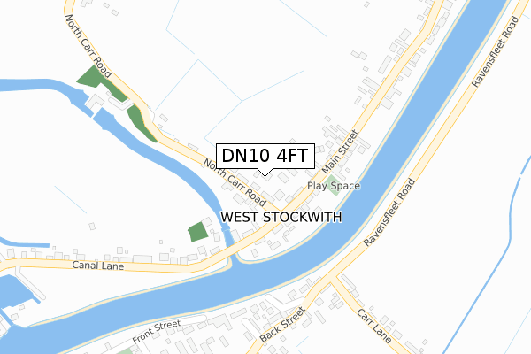
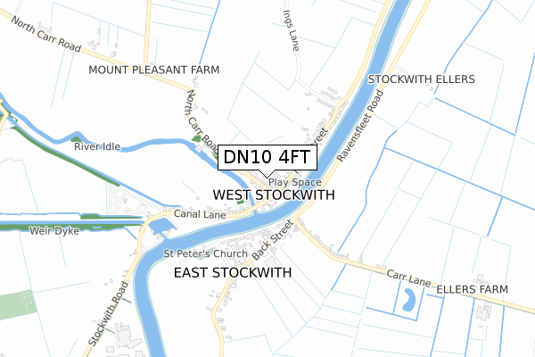
DN10 4FT is located in the Misterton electoral ward, within the local authority district of Bassetlaw and the English Parliamentary constituency of Bassetlaw. The Sub Integrated Care Board (ICB) Location is NHS Nottingham and Nottinghamshire ICB - 02Q and the police force is Nottinghamshire. This postcode has been in use since February 2020.


GetTheData
Source: OS Open Zoomstack (Ordnance Survey)
Licence: Open Government Licence (requires attribution)
Attribution: Contains OS data © Crown copyright and database right 2024
Source: Open Postcode Geo
Licence: Open Government Licence (requires attribution)
Attribution: Contains OS data © Crown copyright and database right 2024; Contains Royal Mail data © Royal Mail copyright and database right 2024; Source: Office for National Statistics licensed under the Open Government Licence v.3.0
| Easting | 479056 |
| Northing | 394836 |
| Latitude | 53.444394 |
| Longitude | -0.811224 |
GetTheData
Source: Open Postcode Geo
Licence: Open Government Licence
| Country | England |
| Postcode District | DN10 |
| ➜ DN10 open data dashboard ➜ See where DN10 is on a map ➜ Where is West Stockwith? | |
GetTheData
Source: Land Registry Price Paid Data
Licence: Open Government Licence
| Ward | Misterton |
| Constituency | Bassetlaw |
GetTheData
Source: ONS Postcode Database
Licence: Open Government Licence
2, DAIRY FARM COURT, WEST STOCKWITH, DONCASTER, DN10 4FT 2022 5 JAN £485,000 |
ORCHARD CROFT, 4, DAIRY FARM COURT, WEST STOCKWITH, DONCASTER, DN10 4FT 2019 26 APR £180,000 |
GetTheData
Source: HM Land Registry Price Paid Data
Licence: Contains HM Land Registry data © Crown copyright and database right 2024. This data is licensed under the Open Government Licence v3.0.
| June 2022 | Other crime | On or near Main Street | 176m |
| June 2022 | Burglary | On or near Main Street | 176m |
| June 2022 | Burglary | On or near St Peters Close | 273m |
| ➜ Get more crime data in our Crime section | |||
GetTheData
Source: data.police.uk
Licence: Open Government Licence
| North Carr Road (Main Street) | West Stockwith | 43m |
| North Carr Road (Main Street) | West Stockwith | 50m |
| Idle Bridge (Canal Lane) | West Stockwith | 205m |
| Front Street (Back Street) | East Stockwith | 214m |
| Idle Bridge (Canal Lane) | West Stockwith | 220m |
| Gainsborough Central Station | 5.7km |
GetTheData
Source: NaPTAN
Licence: Open Government Licence
GetTheData
Source: ONS Postcode Database
Licence: Open Government Licence


➜ Get more ratings from the Food Standards Agency
GetTheData
Source: Food Standards Agency
Licence: FSA terms & conditions
| Last Collection | |||
|---|---|---|---|
| Location | Mon-Fri | Sat | Distance |
| West Stockwith P.o. | 16:00 | 09:15 | 96m |
| East Stockwith Post Office | 16:00 | 11:00 | 234m |
| Chesterfield Terrace West | 16:00 | 09:15 | 471m |
GetTheData
Source: Dracos
Licence: Creative Commons Attribution-ShareAlike
| Facility | Distance |
|---|---|
| Misterton Sports Field Marsh Lane, Misterton, Doncaster Grass Pitches | 1.4km |
| Misterton Primary School & Nursery School Grovewood Road, Misterton, Doncaster Swimming Pool, Grass Pitches | 2.4km |
| Village Playing Fields Millbaulk Lane, Walkeringham, Doncaster Grass Pitches | 2.8km |
GetTheData
Source: Active Places
Licence: Open Government Licence
| School | Phase of Education | Distance |
|---|---|---|
| Misterton Primary and Nursery School Grovewood Road, Misterton, Doncaster, DN10 4EH | Primary | 2.4km |
| Walkeringham Primary School Millbaulk Road, Walkeringham, Doncaster, DN10 4LL | Primary | 3km |
| Morton Trentside Primary School Crooked Billet Street, Morton, Morton Trentside Primary School, GAINSBOROUGH, DN21 3AH | Primary | 3.5km |
GetTheData
Source: Edubase
Licence: Open Government Licence
The below table lists the International Territorial Level (ITL) codes (formerly Nomenclature of Territorial Units for Statistics (NUTS) codes) and Local Administrative Units (LAU) codes for DN10 4FT:
| ITL 1 Code | Name |
|---|---|
| TLF | East Midlands (England) |
| ITL 2 Code | Name |
| TLF1 | Derbyshire and Nottinghamshire |
| ITL 3 Code | Name |
| TLF15 | North Nottinghamshire |
| LAU 1 Code | Name |
| E07000171 | Bassetlaw |
GetTheData
Source: ONS Postcode Directory
Licence: Open Government Licence
The below table lists the Census Output Area (OA), Lower Layer Super Output Area (LSOA), and Middle Layer Super Output Area (MSOA) for DN10 4FT:
| Code | Name | |
|---|---|---|
| OA | E00142825 | |
| LSOA | E01028032 | Bassetlaw 002D |
| MSOA | E02005836 | Bassetlaw 002 |
GetTheData
Source: ONS Postcode Directory
Licence: Open Government Licence
| DN10 4EZ | North Carr Road | 75m |
| DN10 4EY | Main Street | 85m |
| DN10 4HA | Main Street | 169m |
| DN21 3DW | Back Street | 213m |
| DN10 4HB | Main Street | 226m |
| DN21 3DJ | Front Street | 262m |
| DN21 3DL | Back Street | 266m |
| DN21 3DQ | Little Walk | 379m |
| DN21 3DP | Carr Lane | 387m |
| DN10 4ET | Canal Lane | 392m |
GetTheData
Source: Open Postcode Geo; Land Registry Price Paid Data
Licence: Open Government Licence