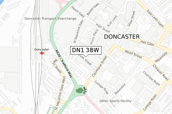
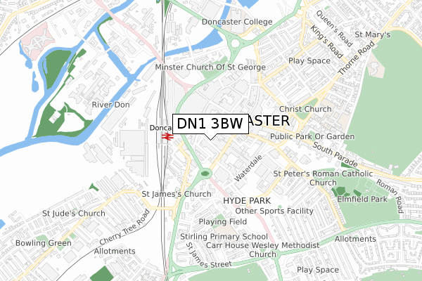
DN1 3BW is located in the Town electoral ward, within the metropolitan district of Doncaster and the English Parliamentary constituency of Doncaster Central. The Sub Integrated Care Board (ICB) Location is NHS South Yorkshire ICB - 02X and the police force is South Yorkshire. This postcode has been in use since July 2018.


GetTheData
Source: OS Open Zoomstack (Ordnance Survey)
Licence: Open Government Licence (requires attribution)
Attribution: Contains OS data © Crown copyright and database right 2024
Source: Open Postcode Geo
Licence: Open Government Licence (requires attribution)
Attribution: Contains OS data © Crown copyright and database right 2024; Contains Royal Mail data © Royal Mail copyright and database right 2024; Source: Office for National Statistics licensed under the Open Government Licence v.3.0
| Easting | 457436 |
| Northing | 403122 |
| Latitude | 53.521658 |
| Longitude | -1.135167 |
GetTheData
Source: Open Postcode Geo
Licence: Open Government Licence
| Country | England |
| Postcode District | DN1 |
| ➜ DN1 open data dashboard ➜ See where DN1 is on a map ➜ Where is Doncaster? | |
GetTheData
Source: Land Registry Price Paid Data
Licence: Open Government Licence
| Ward | Town |
| Constituency | Doncaster Central |
GetTheData
Source: ONS Postcode Database
Licence: Open Government Licence
| January 2024 | Vehicle crime | On or near Parking Area | 369m |
| January 2024 | Violence and sexual offences | On or near Parking Area | 369m |
| January 2024 | Violence and sexual offences | On or near St James Street | 483m |
| ➜ Get more crime data in our Crime section | |||
GetTheData
Source: data.police.uk
Licence: Open Government Licence
| Duke Street | Doncaster Town Centre | 37m |
| Duke Street | Doncaster Town Centre | 37m |
| Ds4 (Duke Street) | Doncaster Town Centre | 52m |
| ** Used For Driver Changes By First ** (Duke Street) | Doncaster Town Centre | 52m |
| Cleveland Street | Doncaster Town Centre | 70m |
| Doncaster Station | 0.3km |
| Bentley (S Yorks) Station | 2.7km |
| Kirk Sandall Station | 6.2km |
GetTheData
Source: NaPTAN
Licence: Open Government Licence
GetTheData
Source: ONS Postcode Database
Licence: Open Government Licence


➜ Get more ratings from the Food Standards Agency
GetTheData
Source: Food Standards Agency
Licence: FSA terms & conditions
| Last Collection | |||
|---|---|---|---|
| Location | Mon-Fri | Sat | Distance |
| St Sepulchre Gate | 18:30 | 11:30 | 155m |
| Priory Place | 18:30 | 13:30 | 173m |
| Trafford Court | 18:30 | 11:15 | 203m |
GetTheData
Source: Dracos
Licence: Creative Commons Attribution-ShareAlike
| Facility | Distance |
|---|---|
| The Gym Group (Doncaster) St. Sepulchre Gate, Doncaster Health and Fitness Gym | 158m |
| Marathon Health Studio (Closed) College Road, Doncaster Health and Fitness Gym, Studio | 208m |
| Holian Health Studio Wood Street, Doncaster Health and Fitness Gym | 234m |
GetTheData
Source: Active Places
Licence: Open Government Licence
| School | Phase of Education | Distance |
|---|---|---|
| Doncaster UTC College Road, Doncaster, DN1 3BF | Secondary | 356m |
| Atlas Academy Prospect Place, Doncaster, DN1 3QP | Primary | 626m |
| DN Colleges Group Chappell Drive, Doncaster, DN1 2RF | 16 plus | 716m |
GetTheData
Source: Edubase
Licence: Open Government Licence
The below table lists the International Territorial Level (ITL) codes (formerly Nomenclature of Territorial Units for Statistics (NUTS) codes) and Local Administrative Units (LAU) codes for DN1 3BW:
| ITL 1 Code | Name |
|---|---|
| TLE | Yorkshire and The Humber |
| ITL 2 Code | Name |
| TLE3 | South Yorkshire |
| ITL 3 Code | Name |
| TLE31 | Barnsley, Doncaster and Rotherham |
| LAU 1 Code | Name |
| E08000017 | Doncaster |
GetTheData
Source: ONS Postcode Directory
Licence: Open Government Licence
The below table lists the Census Output Area (OA), Lower Layer Super Output Area (LSOA), and Middle Layer Super Output Area (MSOA) for DN1 3BW:
| Code | Name | |
|---|---|---|
| OA | E00038726 | |
| LSOA | E01007645 | Doncaster 022E |
| MSOA | E02001560 | Doncaster 022 |
GetTheData
Source: ONS Postcode Directory
Licence: Open Government Licence
| DN1 3EA | Duke Street | 48m |
| DN1 3DJ | Spring Gardens | 96m |
| DN1 3DY | Cleveland Street | 98m |
| DN1 1BZ | Priory Place | 103m |
| DN1 3DP | Cleveland Street | 104m |
| DN1 1BL | Priory Place | 104m |
| DN1 1RU | St Sepulchre Gate | 110m |
| DN1 1TS | Priory Walk | 113m |
| DN1 3EH | Cleveland Street | 150m |
| DN1 3EF | Cleveland Street | 154m |
GetTheData
Source: Open Postcode Geo; Land Registry Price Paid Data
Licence: Open Government Licence