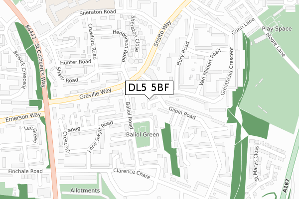
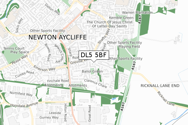
DL5 5BF is located in the Aycliffe East electoral ward, within the unitary authority of County Durham and the English Parliamentary constituency of Sedgefield. The Sub Integrated Care Board (ICB) Location is NHS North East and North Cumbria ICB - 84H and the police force is Durham. This postcode has been in use since February 2019.


GetTheData
Source: OS Open Zoomstack (Ordnance Survey)
Licence: Open Government Licence (requires attribution)
Attribution: Contains OS data © Crown copyright and database right 2024
Source: Open Postcode Geo
Licence: Open Government Licence (requires attribution)
Attribution: Contains OS data © Crown copyright and database right 2024; Contains Royal Mail data © Royal Mail copyright and database right 2024; Source: Office for National Statistics licensed under the Open Government Licence v.3.0
| Easting | 428210 |
| Northing | 524557 |
| Latitude | 54.615395 |
| Longitude | -1.564708 |
GetTheData
Source: Open Postcode Geo
Licence: Open Government Licence
| Country | England |
| Postcode District | DL5 |
| ➜ DL5 open data dashboard ➜ See where DL5 is on a map ➜ Where is Newton Aycliffe? | |
GetTheData
Source: Land Registry Price Paid Data
Licence: Open Government Licence
| Ward | Aycliffe East |
| Constituency | Sedgefield |
GetTheData
Source: ONS Postcode Database
Licence: Open Government Licence
| January 2024 | Robbery | On or near Lumley Close | 340m |
| January 2024 | Violence and sexual offences | On or near Lumley Close | 340m |
| December 2023 | Drugs | On or near Lumley Close | 340m |
| ➜ Get more crime data in our Crime section | |||
GetTheData
Source: data.police.uk
Licence: Open Government Licence
| Neville Parade | Newton Aycliffe | 58m |
| Neville Parade | Newton Aycliffe | 61m |
| Neville Parade (Greville Way) | Newton Aycliffe | 82m |
| Greville Way | Newton Aycliffe | 128m |
| Neville Parade (Shafto Way) | Newton Aycliffe | 158m |
| Newton Aycliffe Station | 1.6km |
| Heighington Station | 2.3km |
| Shildon Station | 4.8km |
GetTheData
Source: NaPTAN
Licence: Open Government Licence
| Percentage of properties with Next Generation Access | 100.0% |
| Percentage of properties with Superfast Broadband | 100.0% |
| Percentage of properties with Ultrafast Broadband | 0.0% |
| Percentage of properties with Full Fibre Broadband | 0.0% |
Superfast Broadband is between 30Mbps and 300Mbps
Ultrafast Broadband is > 300Mbps
| Percentage of properties unable to receive 2Mbps | 0.0% |
| Percentage of properties unable to receive 5Mbps | 0.0% |
| Percentage of properties unable to receive 10Mbps | 0.0% |
| Percentage of properties unable to receive 30Mbps | 0.0% |
GetTheData
Source: Ofcom
Licence: Ofcom Terms of Use (requires attribution)
GetTheData
Source: ONS Postcode Database
Licence: Open Government Licence


➜ Get more ratings from the Food Standards Agency
GetTheData
Source: Food Standards Agency
Licence: FSA terms & conditions
| Last Collection | |||
|---|---|---|---|
| Location | Mon-Fri | Sat | Distance |
| Beveridge Way | 17:30 | 12:00 | 735m |
| Burn Lane | 16:45 | 11:15 | 1,005m |
| Garburn Place | 16:45 | 10:45 | 1,471m |
GetTheData
Source: Dracos
Licence: Creative Commons Attribution-ShareAlike
| Facility | Distance |
|---|---|
| Newton Aycliffe Sports Club Moore Lane, Newton Aycliffe Grass Pitches | 424m |
| Sugar Hill Primary School Sheraton Road, Newton Aycliffe Swimming Pool, Grass Pitches | 427m |
| Moore Lane Park Moore Lane, Newton Aycliffe Grass Pitches | 534m |
GetTheData
Source: Active Places
Licence: Open Government Licence
| School | Phase of Education | Distance |
|---|---|---|
| Sugar Hill Primary School Sheraton Road, Newton Aycliffe, DL5 5NU | Primary | 422m |
| St Mary's Catholic Primary School, Newton Aycliffe Central Avenue, Newton Aycliffe, DL5 5NP | Primary | 856m |
| Vane Road Primary School Vane Road, Newton Aycliffe, DL5 5RH | Primary | 891m |
GetTheData
Source: Edubase
Licence: Open Government Licence
The below table lists the International Territorial Level (ITL) codes (formerly Nomenclature of Territorial Units for Statistics (NUTS) codes) and Local Administrative Units (LAU) codes for DL5 5BF:
| ITL 1 Code | Name |
|---|---|
| TLC | North East (England) |
| ITL 2 Code | Name |
| TLC1 | Tees Valley and Durham |
| ITL 3 Code | Name |
| TLC14 | Durham |
| LAU 1 Code | Name |
| E06000047 | County Durham |
GetTheData
Source: ONS Postcode Directory
Licence: Open Government Licence
The below table lists the Census Output Area (OA), Lower Layer Super Output Area (LSOA), and Middle Layer Super Output Area (MSOA) for DL5 5BF:
| Code | Name | |
|---|---|---|
| OA | E00105676 | |
| LSOA | E01020825 | County Durham 062A |
| MSOA | E02004343 | County Durham 062 |
GetTheData
Source: ONS Postcode Directory
Licence: Open Government Licence
| DL5 5DH | Neville Parade | 68m |
| DL5 5EL | Cosin Close | 96m |
| DL5 5DY | Baliol Green | 106m |
| DL5 5DZ | Hackworth Close | 160m |
| DL5 5EX | Greville Way | 162m |
| DL5 5EJ | Palmer Road | 170m |
| DL5 5DL | Bury Road | 171m |
| DL5 5PD | Crewe Road | 176m |
| DL5 5DS | Van Mildert Road | 176m |
| DL5 5HD | Anne Swyft Road | 187m |
GetTheData
Source: Open Postcode Geo; Land Registry Price Paid Data
Licence: Open Government Licence