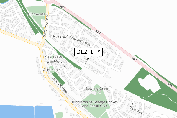
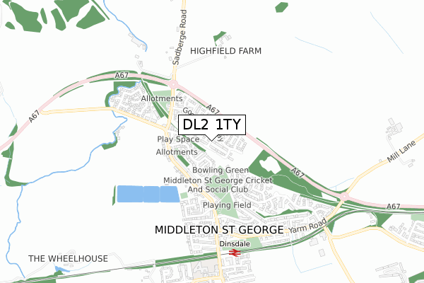
DL2 1TY is located in the Sadberge & Middleton St George electoral ward, within the unitary authority of Darlington and the English Parliamentary constituency of Sedgefield. The Sub Integrated Care Board (ICB) Location is NHS North East and North Cumbria ICB - 16C and the police force is Durham. This postcode has been in use since March 2019.


GetTheData
Source: OS Open Zoomstack (Ordnance Survey)
Licence: Open Government Licence (requires attribution)
Attribution: Contains OS data © Crown copyright and database right 2024
Source: Open Postcode Geo
Licence: Open Government Licence (requires attribution)
Attribution: Contains OS data © Crown copyright and database right 2024; Contains Royal Mail data © Royal Mail copyright and database right 2024; Source: Office for National Statistics licensed under the Open Government Licence v.3.0
| Easting | 434478 |
| Northing | 514088 |
| Latitude | 54.520930 |
| Longitude | -1.468879 |
GetTheData
Source: Open Postcode Geo
Licence: Open Government Licence
| Country | England |
| Postcode District | DL2 |
| ➜ DL2 open data dashboard ➜ See where DL2 is on a map ➜ Where is Middleton St George? | |
GetTheData
Source: Land Registry Price Paid Data
Licence: Open Government Licence
| Ward | Sadberge & Middleton St George |
| Constituency | Sedgefield |
GetTheData
Source: ONS Postcode Database
Licence: Open Government Licence
| November 2023 | Violence and sexual offences | On or near High Stell | 406m |
| September 2023 | Violence and sexual offences | On or near High Stell | 406m |
| July 2023 | Violence and sexual offences | On or near High Stell | 406m |
| ➜ Get more crime data in our Crime section | |||
GetTheData
Source: data.police.uk
Licence: Open Government Licence
| Community Centre (Station Road) | Middleton St George | 245m |
| Community Centre (Station Road) | Middleton St George | 265m |
| Fighting Cocks (Station Road) | Middleton St George | 275m |
| Fighting Cocks (Station Road) | Middleton St George | 298m |
| High Stell (Station Road) | Middleton St George | 415m |
| Dinsdale Station | 0.7km |
| Tees-side Airport Station | 2.8km |
GetTheData
Source: NaPTAN
Licence: Open Government Licence
| Percentage of properties with Next Generation Access | 100.0% |
| Percentage of properties with Superfast Broadband | 100.0% |
| Percentage of properties with Ultrafast Broadband | 84.2% |
| Percentage of properties with Full Fibre Broadband | 84.2% |
Superfast Broadband is between 30Mbps and 300Mbps
Ultrafast Broadband is > 300Mbps
| Percentage of properties unable to receive 2Mbps | 0.0% |
| Percentage of properties unable to receive 5Mbps | 0.0% |
| Percentage of properties unable to receive 10Mbps | 0.0% |
| Percentage of properties unable to receive 30Mbps | 0.0% |
GetTheData
Source: Ofcom
Licence: Ofcom Terms of Use (requires attribution)
GetTheData
Source: ONS Postcode Database
Licence: Open Government Licence


➜ Get more ratings from the Food Standards Agency
GetTheData
Source: Food Standards Agency
Licence: FSA terms & conditions
| Last Collection | |||
|---|---|---|---|
| Location | Mon-Fri | Sat | Distance |
| Oak Tree, Msg | 16:30 | 09:30 | 1,359m |
| Brass Castle, Msg | 16:30 | 07:30 | 1,674m |
| Morrisons, Morton Park | 17:00 | 11:30 | 2,112m |
GetTheData
Source: Dracos
Licence: Creative Commons Attribution-ShareAlike
| Facility | Distance |
|---|---|
| Middleton St George Cricket Club Middleton St. George, Darlington Grass Pitches | 254m |
| Saint George Playing Field Woodlands Green, Middleton St. George, Darlington Grass Pitches | 411m |
| St Georges Academy Neasham Road, Middleton St. George, Darlington Sports Hall, Grass Pitches | 756m |
GetTheData
Source: Active Places
Licence: Open Government Licence
| School | Phase of Education | Distance |
|---|---|---|
| St. George's Church of England Academy Neasham Road, Middleton St George, Darlington, DL2 1LD | Primary | 792m |
| Red Hall Primary School Headingley Crescent, Darlington, DL1 2ST | Primary | 3.5km |
| Firthmoor Primary School Ingleby Moor Crescent, Darlington, DL1 4RW | Primary | 3.6km |
GetTheData
Source: Edubase
Licence: Open Government Licence
The below table lists the International Territorial Level (ITL) codes (formerly Nomenclature of Territorial Units for Statistics (NUTS) codes) and Local Administrative Units (LAU) codes for DL2 1TY:
| ITL 1 Code | Name |
|---|---|
| TLC | North East (England) |
| ITL 2 Code | Name |
| TLC1 | Tees Valley and Durham |
| ITL 3 Code | Name |
| TLC13 | Darlington |
| LAU 1 Code | Name |
| E06000005 | Darlington |
GetTheData
Source: ONS Postcode Directory
Licence: Open Government Licence
The below table lists the Census Output Area (OA), Lower Layer Super Output Area (LSOA), and Middle Layer Super Output Area (MSOA) for DL2 1TY:
| Code | Name | |
|---|---|---|
| OA | E00174213 | |
| LSOA | E01012346 | Darlington 015E |
| MSOA | E02002573 | Darlington 015 |
GetTheData
Source: ONS Postcode Directory
Licence: Open Government Licence
| DL2 1LW | Heathfield Park | 158m |
| DL2 1LN | Heathfield Park | 167m |
| DL2 1JS | Haxby Road | 231m |
| DL2 1JJ | Station Road | 236m |
| DL2 1JQ | Water View | 247m |
| DL2 1JL | Station Terrace | 251m |
| DL2 1JR | Harpers Terrace | 257m |
| DL2 1JH | Palm Tree Villas | 279m |
| DL2 1JG | Station Road | 315m |
| DL2 1UH | Farnborough Court | 319m |
GetTheData
Source: Open Postcode Geo; Land Registry Price Paid Data
Licence: Open Government Licence