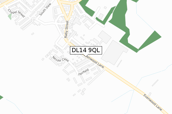
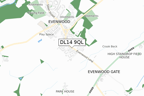
DL14 9QL is located in the Evenwood electoral ward, within the unitary authority of County Durham and the English Parliamentary constituency of Bishop Auckland. The Sub Integrated Care Board (ICB) Location is NHS North East and North Cumbria ICB - 84H and the police force is Durham. This postcode has been in use since December 2019.


GetTheData
Source: OS Open Zoomstack (Ordnance Survey)
Licence: Open Government Licence (requires attribution)
Attribution: Contains OS data © Crown copyright and database right 2024
Source: Open Postcode Geo
Licence: Open Government Licence (requires attribution)
Attribution: Contains OS data © Crown copyright and database right 2024; Contains Royal Mail data © Royal Mail copyright and database right 2024; Source: Office for National Statistics licensed under the Open Government Licence v.3.0
| Easting | 415728 |
| Northing | 524673 |
| Latitude | 54.616976 |
| Longitude | -1.757975 |
GetTheData
Source: Open Postcode Geo
Licence: Open Government Licence
| Country | England |
| Postcode District | DL14 |
| ➜ DL14 open data dashboard ➜ See where DL14 is on a map | |
GetTheData
Source: Land Registry Price Paid Data
Licence: Open Government Licence
| Ward | Evenwood |
| Constituency | Bishop Auckland |
GetTheData
Source: ONS Postcode Database
Licence: Open Government Licence
| January 2024 | Other theft | On or near Fairfield | 90m |
| January 2024 | Anti-social behaviour | On or near South View | 369m |
| November 2023 | Anti-social behaviour | On or near South View | 369m |
| ➜ Get more crime data in our Crime section | |||
GetTheData
Source: data.police.uk
Licence: Open Government Licence
| Evenwood Lane (Street Not Known) | Evenwood | 78m |
| West View (Street Not Known) | Evenwood | 80m |
| Evenwood Lane (Street Not Known) | Evenwood | 119m |
| Bank Top (Street Not Known) | Evenwood | 331m |
| Copeland Lane End (Street Not Known) | Evenwood | 341m |
GetTheData
Source: NaPTAN
Licence: Open Government Licence
GetTheData
Source: ONS Postcode Database
Licence: Open Government Licence


➜ Get more ratings from the Food Standards Agency
GetTheData
Source: Food Standards Agency
Licence: FSA terms & conditions
| Last Collection | |||
|---|---|---|---|
| Location | Mon-Fri | Sat | Distance |
| Windermere Drive | 17:00 | 09:30 | 2,386m |
| Copeland Lane | 17:00 | 08:00 | 2,395m |
| Spring Gardens | 17:15 | 10:00 | 2,426m |
GetTheData
Source: Dracos
Licence: Creative Commons Attribution-ShareAlike
| Facility | Distance |
|---|---|
| Evenwood C Of E Primary School Evenwood, Bishop Auckland Grass Pitches | 584m |
| Randolph Social Welfare Ground Stones End, Evenwood Grass Pitches, Cycling | 866m |
| Ramshaw Primary School Oaks Bank, Evenwood, Bishop Auckland Grass Pitches | 1.3km |
GetTheData
Source: Active Places
Licence: Open Government Licence
| School | Phase of Education | Distance |
|---|---|---|
| Evenwood Church of England Primary School New Road, Evenwood, Bishop Auckland, DL14 9QZ | Primary | 579m |
| Ramshaw Primary School Oaks Bank, Evenwood, Bishop Auckland, DL14 9SD | Primary | 1.3km |
| Copeland Road Primary School West Auckland, Bishop Auckland, DL14 9JJ | Primary | 2.4km |
GetTheData
Source: Edubase
Licence: Open Government Licence
The below table lists the International Territorial Level (ITL) codes (formerly Nomenclature of Territorial Units for Statistics (NUTS) codes) and Local Administrative Units (LAU) codes for DL14 9QL:
| ITL 1 Code | Name |
|---|---|
| TLC | North East (England) |
| ITL 2 Code | Name |
| TLC1 | Tees Valley and Durham |
| ITL 3 Code | Name |
| TLC14 | Durham |
| LAU 1 Code | Name |
| E06000047 | County Durham |
GetTheData
Source: ONS Postcode Directory
Licence: Open Government Licence
The below table lists the Census Output Area (OA), Lower Layer Super Output Area (LSOA), and Middle Layer Super Output Area (MSOA) for DL14 9QL:
| Code | Name | |
|---|---|---|
| OA | E00105876 | |
| LSOA | E01020861 | County Durham 064E |
| MSOA | E02004345 | County Durham 064 |
GetTheData
Source: ONS Postcode Directory
Licence: Open Government Licence
| DL14 9QN | Alexandra Terrace | 40m |
| DL14 9QJ | Randolph Terrace | 40m |
| DL14 9QW | Farncombe Terrace | 61m |
| DL14 9QH | West View | 69m |
| DL14 9SE | Fairfield | 80m |
| DL14 9QQ | Victoria Street | 155m |
| DL14 9QP | The Green | 158m |
| DL14 9SQ | Neville Close | 172m |
| DL14 9QG | Raby Street | 189m |
| DL14 9QF | The Centre | 264m |
GetTheData
Source: Open Postcode Geo; Land Registry Price Paid Data
Licence: Open Government Licence