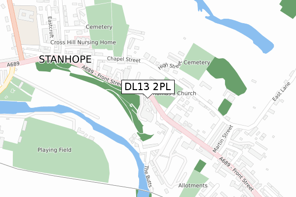
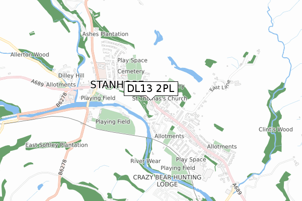
DL13 2PL is located in the Weardale electoral ward, within the unitary authority of County Durham and the English Parliamentary constituency of North West Durham. The Sub Integrated Care Board (ICB) Location is NHS North East and North Cumbria ICB - 84H and the police force is Durham. This postcode has been in use since July 2018.


GetTheData
Source: OS Open Zoomstack (Ordnance Survey)
Licence: Open Government Licence (requires attribution)
Attribution: Contains OS data © Crown copyright and database right 2024
Source: Open Postcode Geo
Licence: Open Government Licence (requires attribution)
Attribution: Contains OS data © Crown copyright and database right 2024; Contains Royal Mail data © Royal Mail copyright and database right 2024; Source: Office for National Statistics licensed under the Open Government Licence v.3.0
| Easting | 399621 |
| Northing | 539214 |
| Latitude | 54.747891 |
| Longitude | -2.007418 |
GetTheData
Source: Open Postcode Geo
Licence: Open Government Licence
| Country | England |
| Postcode District | DL13 |
| ➜ DL13 open data dashboard ➜ See where DL13 is on a map ➜ Where is Stanhope? | |
GetTheData
Source: Land Registry Price Paid Data
Licence: Open Government Licence
| Ward | Weardale |
| Constituency | North West Durham |
GetTheData
Source: ONS Postcode Database
Licence: Open Government Licence
| June 2022 | Violence and sexual offences | On or near The Market Place | 67m |
| June 2022 | Violence and sexual offences | On or near The Market Place | 67m |
| June 2022 | Violence and sexual offences | On or near The Market Place | 67m |
| ➜ Get more crime data in our Crime section | |||
GetTheData
Source: data.police.uk
Licence: Open Government Licence
| Market Place (A689 Front Street) | Stanhope | 65m |
| Fire Station (A689 Front Street) | Stanhope | 82m |
| Queens Head (Front Street) | Stanhope | 265m |
| Queens Head (Front Street) | Stanhope | 333m |
| Paragon Street | Stanhope | 384m |
| Stanhope Station | 0.6km |
| Frosterley Station | 3.6km |
GetTheData
Source: NaPTAN
Licence: Open Government Licence
| Percentage of properties with Next Generation Access | 100.0% |
| Percentage of properties with Superfast Broadband | 100.0% |
| Percentage of properties with Ultrafast Broadband | 0.0% |
| Percentage of properties with Full Fibre Broadband | 0.0% |
Superfast Broadband is between 30Mbps and 300Mbps
Ultrafast Broadband is > 300Mbps
| Percentage of properties unable to receive 2Mbps | 0.0% |
| Percentage of properties unable to receive 5Mbps | 0.0% |
| Percentage of properties unable to receive 10Mbps | 0.0% |
| Percentage of properties unable to receive 30Mbps | 0.0% |
GetTheData
Source: Ofcom
Licence: Ofcom Terms of Use (requires attribution)
GetTheData
Source: ONS Postcode Database
Licence: Open Government Licence


➜ Get more ratings from the Food Standards Agency
GetTheData
Source: Food Standards Agency
Licence: FSA terms & conditions
| Last Collection | |||
|---|---|---|---|
| Location | Mon-Fri | Sat | Distance |
| Stanhope P.o. | 16:45 | 11:00 | 171m |
| West End ,stanhope | 16:15 | 10:00 | 468m |
| Crawleyside, Stanhope | 16:00 | 09:00 | 1,031m |
GetTheData
Source: Dracos
Licence: Creative Commons Attribution-ShareAlike
| Facility | Distance |
|---|---|
| Stanhope Pool Waterside Court, Stanhope, Bishop Auckland Swimming Pool | 433m |
| Bondsle Recreation Ground Station Road, Stanhope, Bishop Auckland Grass Pitches | 574m |
| Frosterley Community School Bridge End, Frosterley, Bishop Auckland Grass Pitches | 3.7km |
GetTheData
Source: Active Places
Licence: Open Government Licence
| School | Phase of Education | Distance |
|---|---|---|
| Stanhope Barrington CofE Primary School Westcroft, Stanhope, BISHOP AUCKLAND, DL13 2NU | Primary | 495m |
| Frosterley Primary School Bridge End, Frosterley, Weardale, Bishop Auckland, DL13 2SN | Primary | 3.7km |
GetTheData
Source: Edubase
Licence: Open Government Licence
The below table lists the International Territorial Level (ITL) codes (formerly Nomenclature of Territorial Units for Statistics (NUTS) codes) and Local Administrative Units (LAU) codes for DL13 2PL:
| ITL 1 Code | Name |
|---|---|
| TLC | North East (England) |
| ITL 2 Code | Name |
| TLC1 | Tees Valley and Durham |
| ITL 3 Code | Name |
| TLC14 | Durham |
| LAU 1 Code | Name |
| E06000047 | County Durham |
GetTheData
Source: ONS Postcode Directory
Licence: Open Government Licence
The below table lists the Census Output Area (OA), Lower Layer Super Output Area (LSOA), and Middle Layer Super Output Area (MSOA) for DL13 2PL:
| Code | Name | |
|---|---|---|
| OA | E00106042 | |
| LSOA | E01020890 | County Durham 042B |
| MSOA | E02004348 | County Durham 042 |
GetTheData
Source: ONS Postcode Directory
Licence: Open Government Licence
| DL13 2UN | Market Place | 34m |
| DL13 2LY | 42m | |
| DL13 2PZ | The Castle | 50m |
| DL13 2UJ | Market Place | 97m |
| DL13 2UF | The Butts | 124m |
| DL13 2YZ | Church Lane | 133m |
| DL13 2NB | Chapel Street | 135m |
| DL13 2UP | High Street | 137m |
| DL13 2UW | Stone Houses | 143m |
| DL13 2UA | Park View | 149m |
GetTheData
Source: Open Postcode Geo; Land Registry Price Paid Data
Licence: Open Government Licence