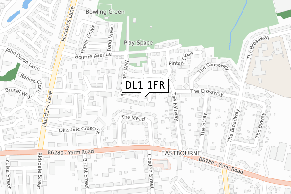
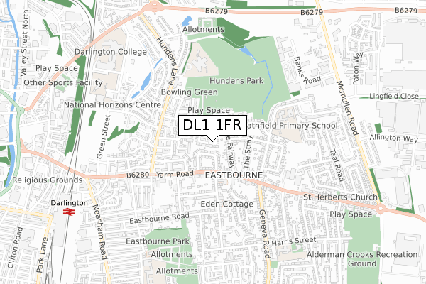
DL1 1FR is located in the Stephenson electoral ward, within the unitary authority of Darlington and the English Parliamentary constituency of Darlington. The Sub Integrated Care Board (ICB) Location is NHS North East and North Cumbria ICB - 16C and the police force is Durham. This postcode has been in use since August 2018.


GetTheData
Source: OS Open Zoomstack (Ordnance Survey)
Licence: Open Government Licence (requires attribution)
Attribution: Contains OS data © Crown copyright and database right 2024
Source: Open Postcode Geo
Licence: Open Government Licence (requires attribution)
Attribution: Contains OS data © Crown copyright and database right 2024; Contains Royal Mail data © Royal Mail copyright and database right 2024; Source: Office for National Statistics licensed under the Open Government Licence v.3.0
| Easting | 430337 |
| Northing | 514510 |
| Latitude | 54.524986 |
| Longitude | -1.532806 |
GetTheData
Source: Open Postcode Geo
Licence: Open Government Licence
| Country | England |
| Postcode District | DL1 |
| ➜ DL1 open data dashboard ➜ See where DL1 is on a map ➜ Where is Darlington? | |
GetTheData
Source: Land Registry Price Paid Data
Licence: Open Government Licence
| Ward | Stephenson |
| Constituency | Darlington |
GetTheData
Source: ONS Postcode Database
Licence: Open Government Licence
5, SKYLARK CLOSE, DARLINGTON, DL1 1FR 2022 29 SEP £224,000 |
2021 7 MAY £230,000 |
2021 15 FEB £196,000 |
12, SKYLARK CLOSE, DARLINGTON, DL1 1FR 2019 4 APR £239,995 |
2018 2 NOV £199,995 |
3, SKYLARK CLOSE, DARLINGTON, DL1 1FR 2018 26 OCT £199,995 |
9, SKYLARK CLOSE, DARLINGTON, DL1 1FR 2018 25 OCT £184,995 |
11, SKYLARK CLOSE, DARLINGTON, DL1 1FR 2018 19 OCT £209,995 |
10, SKYLARK CLOSE, DARLINGTON, DL1 1FR 2018 12 OCT £202,495 |
2018 28 SEP £239,995 |
GetTheData
Source: HM Land Registry Price Paid Data
Licence: Contains HM Land Registry data © Crown copyright and database right 2024. This data is licensed under the Open Government Licence v3.0.
| June 2023 | Violence and sexual offences | On or near Rennie Close | 391m |
| May 2023 | Violence and sexual offences | On or near Rennie Close | 391m |
| May 2023 | Public order | On or near Rennie Close | 391m |
| ➜ Get more crime data in our Crime section | |||
GetTheData
Source: data.police.uk
Licence: Open Government Licence
| Cobden Street (Yarm Road) | Eastbourne | 183m |
| Cobden Street (Yarm Road) | Eastbourne | 188m |
| Yarm Road Post Office (Yarm Road) | Eastbourne | 282m |
| Bright Street (Yarm Road) | Eastbourne | 307m |
| Larkspur Drive (Hundens Lane) | Hundens Lane | 323m |
| Darlington Station | 1.1km |
| North Road Station | 1.9km |
| Dinsdale Station | 4.4km |
GetTheData
Source: NaPTAN
Licence: Open Government Licence
➜ Broadband speed and availability dashboard for DL1 1FR
| Percentage of properties with Next Generation Access | 100.0% |
| Percentage of properties with Superfast Broadband | 100.0% |
| Percentage of properties with Ultrafast Broadband | 0.0% |
| Percentage of properties with Full Fibre Broadband | 0.0% |
Superfast Broadband is between 30Mbps and 300Mbps
Ultrafast Broadband is > 300Mbps
| Median download speed | 39.1Mbps |
| Average download speed | 35.8Mbps |
| Maximum download speed | 55.00Mbps |
| Median upload speed | 9.5Mbps |
| Average upload speed | 7.9Mbps |
| Maximum upload speed | 10.00Mbps |
| Percentage of properties unable to receive 2Mbps | 0.0% |
| Percentage of properties unable to receive 5Mbps | 0.0% |
| Percentage of properties unable to receive 10Mbps | 0.0% |
| Percentage of properties unable to receive 30Mbps | 0.0% |
➜ Broadband speed and availability dashboard for DL1 1FR
GetTheData
Source: Ofcom
Licence: Ofcom Terms of Use (requires attribution)
GetTheData
Source: ONS Postcode Database
Licence: Open Government Licence


➜ Get more ratings from the Food Standards Agency
GetTheData
Source: Food Standards Agency
Licence: FSA terms & conditions
| Last Collection | |||
|---|---|---|---|
| Location | Mon-Fri | Sat | Distance |
| Yarm Road | 18:30 | 11:30 | 278m |
| Cobden Street | 17:30 | 11:15 | 298m |
| Hundens Lane | 17:30 | 11:00 | 463m |
GetTheData
Source: Dracos
Licence: Creative Commons Attribution-ShareAlike
| Facility | Distance |
|---|---|
| Eastbourne Sports Complex Bourne Avenue, Darlington Athletics, Health and Fitness Gym, Sports Hall, Grass Pitches, Artificial Grass Pitch | 131m |
| Eastbourne Church Of England Academy (Closed) The Fairway, Darlington Sports Hall, Grass Pitches | 225m |
| Heathfield Primary School The Broadway, Darlington Grass Pitches | 419m |
GetTheData
Source: Active Places
Licence: Open Government Licence
| School | Phase of Education | Distance |
|---|---|---|
| St Aidan's Church of England Academy Hundens Lane, Darlington, DL1 1LL | Secondary | 94m |
| Heathfield Primary School The Broadway, Darlington, DL1 1EJ | Primary | 419m |
| St Teresa's Catholic Primary School Harris Street, Darlington, DL1 4NL | Primary | 740m |
GetTheData
Source: Edubase
Licence: Open Government Licence
The below table lists the International Territorial Level (ITL) codes (formerly Nomenclature of Territorial Units for Statistics (NUTS) codes) and Local Administrative Units (LAU) codes for DL1 1FR:
| ITL 1 Code | Name |
|---|---|
| TLC | North East (England) |
| ITL 2 Code | Name |
| TLC1 | Tees Valley and Durham |
| ITL 3 Code | Name |
| TLC13 | Darlington |
| LAU 1 Code | Name |
| E06000005 | Darlington |
GetTheData
Source: ONS Postcode Directory
Licence: Open Government Licence
The below table lists the Census Output Area (OA), Lower Layer Super Output Area (LSOA), and Middle Layer Super Output Area (MSOA) for DL1 1FR:
| Code | Name | |
|---|---|---|
| OA | E00062254 | |
| LSOA | E01012342 | Darlington 009C |
| MSOA | E02002567 | Darlington 009 |
GetTheData
Source: ONS Postcode Directory
Licence: Open Government Licence
| DL1 1EU | The Mead | 68m |
| DL1 1ES | The Fairway | 88m |
| DL1 1EX | The Mead | 95m |
| DL1 1ER | The Crossway | 149m |
| DL1 1EE | Yarm Road | 153m |
| DL1 1GR | Violet Grove | 154m |
| DL1 1FF | Lapwing Drive | 160m |
| DL1 1GS | Cyclamen Grove | 165m |
| DL1 1EP | The Stray | 205m |
| DL1 1LN | Bourne Avenue | 213m |
GetTheData
Source: Open Postcode Geo; Land Registry Price Paid Data
Licence: Open Government Licence