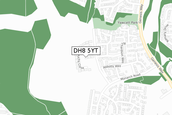
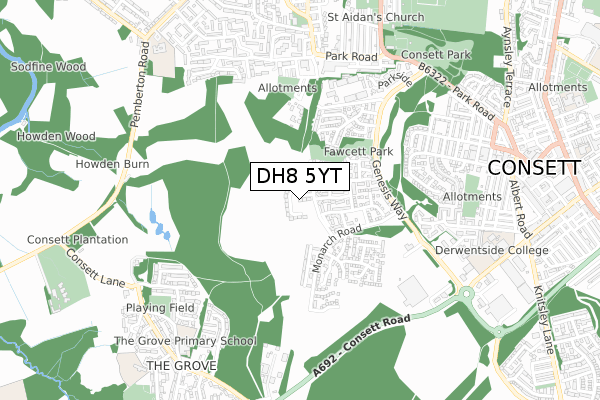
DH8 5YT is located in the Consett South electoral ward, within the unitary authority of County Durham and the English Parliamentary constituency of North West Durham. The Sub Integrated Care Board (ICB) Location is NHS North East and North Cumbria ICB - 84H and the police force is Durham. This postcode has been in use since February 2019.


GetTheData
Source: OS Open Zoomstack (Ordnance Survey)
Licence: Open Government Licence (requires attribution)
Attribution: Contains OS data © Crown copyright and database right 2024
Source: Open Postcode Geo
Licence: Open Government Licence (requires attribution)
Attribution: Contains OS data © Crown copyright and database right 2024; Contains Royal Mail data © Royal Mail copyright and database right 2024; Source: Office for National Statistics licensed under the Open Government Licence v.3.0
| Easting | 409824 |
| Northing | 550809 |
| Latitude | 54.851995 |
| Longitude | -1.848528 |
GetTheData
Source: Open Postcode Geo
Licence: Open Government Licence
| Country | England |
| Postcode District | DH8 |
| ➜ DH8 open data dashboard ➜ See where DH8 is on a map ➜ Where is Consett? | |
GetTheData
Source: Land Registry Price Paid Data
Licence: Open Government Licence
| Ward | Consett South |
| Constituency | North West Durham |
GetTheData
Source: ONS Postcode Database
Licence: Open Government Licence
2023 17 JAN £400,000 |
2022 29 SEP £360,000 |
2022 22 APR £375,500 |
2021 28 MAY £345,000 |
9A, DUCHY CLOSE, CONSETT, DH8 5YT 2021 29 JAN £223,450 |
2021 29 JAN £223,450 |
10, DUCHY CLOSE, CONSETT, DH8 5YT 2021 28 JAN £323,450 |
8A, DUCHY CLOSE, CONSETT, DH8 5YT 2021 28 JAN £231,450 |
7, DUCHY CLOSE, CONSETT, DH8 5YT 2020 18 DEC £223,450 |
5, DUCHY CLOSE, CONSETT, DH8 5YT 2020 17 DEC £231,450 |
GetTheData
Source: HM Land Registry Price Paid Data
Licence: Contains HM Land Registry data © Crown copyright and database right 2024. This data is licensed under the Open Government Licence v3.0.
| June 2022 | Anti-social behaviour | On or near Genesis Way | 384m |
| May 2022 | Violence and sexual offences | On or near Fenwick Way | 373m |
| May 2022 | Violence and sexual offences | On or near Fenwick Way | 373m |
| ➜ Get more crime data in our Crime section | |||
GetTheData
Source: data.police.uk
Licence: Open Government Licence
| St James Court | Consett | 276m |
| Genesis Way | Consett | 383m |
| Genesis Way | Consett | 386m |
| Tesco (Genesis Way) | Consett | 510m |
| Fell Top (Unclassified Road) | Blackhill | 583m |
GetTheData
Source: NaPTAN
Licence: Open Government Licence
| Percentage of properties with Next Generation Access | 100.0% |
| Percentage of properties with Superfast Broadband | 100.0% |
| Percentage of properties with Ultrafast Broadband | 83.3% |
| Percentage of properties with Full Fibre Broadband | 83.3% |
Superfast Broadband is between 30Mbps and 300Mbps
Ultrafast Broadband is > 300Mbps
| Percentage of properties unable to receive 2Mbps | 0.0% |
| Percentage of properties unable to receive 5Mbps | 0.0% |
| Percentage of properties unable to receive 10Mbps | 0.0% |
| Percentage of properties unable to receive 30Mbps | 0.0% |
GetTheData
Source: Ofcom
Licence: Ofcom Terms of Use (requires attribution)
GetTheData
Source: ONS Postcode Database
Licence: Open Government Licence


➜ Get more ratings from the Food Standards Agency
GetTheData
Source: Food Standards Agency
Licence: FSA terms & conditions
| Last Collection | |||
|---|---|---|---|
| Location | Mon-Fri | Sat | Distance |
| West Victoria Road | 16:30 | 11:45 | 679m |
| Berry Edge Road | 16:15 | 11:45 | 737m |
| The Grove | 16:15 | 12:00 | 905m |
GetTheData
Source: Dracos
Licence: Creative Commons Attribution-ShareAlike
| Facility | Distance |
|---|---|
| Ymca (Consett And District) (Closed) Parliament Street, Consett Sports Hall | 742m |
| The Grove Primary School Oakfield Lane, Consett Grass Pitches | 781m |
| Derwentside College (Closed) Front Street, Consett Sports Hall, Health and Fitness Gym, Outdoor Tennis Courts | 831m |
GetTheData
Source: Active Places
Licence: Open Government Licence
| School | Phase of Education | Distance |
|---|---|---|
| Delta Independent School Parliament Street, Consett, DH8 5DH | Not applicable | 756m |
| The Grove Primary School Oakfield Lane, The Grove, Consett, DH8 8AP | Primary | 764m |
| Derwentside College Front Street, Consett, DH8 5EE | 16 plus | 831m |
GetTheData
Source: Edubase
Licence: Open Government Licence
The below table lists the International Territorial Level (ITL) codes (formerly Nomenclature of Territorial Units for Statistics (NUTS) codes) and Local Administrative Units (LAU) codes for DH8 5YT:
| ITL 1 Code | Name |
|---|---|
| TLC | North East (England) |
| ITL 2 Code | Name |
| TLC1 | Tees Valley and Durham |
| ITL 3 Code | Name |
| TLC14 | Durham |
| LAU 1 Code | Name |
| E06000047 | County Durham |
GetTheData
Source: ONS Postcode Directory
Licence: Open Government Licence
The below table lists the Census Output Area (OA), Lower Layer Super Output Area (LSOA), and Middle Layer Super Output Area (MSOA) for DH8 5YT:
| Code | Name | |
|---|---|---|
| OA | E00171775 | |
| LSOA | E01020644 | County Durham 014D |
| MSOA | E02004305 | County Durham 014 |
GetTheData
Source: ONS Postcode Directory
Licence: Open Government Licence
| DH8 5XY | Elliott Way | 134m |
| DH8 5YD | Agar Close | 225m |
| DH8 5XU | Abbotts Way | 230m |
| DH8 5YF | Richardson Way | 257m |
| DH8 5YN | Kensington Close | 281m |
| DH8 5YH | Monarch Road | 308m |
| DH8 5YL | Queen Elizabeth Drive | 326m |
| DH8 5FD | Fenwick Way | 333m |
| DH8 5FE | Fenwick Way | 408m |
| DH8 5XL | Romany Drive | 481m |
GetTheData
Source: Open Postcode Geo; Land Registry Price Paid Data
Licence: Open Government Licence