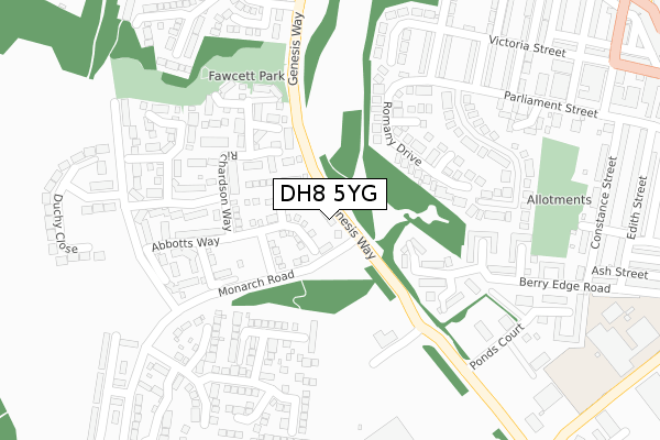
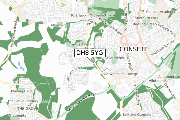
DH8 5YG is located in the Consett South electoral ward, within the unitary authority of County Durham and the English Parliamentary constituency of North West Durham. The Sub Integrated Care Board (ICB) Location is NHS North East and North Cumbria ICB - 84H and the police force is Durham. This postcode has been in use since July 2019.


GetTheData
Source: OS Open Zoomstack (Ordnance Survey)
Licence: Open Government Licence (requires attribution)
Attribution: Contains OS data © Crown copyright and database right 2024
Source: Open Postcode Geo
Licence: Open Government Licence (requires attribution)
Attribution: Contains OS data © Crown copyright and database right 2024; Contains Royal Mail data © Royal Mail copyright and database right 2024; Source: Office for National Statistics licensed under the Open Government Licence v.3.0
| Easting | 410195 |
| Northing | 550793 |
| Latitude | 54.851844 |
| Longitude | -1.842750 |
GetTheData
Source: Open Postcode Geo
Licence: Open Government Licence
| Country | England |
| Postcode District | DH8 |
| ➜ DH8 open data dashboard ➜ See where DH8 is on a map ➜ Where is Consett? | |
GetTheData
Source: Land Registry Price Paid Data
Licence: Open Government Licence
| Ward | Consett South |
| Constituency | North West Durham |
GetTheData
Source: ONS Postcode Database
Licence: Open Government Licence
| June 2022 | Anti-social behaviour | On or near Genesis Way | 21m |
| June 2022 | Violence and sexual offences | On or near Generation Place | 194m |
| June 2022 | Public order | On or near Ponds Court | 318m |
| ➜ Get more crime data in our Crime section | |||
GetTheData
Source: data.police.uk
Licence: Open Government Licence
| Tesco (Genesis Way) | Consett | 179m |
| Genesis Way | Consett | 235m |
| Genesis Way | Consett | 251m |
| Tesco (Genesis Way) | Consett | 259m |
| St James Court | Consett | 418m |
GetTheData
Source: NaPTAN
Licence: Open Government Licence
| Percentage of properties with Next Generation Access | 100.0% |
| Percentage of properties with Superfast Broadband | 100.0% |
| Percentage of properties with Ultrafast Broadband | 0.0% |
| Percentage of properties with Full Fibre Broadband | 0.0% |
Superfast Broadband is between 30Mbps and 300Mbps
Ultrafast Broadband is > 300Mbps
| Percentage of properties unable to receive 2Mbps | 0.0% |
| Percentage of properties unable to receive 5Mbps | 0.0% |
| Percentage of properties unable to receive 10Mbps | 0.0% |
| Percentage of properties unable to receive 30Mbps | 0.0% |
GetTheData
Source: Ofcom
Licence: Ofcom Terms of Use (requires attribution)
GetTheData
Source: ONS Postcode Database
Licence: Open Government Licence


➜ Get more ratings from the Food Standards Agency
GetTheData
Source: Food Standards Agency
Licence: FSA terms & conditions
| Last Collection | |||
|---|---|---|---|
| Location | Mon-Fri | Sat | Distance |
| Berry Edge Road | 16:15 | 11:45 | 371m |
| West Victoria Road | 16:30 | 11:45 | 371m |
| Park Road | 16:30 | 11:45 | 585m |
GetTheData
Source: Dracos
Licence: Creative Commons Attribution-ShareAlike
| Facility | Distance |
|---|---|
| Ymca (Consett And District) (Closed) Parliament Street, Consett Sports Hall | 400m |
| Derwentside College (Closed) Front Street, Consett Sports Hall, Health and Fitness Gym, Outdoor Tennis Courts | 474m |
| Puregym (Consett) Hermiston Retail Park, Consett Health and Fitness Gym | 639m |
GetTheData
Source: Active Places
Licence: Open Government Licence
| School | Phase of Education | Distance |
|---|---|---|
| Delta Independent School Parliament Street, Consett, DH8 5DH | Not applicable | 402m |
| Derwentside College Front Street, Consett, DH8 5EE | 16 plus | 474m |
| Learning for Life Herbert Street, Consett, DH8 6AE | Not applicable | 841m |
GetTheData
Source: Edubase
Licence: Open Government Licence
The below table lists the International Territorial Level (ITL) codes (formerly Nomenclature of Territorial Units for Statistics (NUTS) codes) and Local Administrative Units (LAU) codes for DH8 5YG:
| ITL 1 Code | Name |
|---|---|
| TLC | North East (England) |
| ITL 2 Code | Name |
| TLC1 | Tees Valley and Durham |
| ITL 3 Code | Name |
| TLC14 | Durham |
| LAU 1 Code | Name |
| E06000047 | County Durham |
GetTheData
Source: ONS Postcode Directory
Licence: Open Government Licence
The below table lists the Census Output Area (OA), Lower Layer Super Output Area (LSOA), and Middle Layer Super Output Area (MSOA) for DH8 5YG:
| Code | Name | |
|---|---|---|
| OA | E00171775 | |
| LSOA | E01020644 | County Durham 014D |
| MSOA | E02004305 | County Durham 014 |
GetTheData
Source: ONS Postcode Directory
Licence: Open Government Licence
| DH8 5XL | Romany Drive | 138m |
| DH8 5XU | Abbotts Way | 159m |
| DH8 5XJ | Romany Drive | 173m |
| DH8 5YF | Richardson Way | 179m |
| DH8 5XT | Generation Place | 185m |
| DH8 5YD | Agar Close | 191m |
| DH8 5XW | Edwardia Court | 201m |
| DH8 5XN | Georgia Court | 206m |
| DH8 5YN | Kensington Close | 253m |
| DH8 5GA | Stuart Court | 263m |
GetTheData
Source: Open Postcode Geo; Land Registry Price Paid Data
Licence: Open Government Licence