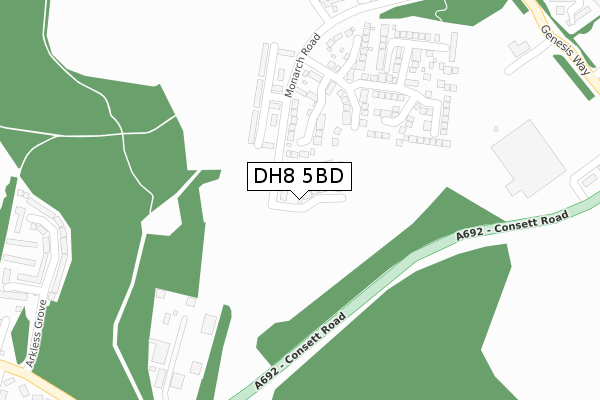
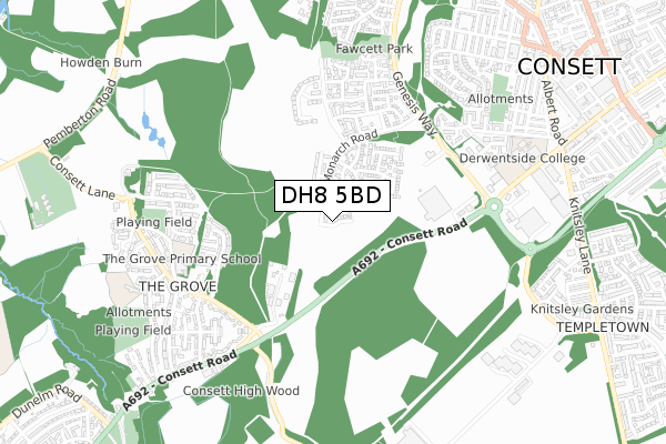
DH8 5BD is located in the Consett South electoral ward, within the unitary authority of County Durham and the English Parliamentary constituency of North West Durham. The Sub Integrated Care Board (ICB) Location is NHS North East and North Cumbria ICB - 84H and the police force is Durham. This postcode has been in use since July 2019.


GetTheData
Source: OS Open Zoomstack (Ordnance Survey)
Licence: Open Government Licence (requires attribution)
Attribution: Contains OS data © Crown copyright and database right 2024
Source: Open Postcode Geo
Licence: Open Government Licence (requires attribution)
Attribution: Contains OS data © Crown copyright and database right 2024; Contains Royal Mail data © Royal Mail copyright and database right 2024; Source: Office for National Statistics licensed under the Open Government Licence v.3.0
| Easting | 409938 |
| Northing | 550375 |
| Latitude | 54.848092 |
| Longitude | -1.846767 |
GetTheData
Source: Open Postcode Geo
Licence: Open Government Licence
| Country | England |
| Postcode District | DH8 |
| ➜ DH8 open data dashboard ➜ See where DH8 is on a map ➜ Where is Consett? | |
GetTheData
Source: Land Registry Price Paid Data
Licence: Open Government Licence
| Ward | Consett South |
| Constituency | North West Durham |
GetTheData
Source: ONS Postcode Database
Licence: Open Government Licence
14, BEAUMONT WAY, CONSETT, DH8 5BD 2020 26 NOV £167,000 |
12, BEAUMONT WAY, CONSETT, DH8 5BD 2020 13 NOV £231,000 |
11, BEAUMONT WAY, CONSETT, DH8 5BD 2020 24 MAR £193,450 |
9, BEAUMONT WAY, CONSETT, DH8 5BD 2020 20 FEB £231,000 |
5, BEAUMONT WAY, CONSETT, DH8 5BD 2020 31 JAN £203,450 |
7, BEAUMONT WAY, CONSETT, DH8 5BD 2020 31 JAN £231,000 |
3, BEAUMONT WAY, CONSETT, DH8 5BD 2019 19 DEC £173,450 |
1, BEAUMONT WAY, CONSETT, DH8 5BD 2019 8 NOV £173,450 |
GetTheData
Source: HM Land Registry Price Paid Data
Licence: Contains HM Land Registry data © Crown copyright and database right 2024. This data is licensed under the Open Government Licence v3.0.
| June 2022 | Anti-social behaviour | On or near Consett Road | 195m |
| May 2022 | Anti-social behaviour | On or near Consett Road | 195m |
| April 2022 | Anti-social behaviour | On or near Arkless Grove | 498m |
| ➜ Get more crime data in our Crime section | |||
GetTheData
Source: data.police.uk
Licence: Open Government Licence
| St James Court | Consett | 177m |
| Fell Coke Works (A692) | Consett | 241m |
| Fell Coke Works (A692) | Consett | 250m |
| Tesco (Genesis Way) | Consett | 468m |
| Tesco (Genesis Way) | Consett | 497m |
GetTheData
Source: NaPTAN
Licence: Open Government Licence
GetTheData
Source: ONS Postcode Database
Licence: Open Government Licence


➜ Get more ratings from the Food Standards Agency
GetTheData
Source: Food Standards Agency
Licence: FSA terms & conditions
| Last Collection | |||
|---|---|---|---|
| Location | Mon-Fri | Sat | Distance |
| Berry Edge Road | 16:15 | 11:45 | 689m |
| The Grove | 16:15 | 12:00 | 700m |
| Hownsgill Industrial Estate | 16:15 | 12:00 | 835m |
GetTheData
Source: Dracos
Licence: Creative Commons Attribution-ShareAlike
| Facility | Distance |
|---|---|
| The Grove Primary School Oakfield Lane, Consett Grass Pitches | 627m |
| Derwentside College (Closed) Front Street, Consett Sports Hall, Health and Fitness Gym, Outdoor Tennis Courts | 726m |
| Puregym (Consett) Hermiston Retail Park, Consett Health and Fitness Gym | 769m |
GetTheData
Source: Active Places
Licence: Open Government Licence
| School | Phase of Education | Distance |
|---|---|---|
| The Grove Primary School Oakfield Lane, The Grove, Consett, DH8 8AP | Primary | 669m |
| Derwentside College Front Street, Consett, DH8 5EE | 16 plus | 728m |
| St Pius Xth Catholic Primary School, Consett Thornfield Road, The Grove, Consett, DH8 8AX | Primary | 826m |
GetTheData
Source: Edubase
Licence: Open Government Licence
The below table lists the International Territorial Level (ITL) codes (formerly Nomenclature of Territorial Units for Statistics (NUTS) codes) and Local Administrative Units (LAU) codes for DH8 5BD:
| ITL 1 Code | Name |
|---|---|
| TLC | North East (England) |
| ITL 2 Code | Name |
| TLC1 | Tees Valley and Durham |
| ITL 3 Code | Name |
| TLC14 | Durham |
| LAU 1 Code | Name |
| E06000047 | County Durham |
GetTheData
Source: ONS Postcode Directory
Licence: Open Government Licence
The below table lists the Census Output Area (OA), Lower Layer Super Output Area (LSOA), and Middle Layer Super Output Area (MSOA) for DH8 5BD:
| Code | Name | |
|---|---|---|
| OA | E00104748 | |
| LSOA | E01020644 | County Durham 014D |
| MSOA | E02004305 | County Durham 014 |
GetTheData
Source: ONS Postcode Directory
Licence: Open Government Licence
| DH8 5YH | Monarch Road | 141m |
| DH8 5YL | Queen Elizabeth Drive | 160m |
| DH8 5YN | Kensington Close | 248m |
| DH8 5YD | Agar Close | 343m |
| DH8 5XU | Abbotts Way | 383m |
| DH8 8AB | Arkless Grove | 477m |
| DH8 5XY | Elliott Way | 504m |
| DH8 5XT | Generation Place | 524m |
| DH8 5YF | Richardson Way | 549m |
| DH8 8AD | Taylors Terrace | 569m |
GetTheData
Source: Open Postcode Geo; Land Registry Price Paid Data
Licence: Open Government Licence