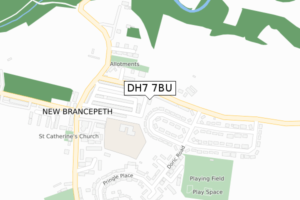
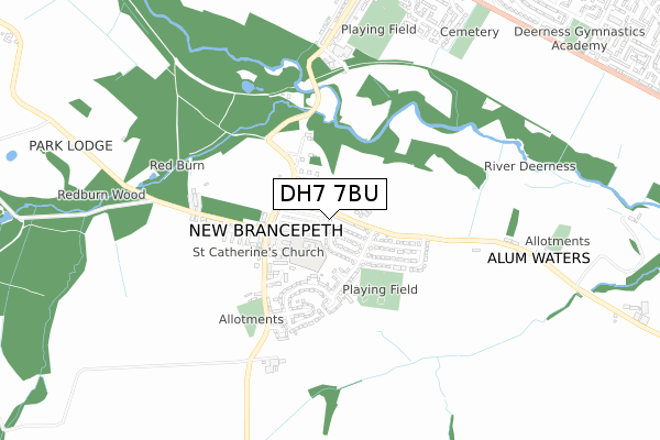
DH7 7BU is located in the Deerness electoral ward, within the unitary authority of County Durham and the English Parliamentary constituency of City of Durham. The Sub Integrated Care Board (ICB) Location is NHS North East and North Cumbria ICB - 84H and the police force is Durham. This postcode has been in use since August 2019.


GetTheData
Source: OS Open Zoomstack (Ordnance Survey)
Licence: Open Government Licence (requires attribution)
Attribution: Contains OS data © Crown copyright and database right 2024
Source: Open Postcode Geo
Licence: Open Government Licence (requires attribution)
Attribution: Contains OS data © Crown copyright and database right 2024; Contains Royal Mail data © Royal Mail copyright and database right 2024; Source: Office for National Statistics licensed under the Open Government Licence v.3.0
| Easting | 422683 |
| Northing | 541599 |
| Latitude | 54.768818 |
| Longitude | -1.648972 |
GetTheData
Source: Open Postcode Geo
Licence: Open Government Licence
| Country | England |
| Postcode District | DH7 |
| ➜ DH7 open data dashboard ➜ See where DH7 is on a map ➜ Where is New Brancepeth? | |
GetTheData
Source: Land Registry Price Paid Data
Licence: Open Government Licence
| Ward | Deerness |
| Constituency | City Of Durham |
GetTheData
Source: ONS Postcode Database
Licence: Open Government Licence
| June 2022 | Violence and sexual offences | On or near Tuscan Close | 214m |
| June 2022 | Violence and sexual offences | On or near Pringle Place | 288m |
| May 2022 | Anti-social behaviour | On or near Tuscan Close | 214m |
| ➜ Get more crime data in our Crime section | |||
GetTheData
Source: data.police.uk
Licence: Open Government Licence
| Waltons Terrace | New Brancepeth | 110m |
| Doric Road - Walton's Terrace (Doric Road) | New Brancepeth | 161m |
| Doric Road | New Brancepeth | 168m |
| Braunespath Cottage (Waltons Terrace) | New Brancepeth | 206m |
| Pringle Place | New Brancepeth | 247m |
| Durham Station | 4.5km |
GetTheData
Source: NaPTAN
Licence: Open Government Licence
GetTheData
Source: ONS Postcode Database
Licence: Open Government Licence


➜ Get more ratings from the Food Standards Agency
GetTheData
Source: Food Standards Agency
Licence: FSA terms & conditions
| Last Collection | |||
|---|---|---|---|
| Location | Mon-Fri | Sat | Distance |
| Station Road, Ushaw Moor | 16:50 | 09:00 | 991m |
| Oakridge Road, Ushaw Moor | 16:00 | 09:15 | 1,110m |
| Temperence Terrace | 17:30 | 12:00 | 1,116m |
GetTheData
Source: Dracos
Licence: Creative Commons Attribution-ShareAlike
| Facility | Distance |
|---|---|
| New Brancepeth Primary Academy New Brancepeth, Durham Grass Pitches | 112m |
| New Brancepeth Recreation Ground Braunespath Estate, New Brancepeth Grass Pitches | 311m |
| Ushaw Moor Park Highfield Terrace, Ushaw Moor Grass Pitches | 837m |
GetTheData
Source: Active Places
Licence: Open Government Licence
| School | Phase of Education | Distance |
|---|---|---|
| New Brancepeth Primary Academy Rock Terrace, New Brancepeth, Durham, DH7 7EU | Primary | 104m |
| Silver Tree Primary School and Nursery Durham Road, Ushaw Moor, Durham Road, Ushaw Moor, Durham, Durham, DH7 7LF | Primary | 1km |
| St Joseph's Catholic Primary School, Ushaw Moor Durham Road, Ushaw Moor, Durham, DH7 7LF | Primary | 1.1km |
GetTheData
Source: Edubase
Licence: Open Government Licence
The below table lists the International Territorial Level (ITL) codes (formerly Nomenclature of Territorial Units for Statistics (NUTS) codes) and Local Administrative Units (LAU) codes for DH7 7BU:
| ITL 1 Code | Name |
|---|---|
| TLC | North East (England) |
| ITL 2 Code | Name |
| TLC1 | Tees Valley and Durham |
| ITL 3 Code | Name |
| TLC14 | Durham |
| LAU 1 Code | Name |
| E06000047 | County Durham |
GetTheData
Source: ONS Postcode Directory
Licence: Open Government Licence
The below table lists the Census Output Area (OA), Lower Layer Super Output Area (LSOA), and Middle Layer Super Output Area (MSOA) for DH7 7BU:
| Code | Name | |
|---|---|---|
| OA | E00105112 | |
| LSOA | E01020714 | County Durham 026D |
| MSOA | E02004310 | County Durham 026 |
GetTheData
Source: ONS Postcode Directory
Licence: Open Government Licence
| DH7 7EL | Model Cottages | 43m |
| DH7 7ER | Waltons Terrace | 61m |
| DH7 7JF | Braunespath Estate | 85m |
| DH7 7EP | Rock Terrace | 102m |
| DH7 7EU | 112m | |
| DH7 7EN | Edward Terrace | 115m |
| DH7 7EJ | Prospect Terrace | 127m |
| DH7 7HY | Cooperative Terrace | 148m |
| DH7 7EF | Barley Rise | 178m |
| DH7 7HX | Benville Terrace | 198m |
GetTheData
Source: Open Postcode Geo; Land Registry Price Paid Data
Licence: Open Government Licence