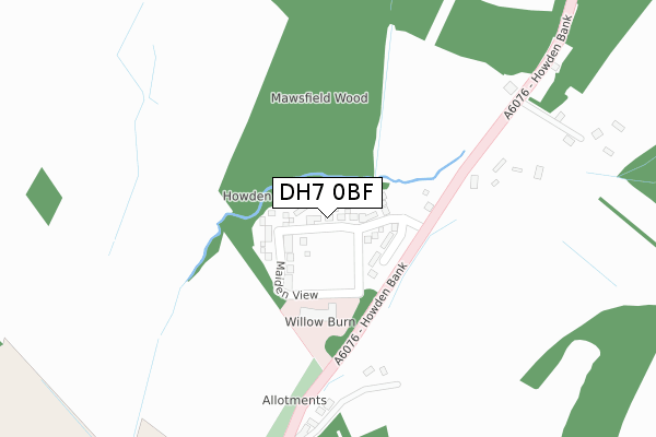
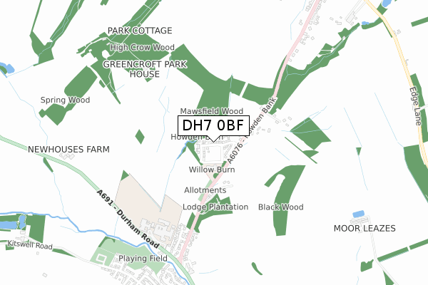
DH7 0BF is located in the Lanchester electoral ward, within the unitary authority of County Durham and the English Parliamentary constituency of North West Durham. The Sub Integrated Care Board (ICB) Location is NHS North East and North Cumbria ICB - 84H and the police force is Durham. This postcode has been in use since April 2019.


GetTheData
Source: OS Open Zoomstack (Ordnance Survey)
Licence: Open Government Licence (requires attribution)
Attribution: Contains OS data © Crown copyright and database right 2024
Source: Open Postcode Geo
Licence: Open Government Licence (requires attribution)
Attribution: Contains OS data © Crown copyright and database right 2024; Contains Royal Mail data © Royal Mail copyright and database right 2024; Source: Office for National Statistics licensed under the Open Government Licence v.3.0
| Easting | 416629 |
| Northing | 548698 |
| Latitude | 54.832847 |
| Longitude | -1.742663 |
GetTheData
Source: Open Postcode Geo
Licence: Open Government Licence
| Country | England |
| Postcode District | DH7 |
| ➜ DH7 open data dashboard ➜ See where DH7 is on a map ➜ Where is Maiden Law? | |
GetTheData
Source: Land Registry Price Paid Data
Licence: Open Government Licence
| Ward | Lanchester |
| Constituency | North West Durham |
GetTheData
Source: ONS Postcode Database
Licence: Open Government Licence
| January 2022 | Violence and sexual offences | On or near Howden Bank | 205m |
| April 2021 | Anti-social behaviour | On or near Howden Bank | 205m |
| March 2021 | Burglary | On or near Howden Bank | 205m |
| ➜ Get more crime data in our Crime section | |||
GetTheData
Source: data.police.uk
Licence: Open Government Licence
| Care Homes (Howden Bank) | Maiden Law | 155m |
| Hospital (A6076) | Maiden Law | 319m |
| Hospital (A6076) | Maiden Law | 374m |
| Ornsby Hill (A6076) | Lanchester | 588m |
| Ornsby Hill (A6076) | Lanchester | 627m |
GetTheData
Source: NaPTAN
Licence: Open Government Licence
| Percentage of properties with Next Generation Access | 100.0% |
| Percentage of properties with Superfast Broadband | 100.0% |
| Percentage of properties with Ultrafast Broadband | 100.0% |
| Percentage of properties with Full Fibre Broadband | 100.0% |
Superfast Broadband is between 30Mbps and 300Mbps
Ultrafast Broadband is > 300Mbps
| Percentage of properties unable to receive 2Mbps | 0.0% |
| Percentage of properties unable to receive 5Mbps | 0.0% |
| Percentage of properties unable to receive 10Mbps | 0.0% |
| Percentage of properties unable to receive 30Mbps | 0.0% |
GetTheData
Source: Ofcom
Licence: Ofcom Terms of Use (requires attribution)
GetTheData
Source: ONS Postcode Database
Licence: Open Government Licence


➜ Get more ratings from the Food Standards Agency
GetTheData
Source: Food Standards Agency
Licence: FSA terms & conditions
| Last Collection | |||
|---|---|---|---|
| Location | Mon-Fri | Sat | Distance |
| Ford Road, Lanchester | 16:00 | 09:45 | 1,540m |
| Durham Road, Lanchester | 16:30 | 09:30 | 1,565m |
| Deneside, Lanchester | 16:30 | 07:15 | 1,574m |
GetTheData
Source: Dracos
Licence: Creative Commons Attribution-ShareAlike
| Facility | Distance |
|---|---|
| St Bede's Roman Catholic Comprehensive School And Sixth Form College Consett Road, Lanchester, Durham Grass Pitches, Sports Hall, Studio, Artificial Grass Pitch | 563m |
| Kitswell Road Playing Field Kitswell Road, Lanchester, Durham Grass Pitches | 808m |
| All Saints Catholic Voluntary Aided Primary School Kitswell Road, Lanchester, Durham Grass Pitches | 998m |
GetTheData
Source: Active Places
Licence: Open Government Licence
| School | Phase of Education | Distance |
|---|---|---|
| St Bede's Catholic School and Sixth Form College, Lanchester Consett Road, Lanchester, Durham, DH7 0RD | Secondary | 563m |
| All Saints' Catholic Primary School, Lanchester Kitswell Road, Lanchester, Durham, DH7 0JG | Primary | 998m |
| Lanchester Endowed Parochial Primary School Front Street, Lanchester, Durham, DH7 0HU | Primary | 1km |
GetTheData
Source: Edubase
Licence: Open Government Licence
The below table lists the International Territorial Level (ITL) codes (formerly Nomenclature of Territorial Units for Statistics (NUTS) codes) and Local Administrative Units (LAU) codes for DH7 0BF:
| ITL 1 Code | Name |
|---|---|
| TLC | North East (England) |
| ITL 2 Code | Name |
| TLC1 | Tees Valley and Durham |
| ITL 3 Code | Name |
| TLC14 | Durham |
| LAU 1 Code | Name |
| E06000047 | County Durham |
GetTheData
Source: ONS Postcode Directory
Licence: Open Government Licence
The below table lists the Census Output Area (OA), Lower Layer Super Output Area (LSOA), and Middle Layer Super Output Area (MSOA) for DH7 0BF:
| Code | Name | |
|---|---|---|
| OA | E00104849 | |
| LSOA | E01020664 | County Durham 020B |
| MSOA | E02004306 | County Durham 020 |
GetTheData
Source: ONS Postcode Directory
Licence: Open Government Licence
| DH7 0QL | Ornsby Hill | 257m |
| DH7 0QW | Howden Bank | 375m |
| DH7 0QR | Howden Bank | 448m |
| DH7 0QF | Foxwood Court | 528m |
| DH7 0QJ | Crow Hall | 534m |
| DH7 0RX | St Bedes Court | 577m |
| DH7 0PU | Bishops Meadow | 690m |
| DH7 0QP | Howden Bank Cottages | 692m |
| DH7 0JT | Fenhall Park | 782m |
| DH7 0JS | Ashdown Grove | 843m |
GetTheData
Source: Open Postcode Geo; Land Registry Price Paid Data
Licence: Open Government Licence