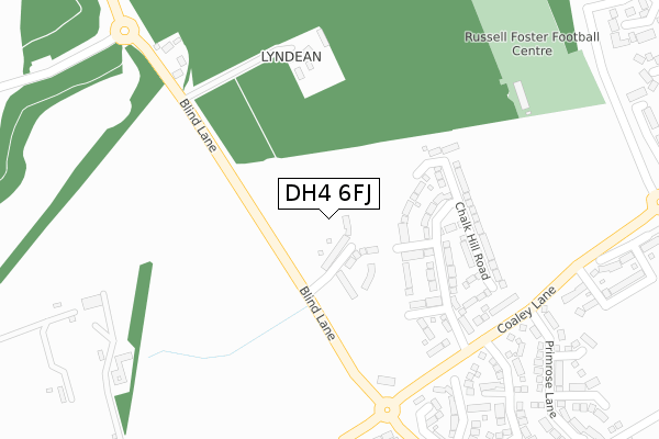
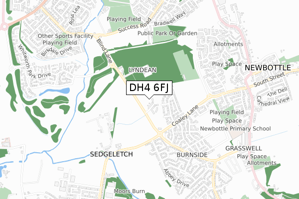
DH4 6FJ is located in the Houghton electoral ward, within the metropolitan district of Sunderland and the English Parliamentary constituency of Houghton and Sunderland South. The Sub Integrated Care Board (ICB) Location is NHS North East and North Cumbria ICB - 00P and the police force is Northumbria. This postcode has been in use since April 2020.


GetTheData
Source: OS Open Zoomstack (Ordnance Survey)
Licence: Open Government Licence (requires attribution)
Attribution: Contains OS data © Crown copyright and database right 2024
Source: Open Postcode Geo
Licence: Open Government Licence (requires attribution)
Attribution: Contains OS data © Crown copyright and database right 2024; Contains Royal Mail data © Royal Mail copyright and database right 2024; Source: Office for National Statistics licensed under the Open Government Licence v.3.0
| Easting | 432915 |
| Northing | 551157 |
| Latitude | 54.854142 |
| Longitude | -1.488861 |
GetTheData
Source: Open Postcode Geo
Licence: Open Government Licence
| Country | England |
| Postcode District | DH4 |
| ➜ DH4 open data dashboard ➜ See where DH4 is on a map ➜ Where is Houghton-le-Spring? | |
GetTheData
Source: Land Registry Price Paid Data
Licence: Open Government Licence
| Ward | Houghton |
| Constituency | Houghton And Sunderland South |
GetTheData
Source: ONS Postcode Database
Licence: Open Government Licence
8, WOODWHITE CLOSE, HOUGHTON LE SPRING, DH4 6FJ 2022 30 MAY £249,950 |
9, WOODWHITE CLOSE, HOUGHTON LE SPRING, DH4 6FJ 2021 26 NOV £224,950 |
7, WOODWHITE CLOSE, HOUGHTON LE SPRING, DH4 6FJ 2021 23 JUL £234,950 |
1, WOODWHITE CLOSE, HOUGHTON LE SPRING, DH4 6FJ 2020 24 NOV £239,950 |
10, WOODWHITE CLOSE, HOUGHTON LE SPRING, DH4 6FJ 2020 30 OCT £209,950 |
6, WOODWHITE CLOSE, HOUGHTON LE SPRING, DH4 6FJ 2020 28 AUG £209,950 |
4, WOODWHITE CLOSE, HOUGHTON LE SPRING, DH4 6FJ 2020 28 AUG £234,950 |
5, WOODWHITE CLOSE, HOUGHTON LE SPRING, DH4 6FJ 2020 16 JUL £269,950 |
➜ Houghton-le-Spring house prices
GetTheData
Source: HM Land Registry Price Paid Data
Licence: Contains HM Land Registry data © Crown copyright and database right 2024. This data is licensed under the Open Government Licence v3.0.
| December 2023 | Anti-social behaviour | On or near Devonport | 493m |
| October 2023 | Anti-social behaviour | On or near Devonport | 493m |
| October 2023 | Anti-social behaviour | On or near Devonport | 493m |
| ➜ Get more crime data in our Crime section | |||
GetTheData
Source: data.police.uk
Licence: Open Government Licence
| Burnside Estate (Coaley Lane) | Houghton-le-spring | 169m |
| Burnside Estate (Coaley Lane) | Houghton-le-spring | 181m |
| Coaley Lane-beechwood Terrace (Coaley Lane) | Houghton-le-spring | 225m |
| Coaley Lane-beechwood Terrace (Coaley Lane) | Houghton-le-spring | 244m |
| Burnside Estate Blind Lane (Blind Lane) | Houghton-le-spring | 245m |
GetTheData
Source: NaPTAN
Licence: Open Government Licence
GetTheData
Source: ONS Postcode Database
Licence: Open Government Licence


➜ Get more ratings from the Food Standards Agency
GetTheData
Source: Food Standards Agency
Licence: FSA terms & conditions
| Last Collection | |||
|---|---|---|---|
| Location | Mon-Fri | Sat | Distance |
| Philadelphia Lane | 17:30 | 11:45 | 1,046m |
| Dunelm Drive | 17:30 | 12:15 | 1,766m |
| Biddick Wood | 16:45 | 11:30 | 1,768m |
GetTheData
Source: Dracos
Licence: Creative Commons Attribution-ShareAlike
| Facility | Distance |
|---|---|
| Russell Foster Football Centre Staddon Way, Houghton Le Spring Grass Pitches | 368m |
| Newbottle Primary Academy Houghton Road, Newbottle, Houghton Le Spring Grass Pitches | 661m |
| Grasswell (Closed) Grasswell Caravan Site, Grasswell, Houghton Le Spring Grass Pitches | 746m |
GetTheData
Source: Active Places
Licence: Open Government Licence
| School | Phase of Education | Distance |
|---|---|---|
| Newbottle Primary Academy Houghton Road, Newbottle, Houghton le Spring, DH4 4EE | Primary | 669m |
| Burnside Academy Inspires Burnside Estate, Houghton le Spring, DH4 5HB | Primary | 1km |
| Shiney Row Primary School Rear South View, Shiney Row, Houghton le Spring, DH4 4QP | Primary | 1.4km |
GetTheData
Source: Edubase
Licence: Open Government Licence
The below table lists the International Territorial Level (ITL) codes (formerly Nomenclature of Territorial Units for Statistics (NUTS) codes) and Local Administrative Units (LAU) codes for DH4 6FJ:
| ITL 1 Code | Name |
|---|---|
| TLC | North East (England) |
| ITL 2 Code | Name |
| TLC2 | Northumberland, and Tyne and Wear |
| ITL 3 Code | Name |
| TLC23 | Sunderland |
| LAU 1 Code | Name |
| E08000024 | Sunderland |
GetTheData
Source: ONS Postcode Directory
Licence: Open Government Licence
The below table lists the Census Output Area (OA), Lower Layer Super Output Area (LSOA), and Middle Layer Super Output Area (MSOA) for DH4 6FJ:
| Code | Name | |
|---|---|---|
| OA | E00044680 | |
| LSOA | E01008797 | Sunderland 030C |
| MSOA | E02001820 | Sunderland 030 |
GetTheData
Source: ONS Postcode Directory
Licence: Open Government Licence
| DH4 5JU | Chestnut Terrace | 195m |
| DH4 5JY | Sedgeletch Road | 254m |
| DH4 5LE | Holystone Close | 275m |
| DH4 5JE | Campion Close | 323m |
| DH4 5JB | Primrose Lane | 335m |
| DH4 5JN | Blind Lane | 345m |
| DH4 5JX | Hazel Terrace | 360m |
| DH4 5LG | Rosedale Crescent | 361m |
| DH4 5LF | Newminster Close | 365m |
| DH4 5JF | Bellflower Close | 391m |
GetTheData
Source: Open Postcode Geo; Land Registry Price Paid Data
Licence: Open Government Licence