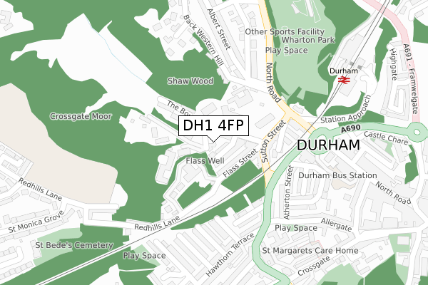
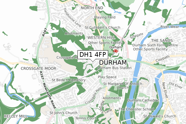
DH1 4FP is located in the Neville's Cross electoral ward, within the unitary authority of County Durham and the English Parliamentary constituency of City of Durham. The Sub Integrated Care Board (ICB) Location is NHS North East and North Cumbria ICB - 84H and the police force is Durham. This postcode has been in use since April 2019.


GetTheData
Source: OS Open Zoomstack (Ordnance Survey)
Licence: Open Government Licence (requires attribution)
Attribution: Contains OS data © Crown copyright and database right 2024
Source: Open Postcode Geo
Licence: Open Government Licence (requires attribution)
Attribution: Contains OS data © Crown copyright and database right 2024; Contains Royal Mail data © Royal Mail copyright and database right 2024; Source: Office for National Statistics licensed under the Open Government Licence v.3.0
| Easting | 426678 |
| Northing | 542635 |
| Latitude | 54.777932 |
| Longitude | -1.586783 |
GetTheData
Source: Open Postcode Geo
Licence: Open Government Licence
| Country | England |
| Postcode District | DH1 |
| ➜ DH1 open data dashboard ➜ See where DH1 is on a map ➜ Where is Durham? | |
GetTheData
Source: Land Registry Price Paid Data
Licence: Open Government Licence
| Ward | Neville's Cross |
| Constituency | City Of Durham |
GetTheData
Source: ONS Postcode Database
Licence: Open Government Licence
| January 2024 | Anti-social behaviour | On or near Crossgate | 400m |
| December 2023 | Other crime | On or near Crossgate | 400m |
| November 2023 | Anti-social behaviour | On or near Crossgate | 400m |
| ➜ Get more crime data in our Crime section | |||
GetTheData
Source: data.police.uk
Licence: Open Government Licence
| County Hospital - Sutton Street (Sutton Street) | Durham | 152m |
| County Hospital - North Road (North Road) | Durham | 174m |
| Hopper House Park And Ride (Sutton Street) | Durham | 183m |
| County Hospital - North Road (North Road) | Durham | 299m |
| North Road Stand A (North Road) | Durham | 312m |
| Durham Station | 0.4km |
GetTheData
Source: NaPTAN
Licence: Open Government Licence
GetTheData
Source: ONS Postcode Database
Licence: Open Government Licence


➜ Get more ratings from the Food Standards Agency
GetTheData
Source: Food Standards Agency
Licence: FSA terms & conditions
| Last Collection | |||
|---|---|---|---|
| Location | Mon-Fri | Sat | Distance |
| Flass Street | 17:15 | 12:00 | 99m |
| Alexandria Crescent | 17:30 | 12:00 | 299m |
| Western Hill | 17:30 | 12:00 | 304m |
GetTheData
Source: Dracos
Licence: Creative Commons Attribution-ShareAlike
| Facility | Distance |
|---|---|
| Shakespeare Hall (Durham Community Association) North Road, Durham Sports Hall | 409m |
| Result Fitness Gym The Riverwalk, Durham Health and Fitness Gym, Studio | 510m |
| St Leonards Catholic School Football Pitch Framwelgate Peth, Durham Grass Pitches | 622m |
GetTheData
Source: Active Places
Licence: Open Government Licence
| School | Phase of Education | Distance |
|---|---|---|
| St Leonard's Catholic School, Durham North End, Durham, DH1 4NG | Secondary | 623m |
| Durham Johnston Comprehensive School Crossgate Moor, Durham, DH1 4SU | Secondary | 643m |
| St Margaret's Church of England Primary School Crossgate Peth, Durham, DH1 4QB | Primary | 652m |
GetTheData
Source: Edubase
Licence: Open Government Licence
The below table lists the International Territorial Level (ITL) codes (formerly Nomenclature of Territorial Units for Statistics (NUTS) codes) and Local Administrative Units (LAU) codes for DH1 4FP:
| ITL 1 Code | Name |
|---|---|
| TLC | North East (England) |
| ITL 2 Code | Name |
| TLC1 | Tees Valley and Durham |
| ITL 3 Code | Name |
| TLC14 | Durham |
| LAU 1 Code | Name |
| E06000047 | County Durham |
GetTheData
Source: ONS Postcode Directory
Licence: Open Government Licence
The below table lists the Census Output Area (OA), Lower Layer Super Output Area (LSOA), and Middle Layer Super Output Area (MSOA) for DH1 4FP:
| Code | Name | |
|---|---|---|
| OA | E00105060 | |
| LSOA | E01020702 | County Durham 033B |
| MSOA | E02004315 | County Durham 033 |
GetTheData
Source: ONS Postcode Directory
Licence: Open Government Licence
| DH1 4BG | Waddington Street | 24m |
| DH1 4BH | Mowbray Street | 41m |
| DH1 4BE | Flass Street | 65m |
| DH1 4BJ | Ainsley Street | 74m |
| DH1 4EH | The Bowers | 105m |
| DH1 4BW | Sutton Street | 128m |
| DH1 4RT | Bridge Street | 143m |
| DH1 4RN | West Terrace | 172m |
| DH1 4RU | Lambton Street | 185m |
| DH1 4DD | Sutton Street | 198m |
GetTheData
Source: Open Postcode Geo; Land Registry Price Paid Data
Licence: Open Government Licence