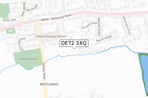
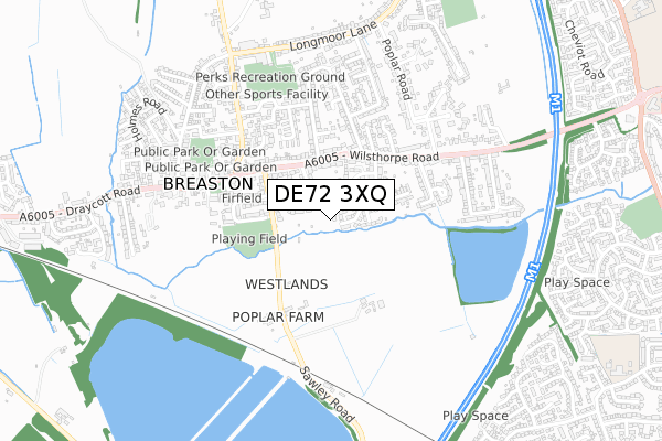
DE72 3XQ is located in the Breaston electoral ward, within the local authority district of Erewash and the English Parliamentary constituency of Erewash. The Sub Integrated Care Board (ICB) Location is NHS Derby and Derbyshire ICB - 15M and the police force is Derbyshire. This postcode has been in use since January 2019.


GetTheData
Source: OS Open Zoomstack (Ordnance Survey)
Licence: Open Government Licence (requires attribution)
Attribution: Contains OS data © Crown copyright and database right 2024
Source: Open Postcode Geo
Licence: Open Government Licence (requires attribution)
Attribution: Contains OS data © Crown copyright and database right 2024; Contains Royal Mail data © Royal Mail copyright and database right 2024; Source: Office for National Statistics licensed under the Open Government Licence v.3.0
| Easting | 446413 |
| Northing | 333368 |
| Latitude | 52.895781 |
| Longitude | -1.311524 |
GetTheData
Source: Open Postcode Geo
Licence: Open Government Licence
| Country | England |
| Postcode District | DE72 |
| ➜ DE72 open data dashboard ➜ See where DE72 is on a map | |
GetTheData
Source: Land Registry Price Paid Data
Licence: Open Government Licence
| Ward | Breaston |
| Constituency | Erewash |
GetTheData
Source: ONS Postcode Database
Licence: Open Government Licence
| October 2023 | Public order | On or near Cherry Close | 406m |
| July 2023 | Violence and sexual offences | On or near Cherry Close | 406m |
| October 2022 | Violence and sexual offences | On or near Cherry Close | 406m |
| ➜ Get more crime data in our Crime section | |||
GetTheData
Source: data.police.uk
Licence: Open Government Licence
| Firfield Avenue (Wilsthorpe Road) | Breaston | 253m |
| Firfield Avenue (Wilsthorpe Road) | Breaston | 265m |
| Maxwell Street (Wilsthorpe Road) | Breaston | 306m |
| Maxwell Street (Wilsthorpe Road) | Breaston | 326m |
| Church (Wilsthorpe Road) | Breaston | 352m |
| Long Eaton Station | 2km |
| East Midlands Parkway Station | 4.9km |
GetTheData
Source: NaPTAN
Licence: Open Government Licence
| Percentage of properties with Next Generation Access | 100.0% |
| Percentage of properties with Superfast Broadband | 100.0% |
| Percentage of properties with Ultrafast Broadband | 0.0% |
| Percentage of properties with Full Fibre Broadband | 0.0% |
Superfast Broadband is between 30Mbps and 300Mbps
Ultrafast Broadband is > 300Mbps
| Percentage of properties unable to receive 2Mbps | 0.0% |
| Percentage of properties unable to receive 5Mbps | 0.0% |
| Percentage of properties unable to receive 10Mbps | 0.0% |
| Percentage of properties unable to receive 30Mbps | 0.0% |
GetTheData
Source: Ofcom
Licence: Ofcom Terms of Use (requires attribution)
GetTheData
Source: ONS Postcode Database
Licence: Open Government Licence


➜ Get more ratings from the Food Standards Agency
GetTheData
Source: Food Standards Agency
Licence: FSA terms & conditions
| Last Collection | |||
|---|---|---|---|
| Location | Mon-Fri | Sat | Distance |
| Breaston Post Office | 16:00 | 10:15 | 492m |
| Poplar Road | 17:00 | 10:30 | 494m |
| Longmoor Lane | 17:00 | 10:30 | 698m |
GetTheData
Source: Dracos
Licence: Creative Commons Attribution-ShareAlike
| Facility | Distance |
|---|---|
| Breaston Park Longmoor Lane, Breaston Grass Pitches | 607m |
| Dovedale Primary School Dovedale Avenue, Long Eaton, Nottingham Grass Pitches | 1.2km |
| West Park Leisure Centre (Long Eaton) Wilsthorpe Road, Long Eaton, Nottingham Sports Hall, Swimming Pool, Health and Fitness Gym, Studio | 1.4km |
GetTheData
Source: Active Places
Licence: Open Government Licence
| School | Phase of Education | Distance |
|---|---|---|
| Firfield Primary School Firfield Avenue, Breaston, Derby, DE72 3EG | Primary | 204m |
| Spring Valley School Spring Valley, The Old Rectory, Risley Lane, Breaston, DE72 3AU | Not applicable | 569m |
| Ellern Mede Derby School 96 Draycott Road, Breaston, Derby, DE72 3DB | Not applicable | 981m |
GetTheData
Source: Edubase
Licence: Open Government Licence
The below table lists the International Territorial Level (ITL) codes (formerly Nomenclature of Territorial Units for Statistics (NUTS) codes) and Local Administrative Units (LAU) codes for DE72 3XQ:
| ITL 1 Code | Name |
|---|---|
| TLF | East Midlands (England) |
| ITL 2 Code | Name |
| TLF1 | Derbyshire and Nottinghamshire |
| ITL 3 Code | Name |
| TLF13 | South and West Derbyshire |
| LAU 1 Code | Name |
| E07000036 | Erewash |
GetTheData
Source: ONS Postcode Directory
Licence: Open Government Licence
The below table lists the Census Output Area (OA), Lower Layer Super Output Area (LSOA), and Middle Layer Super Output Area (MSOA) for DE72 3XQ:
| Code | Name | |
|---|---|---|
| OA | E00099378 | |
| LSOA | E01019643 | Erewash 013B |
| MSOA | E02004090 | Erewash 013 |
GetTheData
Source: ONS Postcode Directory
Licence: Open Government Licence
| DE72 3XH | Goldenbrook Close | 89m |
| DE72 3BF | Astill Pine Close | 112m |
| DE72 3EG | Firfield Avenue | 116m |
| DE72 3EF | Sawley Road | 172m |
| DE72 3AT | Orchard Close | 206m |
| DE72 3EB | Wilsthorpe Road | 212m |
| DE72 3AH | Maxwell Street | 233m |
| DE72 3AJ | Mount Street | 237m |
| DE72 3EA | Wilsthorpe Road | 271m |
| DE72 3EL | Meadow Close | 302m |
GetTheData
Source: Open Postcode Geo; Land Registry Price Paid Data
Licence: Open Government Licence