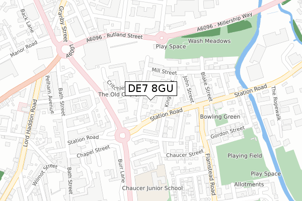
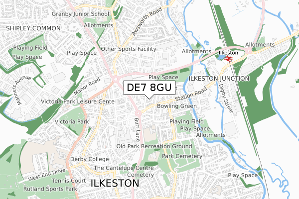
DE7 8GU lies on Scollins Court in Ilkeston. DE7 8GU is located in the Larklands electoral ward, within the local authority district of Erewash and the English Parliamentary constituency of Erewash. The Sub Integrated Care Board (ICB) Location is NHS Derby and Derbyshire ICB - 15M and the police force is Derbyshire. This postcode has been in use since October 2017.


GetTheData
Source: OS Open Zoomstack (Ordnance Survey)
Licence: Open Government Licence (requires attribution)
Attribution: Contains OS data © Crown copyright and database right 2024
Source: Open Postcode Geo
Licence: Open Government Licence (requires attribution)
Attribution: Contains OS data © Crown copyright and database right 2024; Contains Royal Mail data © Royal Mail copyright and database right 2024; Source: Office for National Statistics licensed under the Open Government Licence v.3.0
| Easting | 446773 |
| Northing | 342298 |
| Latitude | 52.976019 |
| Longitude | -1.304890 |
GetTheData
Source: Open Postcode Geo
Licence: Open Government Licence
| Street | Scollins Court |
| Town/City | Ilkeston |
| Country | England |
| Postcode District | DE7 |
| ➜ DE7 open data dashboard ➜ See where DE7 is on a map ➜ Where is Ilkeston? | |
GetTheData
Source: Land Registry Price Paid Data
Licence: Open Government Licence
| Ward | Larklands |
| Constituency | Erewash |
GetTheData
Source: ONS Postcode Database
Licence: Open Government Licence
| January 2024 | Other crime | On or near Supermarket | 387m |
| January 2024 | Possession of weapons | On or near Supermarket | 387m |
| January 2024 | Public order | On or near Supermarket | 387m |
| ➜ Get more crime data in our Crime section | |||
GetTheData
Source: data.police.uk
Licence: Open Government Licence
| Taylor Street (Station Road) | Ilkeston | 108m |
| Albion Street (Station Road) | Ilkeston | 204m |
| Taylor Street (Station Road) | Ilkeston | 231m |
| Tesco (Rutland Street) | Ilkeston | 269m |
| Bath Street Bottom (Bath Street) | Ilkeston | 296m |
| Ilkeston Station | 0.8km |
| Langley Mill Station | 5km |
GetTheData
Source: NaPTAN
Licence: Open Government Licence
➜ Broadband speed and availability dashboard for DE7 8GU
| Percentage of properties with Next Generation Access | 100.0% |
| Percentage of properties with Superfast Broadband | 100.0% |
| Percentage of properties with Ultrafast Broadband | 100.0% |
| Percentage of properties with Full Fibre Broadband | 0.0% |
Superfast Broadband is between 30Mbps and 300Mbps
Ultrafast Broadband is > 300Mbps
| Median download speed | 50.0Mbps |
| Average download speed | 96.3Mbps |
| Maximum download speed | 350.00Mbps |
| Median upload speed | 1.1Mbps |
| Average upload speed | 4.0Mbps |
| Maximum upload speed | 9.99Mbps |
| Percentage of properties unable to receive 2Mbps | 0.0% |
| Percentage of properties unable to receive 5Mbps | 0.0% |
| Percentage of properties unable to receive 10Mbps | 0.0% |
| Percentage of properties unable to receive 30Mbps | 0.0% |
➜ Broadband speed and availability dashboard for DE7 8GU
GetTheData
Source: Ofcom
Licence: Ofcom Terms of Use (requires attribution)
GetTheData
Source: ONS Postcode Database
Licence: Open Government Licence


➜ Get more ratings from the Food Standards Agency
GetTheData
Source: Food Standards Agency
Licence: FSA terms & conditions
| Last Collection | |||
|---|---|---|---|
| Location | Mon-Fri | Sat | Distance |
| Alvenor Street | 17:30 | 07:15 | 161m |
| Tesco | 17:30 | 10:30 | 232m |
| Bath Street Post Office | 17:30 | 11:15 | 303m |
GetTheData
Source: Dracos
Licence: Creative Commons Attribution-ShareAlike
| Facility | Distance |
|---|---|
| Ilkeston Gym (Closed) Wood Street, Ilkeston Health and Fitness Gym | 71m |
| Anytime Fitness (Ilkeston) Rutland Street, Ilkeston Health and Fitness Gym, Studio | 235m |
| Chaucer Junior School Cranmer Street, Ilkeston Grass Pitches | 253m |
GetTheData
Source: Active Places
Licence: Open Government Licence
| School | Phase of Education | Distance |
|---|---|---|
| Chaucer Junior School Cranmer Street, Ilkeston, DE7 5JH | Primary | 247m |
| Chaucer Infant School Cantelupe Road, Ilkeston, DE7 5LN | Primary | 471m |
| Charlotte Nursery and Infant School Trinity Close, Ilkeston, DE7 8LQ | Primary | 800m |
GetTheData
Source: Edubase
Licence: Open Government Licence
The below table lists the International Territorial Level (ITL) codes (formerly Nomenclature of Territorial Units for Statistics (NUTS) codes) and Local Administrative Units (LAU) codes for DE7 8GU:
| ITL 1 Code | Name |
|---|---|
| TLF | East Midlands (England) |
| ITL 2 Code | Name |
| TLF1 | Derbyshire and Nottinghamshire |
| ITL 3 Code | Name |
| TLF13 | South and West Derbyshire |
| LAU 1 Code | Name |
| E07000036 | Erewash |
GetTheData
Source: ONS Postcode Directory
Licence: Open Government Licence
The below table lists the Census Output Area (OA), Lower Layer Super Output Area (LSOA), and Middle Layer Super Output Area (MSOA) for DE7 8GU:
| Code | Name | |
|---|---|---|
| OA | E00099474 | |
| LSOA | E01019662 | Erewash 003D |
| MSOA | E02004080 | Erewash 003 |
GetTheData
Source: ONS Postcode Directory
Licence: Open Government Licence
| DE7 5LE | Station Road | 60m |
| DE7 8GE | Wood Street | 70m |
| DE7 8GJ | King Street | 76m |
| DE7 8GH | Mill Street | 91m |
| DE7 5JQ | King Street | 103m |
| DE7 5LH | Station Road | 105m |
| DE7 8GL | John Street | 123m |
| DE7 5LG | Station Road | 128m |
| DE7 5JR | Chapel Street | 131m |
| DE7 8GG | Mill Street | 131m |
GetTheData
Source: Open Postcode Geo; Land Registry Price Paid Data
Licence: Open Government Licence