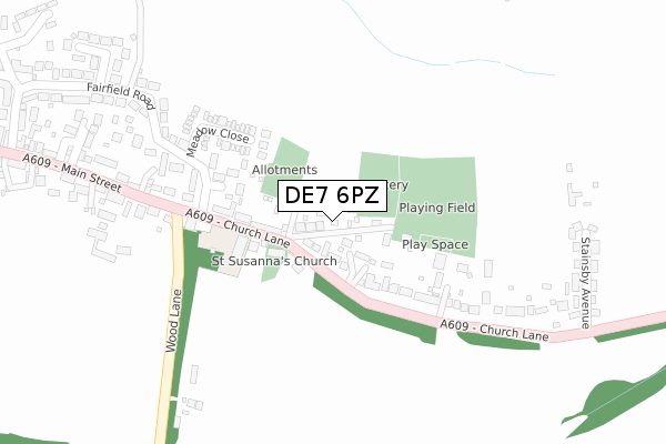
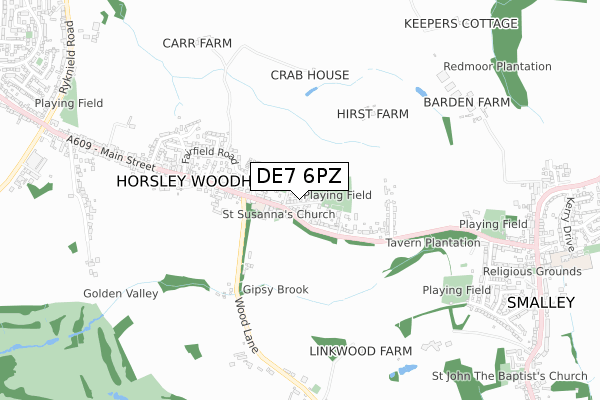
DE7 6PZ is located in the Smalley, Shipley & Horsley Woodhouse electoral ward, within the local authority district of Amber Valley and the English Parliamentary constituency of Amber Valley. The Sub Integrated Care Board (ICB) Location is NHS Derby and Derbyshire ICB - 15M and the police force is Derbyshire. This postcode has been in use since February 2020.


GetTheData
Source: OS Open Zoomstack (Ordnance Survey)
Licence: Open Government Licence (requires attribution)
Attribution: Contains OS data © Crown copyright and database right 2024
Source: Open Postcode Geo
Licence: Open Government Licence (requires attribution)
Attribution: Contains OS data © Crown copyright and database right 2024; Contains Royal Mail data © Royal Mail copyright and database right 2024; Source: Office for National Statistics licensed under the Open Government Licence v.3.0
| Easting | 439749 |
| Northing | 344856 |
| Latitude | 52.999577 |
| Longitude | -1.409173 |
GetTheData
Source: Open Postcode Geo
Licence: Open Government Licence
| Country | England |
| Postcode District | DE7 |
| ➜ DE7 open data dashboard ➜ See where DE7 is on a map ➜ Where is Horsley Woodhouse? | |
GetTheData
Source: Land Registry Price Paid Data
Licence: Open Government Licence
| Ward | Smalley, Shipley & Horsley Woodhouse |
| Constituency | Amber Valley |
GetTheData
Source: ONS Postcode Database
Licence: Open Government Licence
| December 2023 | Public order | On or near Fairfield Road | 292m |
| December 2023 | Anti-social behaviour | On or near Fairfield Road | 292m |
| September 2023 | Violence and sexual offences | On or near Fairfield Road | 292m |
| ➜ Get more crime data in our Crime section | |||
GetTheData
Source: data.police.uk
Licence: Open Government Licence
| Primary School (Main Street) | Horsley Woodhouse | 140m |
| Primary School (Main Street) | Horsley Woodhouse | 171m |
| St Susannas Church (Church Lane) | Horsley Woodhouse | 176m |
| St Susannas Church (Church Lane) | Horsley Woodhouse | 214m |
| Stainsby Avenue (Church Lane) | Horsley Woodhouse | 394m |
| Belper Station | 5.6km |
GetTheData
Source: NaPTAN
Licence: Open Government Licence
GetTheData
Source: ONS Postcode Database
Licence: Open Government Licence


➜ Get more ratings from the Food Standards Agency
GetTheData
Source: Food Standards Agency
Licence: FSA terms & conditions
| Last Collection | |||
|---|---|---|---|
| Location | Mon-Fri | Sat | Distance |
| Horsley Woodhouse So | 17:45 | 11:00 | 387m |
| Wood Lane | 17:45 | 08:30 | 936m |
| St Johns Road | 17:45 | 08:30 | 977m |
GetTheData
Source: Dracos
Licence: Creative Commons Attribution-ShareAlike
| Facility | Distance |
|---|---|
| Stainsby Hall Cricket Club St Johns Road, Smalley, Ilkeston Grass Pitches, Outdoor Tennis Courts | 777m |
| Dobholes Lane Recreation Ground Dobholes Lane, Smalley, Ilkeston Grass Pitches | 813m |
| Horsley Lodge Golf Club Smalley Mill Road, Horsley, Derby Golf | 1.3km |
GetTheData
Source: Active Places
Licence: Open Government Licence
| School | Phase of Education | Distance |
|---|---|---|
| Horsley Woodhouse Primary School Main Street, Horsley Woodhouse, Ilkeston, DE7 6AT | Primary | 141m |
| Richardson Endowed Primary School Main Road, Smalley, Ilkeston, DE7 6EF | Primary | 1.1km |
| Denby Free CofE VA Primary School Church Street, Denby Village, Ripley, DE5 8PH | Primary | 1.6km |
GetTheData
Source: Edubase
Licence: Open Government Licence
The below table lists the International Territorial Level (ITL) codes (formerly Nomenclature of Territorial Units for Statistics (NUTS) codes) and Local Administrative Units (LAU) codes for DE7 6PZ:
| ITL 1 Code | Name |
|---|---|
| TLF | East Midlands (England) |
| ITL 2 Code | Name |
| TLF1 | Derbyshire and Nottinghamshire |
| ITL 3 Code | Name |
| TLF13 | South and West Derbyshire |
| LAU 1 Code | Name |
| E07000032 | Amber Valley |
GetTheData
Source: ONS Postcode Directory
Licence: Open Government Licence
The below table lists the Census Output Area (OA), Lower Layer Super Output Area (LSOA), and Middle Layer Super Output Area (MSOA) for DE7 6PZ:
| Code | Name | |
|---|---|---|
| OA | E00098438 | |
| LSOA | E01019465 | Amber Valley 015D |
| MSOA | E02004043 | Amber Valley 015 |
GetTheData
Source: ONS Postcode Directory
Licence: Open Government Licence
| DE7 6AT | Main Street | 131m |
| DE7 6BB | Church Lane | 178m |
| DE7 6DR | Meadow Close | 216m |
| DE7 6AS | Fairfield Road | 240m |
| DE7 6AU | Main Street | 355m |
| DE7 6BD | Stainsby Avenue | 377m |
| DE7 6JW | Hollies Farm Drive | 408m |
| DE7 6BE | Fairfield Road | 424m |
| DE7 6BG | Carrfields | 439m |
| DE7 6BH | Clement Road | 578m |
GetTheData
Source: Open Postcode Geo; Land Registry Price Paid Data
Licence: Open Government Licence