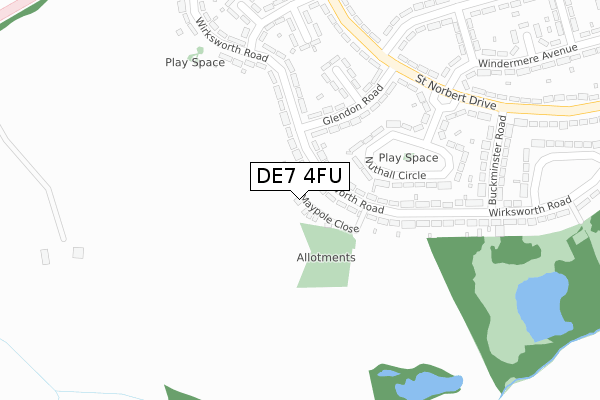
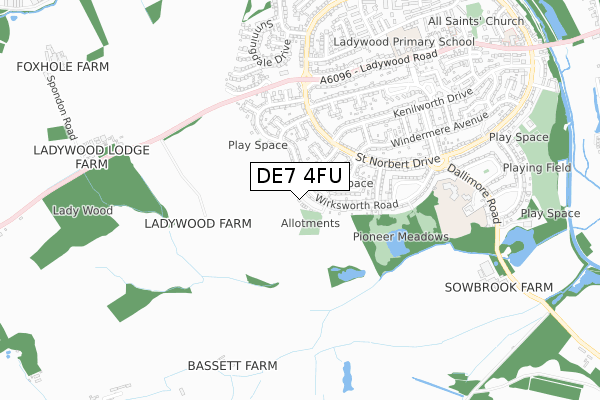
DE7 4FU is located in the Kirk Hallam & Stanton-by-Dale electoral ward, within the local authority district of Erewash and the English Parliamentary constituency of Erewash. The Sub Integrated Care Board (ICB) Location is NHS Derby and Derbyshire ICB - 15M and the police force is Derbyshire. This postcode has been in use since October 2018.


GetTheData
Source: OS Open Zoomstack (Ordnance Survey)
Licence: Open Government Licence (requires attribution)
Attribution: Contains OS data © Crown copyright and database right 2024
Source: Open Postcode Geo
Licence: Open Government Licence (requires attribution)
Attribution: Contains OS data © Crown copyright and database right 2024; Contains Royal Mail data © Royal Mail copyright and database right 2024; Source: Office for National Statistics licensed under the Open Government Licence v.3.0
| Easting | 445123 |
| Northing | 339814 |
| Latitude | 52.953832 |
| Longitude | -1.329805 |
GetTheData
Source: Open Postcode Geo
Licence: Open Government Licence
| Country | England |
| Postcode District | DE7 |
| ➜ DE7 open data dashboard ➜ See where DE7 is on a map ➜ Where is Ilkeston? | |
GetTheData
Source: Land Registry Price Paid Data
Licence: Open Government Licence
| Ward | Kirk Hallam & Stanton-by-dale |
| Constituency | Erewash |
GetTheData
Source: ONS Postcode Database
Licence: Open Government Licence
3, MAYPOLE CLOSE, KIRK HALLAM, ILKESTON, DE7 4FU 2020 18 DEC £263,500 |
1, MAYPOLE CLOSE, KIRK HALLAM, ILKESTON, DE7 4FU 2020 6 NOV £263,500 |
3, MAYPOLE CLOSE, KIRK HALLAM, ILKESTON, DE7 4FU 2019 4 JAN £220,000 |
2, MAYPOLE CLOSE, KIRK HALLAM, ILKESTON, DE7 4FU 2018 14 DEC £220,000 |
1, MAYPOLE CLOSE, KIRK HALLAM, ILKESTON, DE7 4FU 2018 19 OCT £220,000 |
GetTheData
Source: HM Land Registry Price Paid Data
Licence: Contains HM Land Registry data © Crown copyright and database right 2024. This data is licensed under the Open Government Licence v3.0.
| January 2024 | Violence and sexual offences | On or near Buckminster Road | 332m |
| December 2023 | Violence and sexual offences | On or near Buckminster Road | 332m |
| October 2023 | Criminal damage and arson | On or near Buckminster Road | 332m |
| ➜ Get more crime data in our Crime section | |||
GetTheData
Source: data.police.uk
Licence: Open Government Licence
| Glendon Road 90 (Wirksworth Road) | Kirk Hallam | 96m |
| Wirksworth Road 64 (Wirksworth Road) | Kirk Hallam | 104m |
| Avondale Road (Wirksworth Road) | Kirk Hallam | 251m |
| Glendon Road (St Norbert Drive) | Kirk Hallam | 276m |
| Buckminster Road South (Wirksworth Road) | Kirk Hallam | 294m |
| Ilkeston Station | 3.7km |
GetTheData
Source: NaPTAN
Licence: Open Government Licence
➜ Broadband speed and availability dashboard for DE7 4FU
| Percentage of properties with Next Generation Access | 100.0% |
| Percentage of properties with Superfast Broadband | 100.0% |
| Percentage of properties with Ultrafast Broadband | 100.0% |
| Percentage of properties with Full Fibre Broadband | 0.0% |
Superfast Broadband is between 30Mbps and 300Mbps
Ultrafast Broadband is > 300Mbps
| Median download speed | 32.4Mbps |
| Average download speed | 27.8Mbps |
| Maximum download speed | 35.08Mbps |
| Median upload speed | 7.0Mbps |
| Average upload speed | 6.1Mbps |
| Maximum upload speed | 7.74Mbps |
| Percentage of properties unable to receive 2Mbps | 0.0% |
| Percentage of properties unable to receive 5Mbps | 0.0% |
| Percentage of properties unable to receive 10Mbps | 0.0% |
| Percentage of properties unable to receive 30Mbps | 0.0% |
➜ Broadband speed and availability dashboard for DE7 4FU
GetTheData
Source: Ofcom
Licence: Ofcom Terms of Use (requires attribution)
GetTheData
Source: ONS Postcode Database
Licence: Open Government Licence


➜ Get more ratings from the Food Standards Agency
GetTheData
Source: Food Standards Agency
Licence: FSA terms & conditions
| Last Collection | |||
|---|---|---|---|
| Location | Mon-Fri | Sat | Distance |
| Avondale Road | 17:45 | 07:15 | 344m |
| Nutbrook Crescent | 17:45 | 07:15 | 562m |
| Kirk Hallam Tso | 17:45 | 11:30 | 715m |
GetTheData
Source: Dracos
Licence: Creative Commons Attribution-ShareAlike
| Facility | Distance |
|---|---|
| Dallimore Primary School Dallimore Road, Ilkeston Grass Pitches | 606m |
| Ladywood Primary School Oliver Road, Kirk Hallam, Ilkeston Grass Pitches | 753m |
| Kirk Hallam Playing Fields Windsor Crescent, Ilkeston Grass Pitches | 980m |
GetTheData
Source: Active Places
Licence: Open Government Licence
| School | Phase of Education | Distance |
|---|---|---|
| Dallimore Primary & Nursery School Dallimore Road, Kirk Hallam, Ilkeston, DE7 4GZ | Primary | 634m |
| Ladywood Primary School Oliver Road, Kirk Hallam, Ilkeston, DE7 4NH | Primary | 818m |
| Saint John Houghton Catholic Voluntary Academy Abbot Road, Kirk Hallam, Ilkeston, DE7 4HX | Secondary | 1.1km |
GetTheData
Source: Edubase
Licence: Open Government Licence
The below table lists the International Territorial Level (ITL) codes (formerly Nomenclature of Territorial Units for Statistics (NUTS) codes) and Local Administrative Units (LAU) codes for DE7 4FU:
| ITL 1 Code | Name |
|---|---|
| TLF | East Midlands (England) |
| ITL 2 Code | Name |
| TLF1 | Derbyshire and Nottinghamshire |
| ITL 3 Code | Name |
| TLF13 | South and West Derbyshire |
| LAU 1 Code | Name |
| E07000036 | Erewash |
GetTheData
Source: ONS Postcode Directory
Licence: Open Government Licence
The below table lists the Census Output Area (OA), Lower Layer Super Output Area (LSOA), and Middle Layer Super Output Area (MSOA) for DE7 4FU:
| Code | Name | |
|---|---|---|
| OA | E00099516 | |
| LSOA | E01019667 | Erewash 007B |
| MSOA | E02004084 | Erewash 007 |
GetTheData
Source: ONS Postcode Directory
Licence: Open Government Licence
| DE7 4GL | Wirksworth Road | 121m |
| DE7 4GS | Wirksworth Road | 143m |
| DE7 4GQ | Glendon Road | 173m |
| DE7 4GP | Wirksworth Road | 217m |
| DE7 4GU | Nuthall Circle | 227m |
| DE7 4GR | Tilton Grove | 232m |
| DE7 4GJ | Wirksworth Road | 254m |
| DE7 4ER | St Norbert Drive | 278m |
| DE7 4EQ | St Norbert Drive | 285m |
| DE7 4GB | Ascot Place | 287m |
GetTheData
Source: Open Postcode Geo; Land Registry Price Paid Data
Licence: Open Government Licence