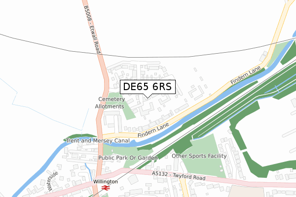
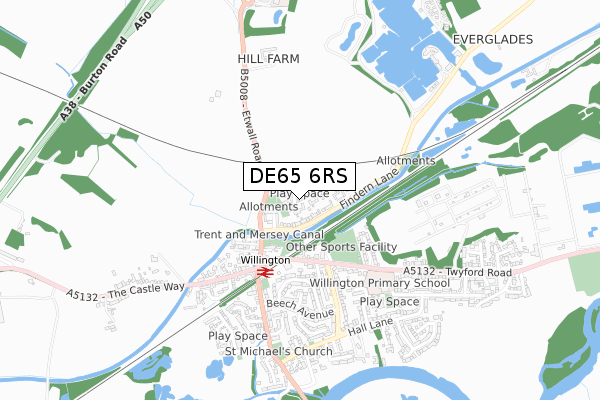
DE65 6RS is located in the Willington and Findern electoral ward, within the local authority district of South Derbyshire and the English Parliamentary constituency of South Derbyshire. The Sub Integrated Care Board (ICB) Location is NHS Derby and Derbyshire ICB - 15M and the police force is Derbyshire. This postcode has been in use since September 2017.


GetTheData
Source: OS Open Zoomstack (Ordnance Survey)
Licence: Open Government Licence (requires attribution)
Attribution: Contains OS data © Crown copyright and database right 2024
Source: Open Postcode Geo
Licence: Open Government Licence (requires attribution)
Attribution: Contains OS data © Crown copyright and database right 2024; Contains Royal Mail data © Royal Mail copyright and database right 2024; Source: Office for National Statistics licensed under the Open Government Licence v.3.0
| Easting | 429571 |
| Northing | 328806 |
| Latitude | 52.855958 |
| Longitude | -1.562279 |
GetTheData
Source: Open Postcode Geo
Licence: Open Government Licence
| Country | England |
| Postcode District | DE65 |
| ➜ DE65 open data dashboard ➜ See where DE65 is on a map ➜ Where is Willington? | |
GetTheData
Source: Land Registry Price Paid Data
Licence: Open Government Licence
| Ward | Willington And Findern |
| Constituency | South Derbyshire |
GetTheData
Source: ONS Postcode Database
Licence: Open Government Licence
2, PEACEHAVEN, WILLINGTON, DERBY, DE65 6RS 2023 23 OCT £575,000 |
4, PEACEHAVEN, WILLINGTON, DERBY, DE65 6RS 2018 9 FEB £349,995 |
2, PEACEHAVEN, WILLINGTON, DERBY, DE65 6RS 2018 19 JAN £414,995 |
GetTheData
Source: HM Land Registry Price Paid Data
Licence: Contains HM Land Registry data © Crown copyright and database right 2024. This data is licensed under the Open Government Licence v3.0.
| June 2022 | Violence and sexual offences | On or near Derwent Court | 142m |
| June 2022 | Violence and sexual offences | On or near Pedestrian Subway | 211m |
| June 2022 | Violence and sexual offences | On or near Pedestrian Subway | 211m |
| ➜ Get more crime data in our Crime section | |||
GetTheData
Source: data.police.uk
Licence: Open Government Licence
| Derwent Court (Findern Lane) | Willington | 109m |
| Derwent Court (Findern Lane) | Willington | 116m |
| The Green (Canal Bridge) | Willington | 275m |
| The Green (Canal Bridge) | Willington | 301m |
| Baptist Church (Twyford Road) | Willington | 308m |
| Willington Station | 0.3km |
GetTheData
Source: NaPTAN
Licence: Open Government Licence
| Percentage of properties with Next Generation Access | 100.0% |
| Percentage of properties with Superfast Broadband | 100.0% |
| Percentage of properties with Ultrafast Broadband | 0.0% |
| Percentage of properties with Full Fibre Broadband | 0.0% |
Superfast Broadband is between 30Mbps and 300Mbps
Ultrafast Broadband is > 300Mbps
| Percentage of properties unable to receive 2Mbps | 0.0% |
| Percentage of properties unable to receive 5Mbps | 0.0% |
| Percentage of properties unable to receive 10Mbps | 0.0% |
| Percentage of properties unable to receive 30Mbps | 0.0% |
GetTheData
Source: Ofcom
Licence: Ofcom Terms of Use (requires attribution)
GetTheData
Source: ONS Postcode Database
Licence: Open Government Licence


➜ Get more ratings from the Food Standards Agency
GetTheData
Source: Food Standards Agency
Licence: FSA terms & conditions
| Last Collection | |||
|---|---|---|---|
| Location | Mon-Fri | Sat | Distance |
| Willington Post Office | 17:15 | 10:30 | 363m |
| Oaks Road | 17:00 | 10:30 | 466m |
| Twyford Road | 17:00 | 10:30 | 732m |
GetTheData
Source: Dracos
Licence: Creative Commons Attribution-ShareAlike
| Facility | Distance |
|---|---|
| Twyford Road Playing Field Orchard Close, Willington, Derby Grass Pitches | 273m |
| Willington Primary School Trent Avenue, Willington, Derby Grass Pitches | 510m |
| Willington Football Club Twyford Road, Willington, Derby Grass Pitches | 1.3km |
GetTheData
Source: Active Places
Licence: Open Government Licence
| School | Phase of Education | Distance |
|---|---|---|
| Willington Primary School Trent Avenue, Willington, Derby, DE65 6DN | Primary | 510m |
| Findern Primary School Buckford Lane, Findern, Derby, DE65 6AR | Primary | 1.8km |
| Repton School Repton, Derby, DE65 6FH | Not applicable | 1.9km |
GetTheData
Source: Edubase
Licence: Open Government Licence
The below table lists the International Territorial Level (ITL) codes (formerly Nomenclature of Territorial Units for Statistics (NUTS) codes) and Local Administrative Units (LAU) codes for DE65 6RS:
| ITL 1 Code | Name |
|---|---|
| TLF | East Midlands (England) |
| ITL 2 Code | Name |
| TLF1 | Derbyshire and Nottinghamshire |
| ITL 3 Code | Name |
| TLF13 | South and West Derbyshire |
| LAU 1 Code | Name |
| E07000039 | South Derbyshire |
GetTheData
Source: ONS Postcode Directory
Licence: Open Government Licence
The below table lists the Census Output Area (OA), Lower Layer Super Output Area (LSOA), and Middle Layer Super Output Area (MSOA) for DE65 6RS:
| Code | Name | |
|---|---|---|
| OA | E00100607 | |
| LSOA | E01019882 | South Derbyshire 003E |
| MSOA | E02004120 | South Derbyshire 003 |
GetTheData
Source: ONS Postcode Directory
Licence: Open Government Licence
| DE65 6RD | James Clarke Road | 69m |
| DE65 6ED | Derwent Court | 146m |
| DE65 6DS | Chapel Close | 239m |
| DE65 6EL | Willow Grove | 277m |
| DE65 6BP | The Green | 290m |
| DE65 6BQ | Canal Bridge | 293m |
| DE65 6BR | Green Close | 325m |
| DE65 6DJ | Orchard Close | 336m |
| DE65 6DH | Hamilton Terrace | 342m |
| DE65 6DA | Mercia Drive | 350m |
GetTheData
Source: Open Postcode Geo; Land Registry Price Paid Data
Licence: Open Government Licence