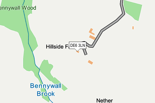
DE6 3LN is located in the Hulland electoral ward, within the local authority district of Derbyshire Dales and the English Parliamentary constituency of Derbyshire Dales. The Sub Integrated Care Board (ICB) Location is NHS Derby and Derbyshire ICB - 15M and the police force is Derbyshire. This postcode has been in use since February 2017.


GetTheData
Source: OS OpenMap – Local (Ordnance Survey)
Source: OS VectorMap District (Ordnance Survey)
Licence: Open Government Licence (requires attribution)
| Easting | 426376 |
| Northing | 349311 |
| Latitude | 53.040444 |
| Longitude | -1.608066 |
GetTheData
Source: Open Postcode Geo
Licence: Open Government Licence
| Country | England |
| Postcode District | DE6 |
| ➜ DE6 open data dashboard ➜ See where DE6 is on a map | |
GetTheData
Source: Land Registry Price Paid Data
Licence: Open Government Licence
| Ward | Hulland |
| Constituency | Derbyshire Dales |
GetTheData
Source: ONS Postcode Database
Licence: Open Government Licence
| Blackwall Farm (Blackwall Lane) | Blackwall | 600m |
| Town End (Main Street) | Kirk Ireton | 830m |
| Biggin House (Hoonwell Lane) | Nether Biggin | 839m |
| Town End (Main Street) | Kirk Ireton | 841m |
| School (Main Street) | Kirk Ireton | 963m |
GetTheData
Source: NaPTAN
Licence: Open Government Licence
GetTheData
Source: ONS Postcode Database
Licence: Open Government Licence


➜ Get more ratings from the Food Standards Agency
GetTheData
Source: Food Standards Agency
Licence: FSA terms & conditions
| Last Collection | |||
|---|---|---|---|
| Location | Mon-Fri | Sat | Distance |
| Blackwall | 16:00 | 07:15 | 626m |
| Biggin | 16:00 | 09:00 | 846m |
| Kirk Ireton | 16:00 | 09:45 | 969m |
GetTheData
Source: Dracos
Licence: Creative Commons Attribution-ShareAlike
| Facility | Distance |
|---|---|
| Hulland Ward Playing Field Ashes Avenue, Hulland Ward Grass Pitches | 2.1km |
| Idridgehay Playing Field Idridgehay, Belper Grass Pitches | 2.1km |
| Wirksworth Recreation Ground Derby Road, Wirksworth, Matlock Grass Pitches | 4.3km |
GetTheData
Source: Active Places
Licence: Open Government Licence
| School | Phase of Education | Distance |
|---|---|---|
| Kirk Ireton C of E Primary School Main Street, Kirk Ireton, Ashbourne, DE6 3LD | Primary | 991m |
| Hulland CofE Primary School Firs Avenue, Hulland, Ashbourne, DE6 3FS | Primary | 2.8km |
| Carsington and Hopton Primary School Carsington, Matlock, DE4 4DE | Primary | 4.1km |
GetTheData
Source: Edubase
Licence: Open Government Licence
The below table lists the International Territorial Level (ITL) codes (formerly Nomenclature of Territorial Units for Statistics (NUTS) codes) and Local Administrative Units (LAU) codes for DE6 3LN:
| ITL 1 Code | Name |
|---|---|
| TLF | East Midlands (England) |
| ITL 2 Code | Name |
| TLF1 | Derbyshire and Nottinghamshire |
| ITL 3 Code | Name |
| TLF13 | South and West Derbyshire |
| LAU 1 Code | Name |
| E07000035 | Derbyshire Dales |
GetTheData
Source: ONS Postcode Directory
Licence: Open Government Licence
The below table lists the Census Output Area (OA), Lower Layer Super Output Area (LSOA), and Middle Layer Super Output Area (MSOA) for DE6 3LN:
| Code | Name | |
|---|---|---|
| OA | E00099246 | |
| LSOA | E01019616 | Derbyshire Dales 008D |
| MSOA | E02004075 | Derbyshire Dales 008 |
GetTheData
Source: ONS Postcode Directory
Licence: Open Government Licence
| DE6 3JR | 613m | |
| DE6 3LJ | Broadway | 744m |
| DE6 3JU | 794m | |
| DE6 3FJ | 800m | |
| DE6 3LH | Peats Close | 808m |
| DE6 3JW | 872m | |
| DE6 3JQ | 908m | |
| DE6 3JP | Main Street | 909m |
| DE6 3LD | Main Street | 947m |
| DE6 3JJ | Hardings Close | 969m |
GetTheData
Source: Open Postcode Geo; Land Registry Price Paid Data
Licence: Open Government Licence