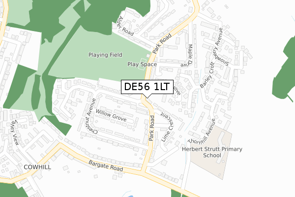
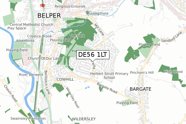
DE56 1LT is located in the Belper South electoral ward, within the local authority district of Amber Valley and the English Parliamentary constituency of Mid Derbyshire. The Sub Integrated Care Board (ICB) Location is NHS Derby and Derbyshire ICB - 15M and the police force is Derbyshire. This postcode has been in use since March 2019.


GetTheData
Source: OS Open Zoomstack (Ordnance Survey)
Licence: Open Government Licence (requires attribution)
Attribution: Contains OS data © Crown copyright and database right 2024
Source: Open Postcode Geo
Licence: Open Government Licence (requires attribution)
Attribution: Contains OS data © Crown copyright and database right 2024; Contains Royal Mail data © Royal Mail copyright and database right 2024; Source: Office for National Statistics licensed under the Open Government Licence v.3.0
| Easting | 435480 |
| Northing | 346831 |
| Latitude | 53.017628 |
| Longitude | -1.472564 |
GetTheData
Source: Open Postcode Geo
Licence: Open Government Licence
| Country | England |
| Postcode District | DE56 |
| ➜ DE56 open data dashboard ➜ See where DE56 is on a map ➜ Where is Belper? | |
GetTheData
Source: Land Registry Price Paid Data
Licence: Open Government Licence
| Ward | Belper South |
| Constituency | Mid Derbyshire |
GetTheData
Source: ONS Postcode Database
Licence: Open Government Licence
| December 2023 | Criminal damage and arson | On or near Park Road | 33m |
| September 2023 | Anti-social behaviour | On or near Park Road | 33m |
| August 2023 | Violence and sexual offences | On or near Park Road | 33m |
| ➜ Get more crime data in our Crime section | |||
GetTheData
Source: data.police.uk
Licence: Open Government Licence
| Park Road Shops (Park Road) | Parks Estate | 31m |
| Park Road Shops (Park Road) | Parks Estate | 90m |
| Chestnut Avenue (Park Road) | Parks Estate | 147m |
| Chestnut Avenue (Park Road) | Parks Estate | 213m |
| Maple Drive (Park Road) | Parks Estate | 247m |
| Belper Station | 1km |
| Duffield Station | 3.4km |
| Ambergate Station | 4.8km |
GetTheData
Source: NaPTAN
Licence: Open Government Licence
| Percentage of properties with Next Generation Access | 100.0% |
| Percentage of properties with Superfast Broadband | 100.0% |
| Percentage of properties with Ultrafast Broadband | 0.0% |
| Percentage of properties with Full Fibre Broadband | 0.0% |
Superfast Broadband is between 30Mbps and 300Mbps
Ultrafast Broadband is > 300Mbps
| Percentage of properties unable to receive 2Mbps | 0.0% |
| Percentage of properties unable to receive 5Mbps | 0.0% |
| Percentage of properties unable to receive 10Mbps | 0.0% |
| Percentage of properties unable to receive 30Mbps | 0.0% |
GetTheData
Source: Ofcom
Licence: Ofcom Terms of Use (requires attribution)
GetTheData
Source: ONS Postcode Database
Licence: Open Government Licence


➜ Get more ratings from the Food Standards Agency
GetTheData
Source: Food Standards Agency
Licence: FSA terms & conditions
| Last Collection | |||
|---|---|---|---|
| Location | Mon-Fri | Sat | Distance |
| Park Road Post Office | 17:30 | 11:45 | 59m |
| Bargate Road | 17:30 | 08:45 | 300m |
| Chevin Mews | 17:30 | 07:30 | 593m |
GetTheData
Source: Dracos
Licence: Creative Commons Attribution-ShareAlike
| Facility | Distance |
|---|---|
| Manor Rec Park Road, Belper Grass Pitches | 171m |
| Bargate Road Recreation Ground Bargate Road, Belper Grass Pitches | 718m |
| Herbert Strutt Playing Fields Derby Road, Derby Road, Belper Grass Pitches | 1km |
GetTheData
Source: Active Places
Licence: Open Government Licence
| School | Phase of Education | Distance |
|---|---|---|
| Herbert Strutt Primary School Thornhill Avenue, Belper, DE56 1SH | Primary | 301m |
| Pottery Primary School Kilbourne Road, Belper, DE56 1HA | Primary | 1.3km |
| St John's CofE Primary School and Nursery Laund Nook, Belper, DE56 1GY | Primary | 1.3km |
GetTheData
Source: Edubase
Licence: Open Government Licence
The below table lists the International Territorial Level (ITL) codes (formerly Nomenclature of Territorial Units for Statistics (NUTS) codes) and Local Administrative Units (LAU) codes for DE56 1LT:
| ITL 1 Code | Name |
|---|---|
| TLF | East Midlands (England) |
| ITL 2 Code | Name |
| TLF1 | Derbyshire and Nottinghamshire |
| ITL 3 Code | Name |
| TLF13 | South and West Derbyshire |
| LAU 1 Code | Name |
| E07000032 | Amber Valley |
GetTheData
Source: ONS Postcode Directory
Licence: Open Government Licence
The below table lists the Census Output Area (OA), Lower Layer Super Output Area (LSOA), and Middle Layer Super Output Area (MSOA) for DE56 1LT:
| Code | Name | |
|---|---|---|
| OA | E00098208 | |
| LSOA | E01019417 | Amber Valley 010C |
| MSOA | E02004038 | Amber Valley 010 |
GetTheData
Source: ONS Postcode Directory
Licence: Open Government Licence
| DE56 1LS | Cedar Grove | 74m |
| DE56 1NA | Lime Crescent | 93m |
| DE56 1LX | Willow Grove | 101m |
| DE56 1LW | Chestnut Avenue | 106m |
| DE56 1LZ | Park Road | 144m |
| DE56 1QD | Millbank Avenue | 157m |
| DE56 1QE | Redhill Court | 168m |
| DE56 1LY | Chestnut Avenue | 176m |
| DE56 1ND | Park Road | 186m |
| DE56 1LN | Park Road | 187m |
GetTheData
Source: Open Postcode Geo; Land Registry Price Paid Data
Licence: Open Government Licence