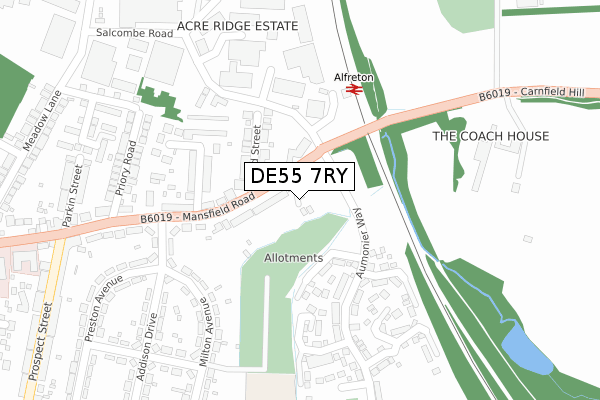
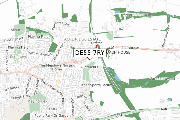
DE55 7RY is located in the Alfreton electoral ward, within the local authority district of Amber Valley and the English Parliamentary constituency of Amber Valley. The Sub Integrated Care Board (ICB) Location is NHS Derby and Derbyshire ICB - 15M and the police force is Derbyshire. This postcode has been in use since December 2019.


GetTheData
Source: OS Open Zoomstack (Ordnance Survey)
Licence: Open Government Licence (requires attribution)
Attribution: Contains OS data © Crown copyright and database right 2024
Source: Open Postcode Geo
Licence: Open Government Licence (requires attribution)
Attribution: Contains OS data © Crown copyright and database right 2024; Contains Royal Mail data © Royal Mail copyright and database right 2024; Source: Office for National Statistics licensed under the Open Government Licence v.3.0
| Easting | 442218 |
| Northing | 355929 |
| Latitude | 53.098919 |
| Longitude | -1.370941 |
GetTheData
Source: Open Postcode Geo
Licence: Open Government Licence
| Country | England |
| Postcode District | DE55 |
| ➜ DE55 open data dashboard ➜ See where DE55 is on a map ➜ Where is Alfreton? | |
GetTheData
Source: Land Registry Price Paid Data
Licence: Open Government Licence
| Ward | Alfreton |
| Constituency | Amber Valley |
GetTheData
Source: ONS Postcode Database
Licence: Open Government Licence
2021 19 NOV £242,000 |
2020 16 DEC £213,500 |
2, DOVE WELL VIEW, ALFRETON, DE55 7RY 2020 30 APR £205,000 |
2020 27 MAR £204,000 |
2004 24 AUG £203,000 |
2004 2 JUL £203,000 |
GetTheData
Source: HM Land Registry Price Paid Data
Licence: Contains HM Land Registry data © Crown copyright and database right 2024. This data is licensed under the Open Government Licence v3.0.
| June 2022 | Criminal damage and arson | On or near Wood Street | 130m |
| June 2022 | Anti-social behaviour | On or near Catherine Street | 184m |
| June 2022 | Violence and sexual offences | On or near Catherine Street | 184m |
| ➜ Get more crime data in our Crime section | |||
GetTheData
Source: data.police.uk
Licence: Open Government Licence
| Railway Station (Mansfield Road) | Alfreton | 66m |
| Railway Station (Mansfield Road) | Alfreton | 100m |
| Station Forecourt | Alfreton | 203m |
| Preston Avenue (Mansfield Road) | Alfreton | 213m |
| Carnfield Hall Garden Centre (Carnfield Hill) | Alfreton | 347m |
| Alfreton Station | 0.2km |
GetTheData
Source: NaPTAN
Licence: Open Government Licence
GetTheData
Source: ONS Postcode Database
Licence: Open Government Licence


➜ Get more ratings from the Food Standards Agency
GetTheData
Source: Food Standards Agency
Licence: FSA terms & conditions
| Last Collection | |||
|---|---|---|---|
| Location | Mon-Fri | Sat | Distance |
| Mansfield Road Post Office | 17:00 | 12:00 | 394m |
| Meadow Lane Industrial Estate | 17:30 | 09:30 | 433m |
| Leabrooks Post Office | 17:30 | 11:00 | 601m |
GetTheData
Source: Dracos
Licence: Creative Commons Attribution-ShareAlike
| Facility | Distance |
|---|---|
| Atlas Workout Warehouse (Closed) Salcombe Road, Alfreton Health and Fitness Gym | 362m |
| Leys Junior School Flowery Leys Lane, Alfreton Grass Pitches | 395m |
| Impact Arena North Street, Alfreton Grass Pitches | 886m |
GetTheData
Source: Active Places
Licence: Open Government Licence
| School | Phase of Education | Distance |
|---|---|---|
| Leys Junior School Flowery Leys Lane, Leys Junior School, Alfreton, DE55 7HA | Primary | 398m |
| Christ the King Catholic Voluntary Academy Firs Avenue, Alfreton, DE55 7EN | Primary | 919m |
| Copthorne Community Infant School Rodgers Lane, Alfreton, DE55 7FF | Primary | 988m |
GetTheData
Source: Edubase
Licence: Open Government Licence
The below table lists the International Territorial Level (ITL) codes (formerly Nomenclature of Territorial Units for Statistics (NUTS) codes) and Local Administrative Units (LAU) codes for DE55 7RY:
| ITL 1 Code | Name |
|---|---|
| TLF | East Midlands (England) |
| ITL 2 Code | Name |
| TLF1 | Derbyshire and Nottinghamshire |
| ITL 3 Code | Name |
| TLF13 | South and West Derbyshire |
| LAU 1 Code | Name |
| E07000032 | Amber Valley |
GetTheData
Source: ONS Postcode Directory
Licence: Open Government Licence
The below table lists the Census Output Area (OA), Lower Layer Super Output Area (LSOA), and Middle Layer Super Output Area (MSOA) for DE55 7RY:
| Code | Name | |
|---|---|---|
| OA | E00098126 | |
| LSOA | E01019400 | Amber Valley 001A |
| MSOA | E02004029 | Amber Valley 001 |
GetTheData
Source: ONS Postcode Directory
Licence: Open Government Licence
| DE55 7JQ | Mansfield Road | 68m |
| DE55 7JW | Wood Street | 143m |
| DE55 7JU | Catherine Street | 201m |
| DE55 7FJ | Catherine Street | 232m |
| DE55 7JR | Wood Street North | 275m |
| DE55 7LA | Milton Avenue | 281m |
| DE55 7JF | Meadow Court | 298m |
| DE55 7JP | Mansfield Road | 306m |
| DE55 7JT | Priory Road | 321m |
| DE55 7JX | Preston Avenue | 328m |
GetTheData
Source: Open Postcode Geo; Land Registry Price Paid Data
Licence: Open Government Licence