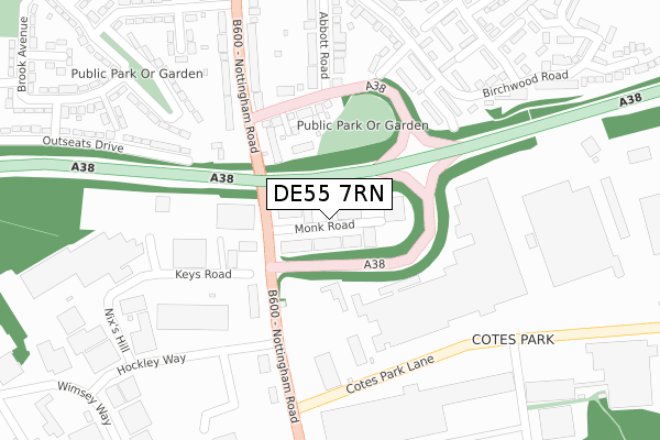
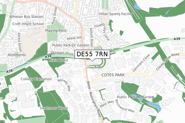
DE55 7RN is located in the Crich & South Wingfield electoral ward, within the local authority district of Amber Valley and the English Parliamentary constituency of Amber Valley. The Sub Integrated Care Board (ICB) Location is NHS Derby and Derbyshire ICB - 15M and the police force is Derbyshire. This postcode has been in use since February 2019.


GetTheData
Source: OS Open Zoomstack (Ordnance Survey)
Licence: Open Government Licence (requires attribution)
Attribution: Contains OS data © Crown copyright and database right 2024
Source: Open Postcode Geo
Licence: Open Government Licence (requires attribution)
Attribution: Contains OS data © Crown copyright and database right 2024; Contains Royal Mail data © Royal Mail copyright and database right 2024; Source: Office for National Statistics licensed under the Open Government Licence v.3.0
| Easting | 438356 |
| Northing | 354709 |
| Latitude | 53.088243 |
| Longitude | -1.428760 |
GetTheData
Source: Open Postcode Geo
Licence: Open Government Licence
| Country | England |
| Postcode District | DE55 |
| ➜ DE55 open data dashboard ➜ See where DE55 is on a map | |
GetTheData
Source: Land Registry Price Paid Data
Licence: Open Government Licence
| Ward | Crich & South Wingfield |
| Constituency | Amber Valley |
GetTheData
Source: ONS Postcode Database
Licence: Open Government Licence
| Parks Avenue (Church Lane) | South Wingfield | 894m |
| Parks Avenue (Church Lane) | South Wingfield | 915m |
| Holm Lane | Oakerthorpe | 943m |
| Holm Lane | Oakerthorpe | 948m |
| Church (Holm Lane) | South Wingfield | 1,002m |
| Alfreton Station | 4.2km |
| Ambergate Station | 4.6km |
GetTheData
Source: NaPTAN
Licence: Open Government Licence
GetTheData
Source: ONS Postcode Database
Licence: Open Government Licence


➜ Get more ratings from the Food Standards Agency
GetTheData
Source: Food Standards Agency
Licence: FSA terms & conditions
| Last Collection | |||
|---|---|---|---|
| Location | Mon-Fri | Sat | Distance |
| Chesterfield Road | 16:30 | 09:30 | 696m |
| Shaw Wood Close | 16:00 | 08:00 | 856m |
| Church Street | 16:00 | 07:00 | 914m |
GetTheData
Source: Dracos
Licence: Creative Commons Attribution-ShareAlike
| Facility | Distance |
|---|---|
| South Wingfield Cricket Club Holme Lane, South Wingfield, Alfreton Grass Pitches | 905m |
| South Wingfield Primary School Church Lane, South Wingfield, Alfreton Grass Pitches | 949m |
| Alfreton Golf Club Wingfield Road, Oakerthorpe, Alfreton Golf | 1.4km |
GetTheData
Source: Active Places
Licence: Open Government Licence
| School | Phase of Education | Distance |
|---|---|---|
| South Wingfield Primary School Church Lane, South Wingfield, Alfreton, DE55 7NJ | Primary | 953m |
| Alfreton Park Community Special School Alfreton Park, Wingfield Road, Alfreton, DE55 7AL | Not applicable | 2.3km |
| Swanwick Primary School South Street, Swanwick, Alfreton, DE55 1BZ | Primary | 2.3km |
GetTheData
Source: Edubase
Licence: Open Government Licence
The below table lists the International Territorial Level (ITL) codes (formerly Nomenclature of Territorial Units for Statistics (NUTS) codes) and Local Administrative Units (LAU) codes for DE55 7RN:
| ITL 1 Code | Name |
|---|---|
| TLF | East Midlands (England) |
| ITL 2 Code | Name |
| TLF1 | Derbyshire and Nottinghamshire |
| ITL 3 Code | Name |
| TLF13 | South and West Derbyshire |
| LAU 1 Code | Name |
| E07000032 | Amber Valley |
GetTheData
Source: ONS Postcode Directory
Licence: Open Government Licence
The below table lists the Census Output Area (OA), Lower Layer Super Output Area (LSOA), and Middle Layer Super Output Area (MSOA) for DE55 7RN:
| Code | Name | |
|---|---|---|
| OA | E00098503 | |
| LSOA | E01019477 | Amber Valley 002D |
| MSOA | E02004030 | Amber Valley 002 |
GetTheData
Source: ONS Postcode Directory
Licence: Open Government Licence
| DE55 7NQ | 616m | |
| DE55 7LP | Holly Bank Close | 641m |
| DE55 7PE | Chesterfield Road | 800m |
| DE55 7NL | Parks Avenue | 838m |
| DE55 7NN | Parks Avenue | 881m |
| DE55 7NP | Shaw Wood View | 895m |
| DE55 7PG | The Paddock | 908m |
| DE5 3RL | 932m | |
| DE55 7NH | Manor Road | 973m |
| DE55 7NJ | Church Lane | 995m |
GetTheData
Source: Open Postcode Geo; Land Registry Price Paid Data
Licence: Open Government Licence