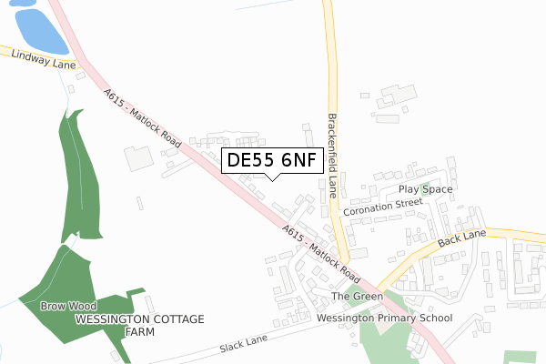
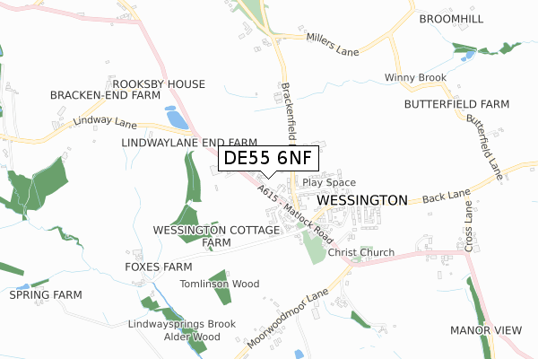
DE55 6NF is located in the Shirland electoral ward, within the local authority district of North East Derbyshire and the English Parliamentary constituency of Bolsover. The Sub Integrated Care Board (ICB) Location is NHS Derby and Derbyshire ICB - 15M and the police force is Derbyshire. This postcode has been in use since September 2019.


GetTheData
Source: OS Open Zoomstack (Ordnance Survey)
Licence: Open Government Licence (requires attribution)
Attribution: Contains OS data © Crown copyright and database right 2024
Source: Open Postcode Geo
Licence: Open Government Licence (requires attribution)
Attribution: Contains OS data © Crown copyright and database right 2024; Contains Royal Mail data © Royal Mail copyright and database right 2024; Source: Office for National Statistics licensed under the Open Government Licence v.3.0
| Easting | 436899 |
| Northing | 358014 |
| Latitude | 53.118053 |
| Longitude | -1.450135 |
GetTheData
Source: Open Postcode Geo
Licence: Open Government Licence
| Country | England |
| Postcode District | DE55 |
| ➜ DE55 open data dashboard ➜ See where DE55 is on a map ➜ Where is Wessington? | |
GetTheData
Source: Land Registry Price Paid Data
Licence: Open Government Licence
| Ward | Shirland |
| Constituency | Bolsover |
GetTheData
Source: ONS Postcode Database
Licence: Open Government Licence
29, BRACKENFIELD VIEW, WESSINGTON, ALFRETON, DE55 6NF 2021 29 OCT £409,950 |
31, BRACKENFIELD VIEW, WESSINGTON, ALFRETON, DE55 6NF 2021 22 OCT £420,000 |
33, BRACKENFIELD VIEW, WESSINGTON, ALFRETON, DE55 6NF 2021 15 OCT £499,950 |
14, BRACKENFIELD VIEW, WESSINGTON, ALFRETON, DE55 6NF 2021 30 SEP £372,000 |
35, BRACKENFIELD VIEW, WESSINGTON, ALFRETON, DE55 6NF 2021 10 SEP £299,950 |
37, BRACKENFIELD VIEW, WESSINGTON, ALFRETON, DE55 6NF 2021 1 SEP £299,950 |
16, BRACKENFIELD VIEW, WESSINGTON, ALFRETON, DE55 6NF 2021 13 AUG £309,950 |
12, BRACKENFIELD VIEW, WESSINGTON, ALFRETON, DE55 6NF 2021 28 MAY £305,000 |
25, BRACKENFIELD VIEW, WESSINGTON, ALFRETON, DE55 6NF 2021 31 MAR £499,950 |
27, BRACKENFIELD VIEW, WESSINGTON, ALFRETON, DE55 6NF 2021 31 MAR £405,000 |
GetTheData
Source: HM Land Registry Price Paid Data
Licence: Contains HM Land Registry data © Crown copyright and database right 2024. This data is licensed under the Open Government Licence v3.0.
| June 2022 | Vehicle crime | On or near Riley Avenue | 95m |
| June 2022 | Other theft | On or near Hill Crest Avenue | 445m |
| April 2022 | Violence and sexual offences | On or near The Greendale | 251m |
| ➜ Get more crime data in our Crime section | |||
GetTheData
Source: data.police.uk
Licence: Open Government Licence
| Brackenfield Lane | Wessington | 117m |
| Brackenfield Lane | Wessington | 130m |
| Horse And Jockey (Matlock Road) | Wessington | 250m |
| Horse And Jockey (Matlock Road) | Wessington | 255m |
| The Green (Matlock Road) | Wessington | 423m |
| Whatstandwell Station | 5.3km |
GetTheData
Source: NaPTAN
Licence: Open Government Licence
GetTheData
Source: ONS Postcode Database
Licence: Open Government Licence


➜ Get more ratings from the Food Standards Agency
GetTheData
Source: Food Standards Agency
Licence: FSA terms & conditions
| Last Collection | |||
|---|---|---|---|
| Location | Mon-Fri | Sat | Distance |
| Wessington | 16:00 | 08:00 | 179m |
| Church Street, Wessington | 16:00 | 09:00 | 581m |
| The Green Brackenfield | 16:00 | 08:00 | 957m |
GetTheData
Source: Dracos
Licence: Creative Commons Attribution-ShareAlike
| Facility | Distance |
|---|---|
| South Wingfield Primary School Church Lane, South Wingfield, Alfreton Grass Pitches | 2.7km |
| South Wingfield Cricket Club Holme Lane, South Wingfield, Alfreton Grass Pitches | 2.8km |
| Shirland Golf Club Pit Lane, Shirland, Alfreton Golf | 2.8km |
GetTheData
Source: Active Places
Licence: Open Government Licence
| School | Phase of Education | Distance |
|---|---|---|
| Wessington Primary School The Green, Wessington, Alfreton, DE55 6DQ | Primary | 333m |
| South Wingfield Primary School Church Lane, South Wingfield, Alfreton, DE55 7NJ | Primary | 2.7km |
| Mickley Village Primary & Nursery School Milton Avenue, Stretton, Alfreton, DE55 6GG | Primary | 2.9km |
GetTheData
Source: Edubase
Licence: Open Government Licence
The below table lists the International Territorial Level (ITL) codes (formerly Nomenclature of Territorial Units for Statistics (NUTS) codes) and Local Administrative Units (LAU) codes for DE55 6NF:
| ITL 1 Code | Name |
|---|---|
| TLF | East Midlands (England) |
| ITL 2 Code | Name |
| TLF1 | Derbyshire and Nottinghamshire |
| ITL 3 Code | Name |
| TLF12 | East Derbyshire |
| LAU 1 Code | Name |
| E07000038 | North East Derbyshire |
GetTheData
Source: ONS Postcode Directory
Licence: Open Government Licence
The below table lists the Census Output Area (OA), Lower Layer Super Output Area (LSOA), and Middle Layer Super Output Area (MSOA) for DE55 6NF:
| Code | Name | |
|---|---|---|
| OA | E00100306 | |
| LSOA | E01019819 | North East Derbyshire 013D |
| MSOA | E02004117 | North East Derbyshire 013 |
GetTheData
Source: ONS Postcode Directory
Licence: Open Government Licence
| DE55 6DT | Riley Avenue | 69m |
| DE55 6DS | Matlock Road | 78m |
| DE55 6DW | Brackenfield Lane | 90m |
| DE55 6DX | Coronation Street | 190m |
| DE55 6DY | Park Street | 204m |
| DE55 6FQ | Spring Gardens | 210m |
| DE55 6EZ | The Greendale | 244m |
| DE55 6DZ | King George Street | 291m |
| DE55 6EB | Birch Close | 325m |
| DE55 6EA | Back Lane | 345m |
GetTheData
Source: Open Postcode Geo; Land Registry Price Paid Data
Licence: Open Government Licence