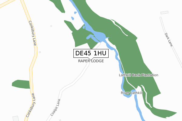
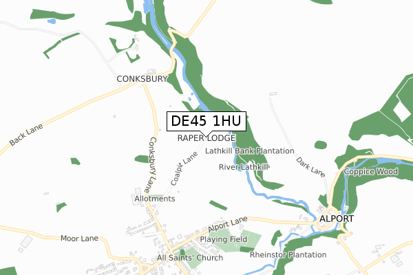
DE45 1HU is located in the Youlgrave electoral ward, within the local authority district of Derbyshire Dales and the English Parliamentary constituency of Derbyshire Dales. The Sub Integrated Care Board (ICB) Location is NHS Derby and Derbyshire ICB - 15M and the police force is Derbyshire. This postcode has been in use since September 2019.


GetTheData
Source: OS Open Zoomstack (Ordnance Survey)
Licence: Open Government Licence (requires attribution)
Attribution: Contains OS data © Crown copyright and database right 2024
Source: Open Postcode Geo
Licence: Open Government Licence (requires attribution)
Attribution: Contains OS data © Crown copyright and database right 2024; Contains Royal Mail data © Royal Mail copyright and database right 2024; Source: Office for National Statistics licensed under the Open Government Licence v.3.0
| Easting | 421389 |
| Northing | 365066 |
| Latitude | 53.182285 |
| Longitude | -1.681401 |
GetTheData
Source: Open Postcode Geo
Licence: Open Government Licence
| Country | England |
| Postcode District | DE45 |
| ➜ DE45 open data dashboard ➜ See where DE45 is on a map | |
GetTheData
Source: Land Registry Price Paid Data
Licence: Open Government Licence
| Ward | Youlgrave |
| Constituency | Derbyshire Dales |
GetTheData
Source: ONS Postcode Database
Licence: Open Government Licence
| Alport Lane | Youlgreave | 616m |
| Alport Lane | Youlgreave | 617m |
| Church (Alport Lane) | Youlgreave | 700m |
| Church (Church Street) | Youlgreave | 753m |
| Riverside (Alport Lane) | Alport | 845m |
GetTheData
Source: NaPTAN
Licence: Open Government Licence
GetTheData
Source: ONS Postcode Database
Licence: Open Government Licence


➜ Get more ratings from the Food Standards Agency
GetTheData
Source: Food Standards Agency
Licence: FSA terms & conditions
| Last Collection | |||
|---|---|---|---|
| Location | Mon-Fri | Sat | Distance |
| Youlgrave Church | 16:00 | 10:00 | 698m |
| Alport | 16:00 | 10:00 | 848m |
| Youlgrave Post Office | 16:00 | 10:00 | 863m |
GetTheData
Source: Dracos
Licence: Creative Commons Attribution-ShareAlike
| Facility | Distance |
|---|---|
| Alport Lane Recreation Ground Alport Lane, Youlgrave Grass Pitches, Outdoor Tennis Courts | 554m |
| Bakewell Methodist Junior School Stoney Close, Bakewell Grass Pitches, Sports Hall | 2.7km |
| Lady Manners School Shutts Lane, Bakewell Health and Fitness Gym, Sports Hall, Grass Pitches, Studio, Outdoor Tennis Courts, Artificial Grass Pitch | 2.7km |
GetTheData
Source: Active Places
Licence: Open Government Licence
| School | Phase of Education | Distance |
|---|---|---|
| Youlgrave, All Saints' CofE (VA) Primary School Alport Lane, Youlgrave, Bakewell, DE45 1WN | Primary | 665m |
| Lady Manners School Shutts Lane, Bakewell, DE45 1JA | Secondary | 2.6km |
| Bakewell Methodist Academy Stoney Close, Bakewell, DE45 1FR | Primary | 2.7km |
GetTheData
Source: Edubase
Licence: Open Government Licence
The below table lists the International Territorial Level (ITL) codes (formerly Nomenclature of Territorial Units for Statistics (NUTS) codes) and Local Administrative Units (LAU) codes for DE45 1HU:
| ITL 1 Code | Name |
|---|---|
| TLF | East Midlands (England) |
| ITL 2 Code | Name |
| TLF1 | Derbyshire and Nottinghamshire |
| ITL 3 Code | Name |
| TLF13 | South and West Derbyshire |
| LAU 1 Code | Name |
| E07000035 | Derbyshire Dales |
GetTheData
Source: ONS Postcode Directory
Licence: Open Government Licence
The below table lists the Census Output Area (OA), Lower Layer Super Output Area (LSOA), and Middle Layer Super Output Area (MSOA) for DE45 1HU:
| Code | Name | |
|---|---|---|
| OA | E00099249 | |
| LSOA | E01019617 | Derbyshire Dales 003D |
| MSOA | E02004070 | Derbyshire Dales 003 |
GetTheData
Source: ONS Postcode Directory
Licence: Open Government Licence
| DE45 1JW | Conksbury | 554m |
| DE45 1WN | Alport Lane | 612m |
| DE45 1WR | Conksbury Lane | 616m |
| DE45 1WP | New Road | 668m |
| DE45 1WQ | Conksbury Avenue | 686m |
| DE45 1WS | The Orchard | 715m |
| DE45 1WL | Church Street | 745m |
| DE45 1UR | Church Street | 845m |
| DE45 1US | Moor Lane | 861m |
| DE45 1WG | Bradford | 880m |
GetTheData
Source: Open Postcode Geo; Land Registry Price Paid Data
Licence: Open Government Licence