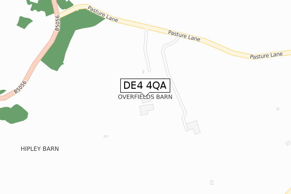
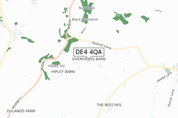
DE4 4QA is located in the Dovedale, Parwich & Brassington electoral ward, within the local authority district of Derbyshire Dales and the English Parliamentary constituency of Derbyshire Dales. The Sub Integrated Care Board (ICB) Location is NHS Derby and Derbyshire ICB - 15M and the police force is Derbyshire. This postcode has been in use since March 2018.


GetTheData
Source: OS Open Zoomstack (Ordnance Survey)
Licence: Open Government Licence (requires attribution)
Attribution: Contains OS data © Crown copyright and database right 2024
Source: Open Postcode Geo
Licence: Open Government Licence (requires attribution)
Attribution: Contains OS data © Crown copyright and database right 2024; Contains Royal Mail data © Royal Mail copyright and database right 2024; Source: Office for National Statistics licensed under the Open Government Licence v.3.0
| Easting | 421465 |
| Northing | 354265 |
| Latitude | 53.085194 |
| Longitude | -1.680981 |
GetTheData
Source: Open Postcode Geo
Licence: Open Government Licence
| Country | England |
| Postcode District | DE4 |
| ➜ DE4 open data dashboard ➜ See where DE4 is on a map | |
GetTheData
Source: Land Registry Price Paid Data
Licence: Open Government Licence
| Ward | Dovedale, Parwich & Brassington |
| Constituency | Derbyshire Dales |
GetTheData
Source: ONS Postcode Database
Licence: Open Government Licence
| The Council Houses (Main Street) | Ballidon | 1,164m |
GetTheData
Source: NaPTAN
Licence: Open Government Licence
GetTheData
Source: ONS Postcode Database
Licence: Open Government Licence


➜ Get more ratings from the Food Standards Agency
GetTheData
Source: Food Standards Agency
Licence: FSA terms & conditions
| Last Collection | |||
|---|---|---|---|
| Location | Mon-Fri | Sat | Distance |
| Ballidon | 16:15 | 08:30 | 1,286m |
| Old Brassington Post Office | 16:30 | 07:00 | 1,503m |
| Church Street | 16:30 | 07:00 | 1,664m |
GetTheData
Source: Dracos
Licence: Creative Commons Attribution-ShareAlike
| Facility | Distance |
|---|---|
| Brassington Primary School School Hill, Brassington, Matlock Grass Pitches | 1.7km |
| Parsons Croft Parwich, Ashbourne Grass Pitches, Outdoor Tennis Courts | 2.4km |
| Kniveton Ce Primary School Kniveton, Ashbourne Grass Pitches | 3.8km |
GetTheData
Source: Active Places
Licence: Open Government Licence
| School | Phase of Education | Distance |
|---|---|---|
| Brassington Primary School School Hill, Brassington, Matlock, DE4 4HB | Primary | 1.7km |
| Parwich Primary School Parwich, Parwich Primary School, Parwich, Ashbourne, DE6 1QJ | Primary | 2.9km |
| Kniveton CofE Primary School Kniveton, Ashbourne, DE6 1JJ | Primary | 3.8km |
GetTheData
Source: Edubase
Licence: Open Government Licence
The below table lists the International Territorial Level (ITL) codes (formerly Nomenclature of Territorial Units for Statistics (NUTS) codes) and Local Administrative Units (LAU) codes for DE4 4QA:
| ITL 1 Code | Name |
|---|---|
| TLF | East Midlands (England) |
| ITL 2 Code | Name |
| TLF1 | Derbyshire and Nottinghamshire |
| ITL 3 Code | Name |
| TLF13 | South and West Derbyshire |
| LAU 1 Code | Name |
| E07000035 | Derbyshire Dales |
GetTheData
Source: ONS Postcode Directory
Licence: Open Government Licence
The below table lists the Census Output Area (OA), Lower Layer Super Output Area (LSOA), and Middle Layer Super Output Area (MSOA) for DE4 4QA:
| Code | Name | |
|---|---|---|
| OA | E00099164 | |
| LSOA | E01019605 | Derbyshire Dales 008B |
| MSOA | E02004075 | Derbyshire Dales 008 |
GetTheData
Source: ONS Postcode Directory
Licence: Open Government Licence
| DE6 1QX | Hillside Cottages | 1219m |
| DE6 1PD | 1270m | |
| DE4 4HL | West End | 1306m |
| DE4 4HP | Ballidon Moor | 1390m |
| DE4 4HJ | Church Street | 1551m |
| DE4 4HZ | Manor Close | 1604m |
| DE4 4HG | Field End | 1620m |
| DE4 4HD | Greenway | 1679m |
| DE4 4HA | Dale End | 1680m |
| DE4 4NT | Jaspers Lane | 1689m |
GetTheData
Source: Open Postcode Geo; Land Registry Price Paid Data
Licence: Open Government Licence