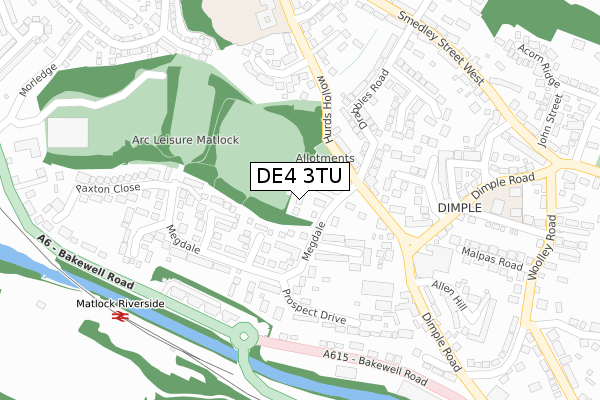
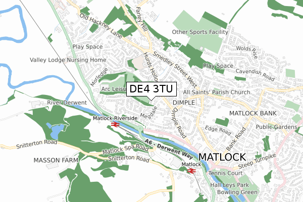
DE4 3TU is located in the Matlock West electoral ward, within the local authority district of Derbyshire Dales and the English Parliamentary constituency of Derbyshire Dales. The Sub Integrated Care Board (ICB) Location is NHS Derby and Derbyshire ICB - 15M and the police force is Derbyshire. This postcode has been in use since May 2019.


GetTheData
Source: OS Open Zoomstack (Ordnance Survey)
Licence: Open Government Licence (requires attribution)
Attribution: Contains OS data © Crown copyright and database right 2024
Source: Open Postcode Geo
Licence: Open Government Licence (requires attribution)
Attribution: Contains OS data © Crown copyright and database right 2024; Contains Royal Mail data © Royal Mail copyright and database right 2024; Source: Office for National Statistics licensed under the Open Government Licence v.3.0
| Easting | 429311 |
| Northing | 360755 |
| Latitude | 53.143160 |
| Longitude | -1.563255 |
GetTheData
Source: Open Postcode Geo
Licence: Open Government Licence
| Country | England |
| Postcode District | DE4 |
| ➜ DE4 open data dashboard ➜ See where DE4 is on a map ➜ Where is Matlock? | |
GetTheData
Source: Land Registry Price Paid Data
Licence: Open Government Licence
| Ward | Matlock West |
| Constituency | Derbyshire Dales |
GetTheData
Source: ONS Postcode Database
Licence: Open Government Licence
| March 2023 | Violence and sexual offences | On or near All Saints' Road | 344m |
| March 2023 | Violence and sexual offences | On or near All Saints' Road | 344m |
| March 2023 | Burglary | On or near All Saints' Road | 344m |
| ➜ Get more crime data in our Crime section | |||
GetTheData
Source: data.police.uk
Licence: Open Government Licence
| Dimple Mill (Dimple Road) | Matlock | 212m |
| Dimple Mill (Dimple Road) | Matlock | 223m |
| Twiggs (Bakewell Road) | Matlock | 274m |
| Gateway Court (Bakewell Road) | Matlock | 287m |
| Gateway Court (Bakewell Road) | Matlock | 297m |
| Matlock (Peak Rail) | Matlock | 651m |
| Matlock Station | 0.6km |
| Matlock Bath Station | 2.4km |
| Cromford Station | 3.5km |
GetTheData
Source: NaPTAN
Licence: Open Government Licence
| Percentage of properties with Next Generation Access | 100.0% |
| Percentage of properties with Superfast Broadband | 100.0% |
| Percentage of properties with Ultrafast Broadband | 0.0% |
| Percentage of properties with Full Fibre Broadband | 0.0% |
Superfast Broadband is between 30Mbps and 300Mbps
Ultrafast Broadband is > 300Mbps
| Percentage of properties unable to receive 2Mbps | 0.0% |
| Percentage of properties unable to receive 5Mbps | 0.0% |
| Percentage of properties unable to receive 10Mbps | 0.0% |
| Percentage of properties unable to receive 30Mbps | 0.0% |
GetTheData
Source: Ofcom
Licence: Ofcom Terms of Use (requires attribution)
GetTheData
Source: ONS Postcode Database
Licence: Open Government Licence


➜ Get more ratings from the Food Standards Agency
GetTheData
Source: Food Standards Agency
Licence: FSA terms & conditions
| Last Collection | |||
|---|---|---|---|
| Location | Mon-Fri | Sat | Distance |
| Dimple | 17:30 | 08:00 | 210m |
| Smedley Street | 17:30 | 07:00 | 385m |
| Holme Close | 17:00 | 07:30 | 409m |
GetTheData
Source: Dracos
Licence: Creative Commons Attribution-ShareAlike
| Facility | Distance |
|---|---|
| Dimple Recreation Ground Hurds Hollow, Matlock Grass Pitches | 24m |
| Arc Leisure Matlock Bakewell Road, Matlock Swimming Pool, Health and Fitness Gym, Sports Hall, Studio | 403m |
| Cavendish Fields Sports Association Cavendish Road, Matlock Grass Pitches, Artificial Grass Pitch | 682m |
GetTheData
Source: Active Places
Licence: Open Government Licence
| School | Phase of Education | Distance |
|---|---|---|
| All Saints CofE Infant School Dimple Road, Matlock, DE4 3HX | Primary | 330m |
| All Saints CofE Junior School Hurds Hollow, Matlock, DE4 3LA | Primary | 337m |
| Castle View Primary School School Road, Matlock, DE4 3DS | Primary | 1.2km |
GetTheData
Source: Edubase
Licence: Open Government Licence
The below table lists the International Territorial Level (ITL) codes (formerly Nomenclature of Territorial Units for Statistics (NUTS) codes) and Local Administrative Units (LAU) codes for DE4 3TU:
| ITL 1 Code | Name |
|---|---|
| TLF | East Midlands (England) |
| ITL 2 Code | Name |
| TLF1 | Derbyshire and Nottinghamshire |
| ITL 3 Code | Name |
| TLF13 | South and West Derbyshire |
| LAU 1 Code | Name |
| E07000035 | Derbyshire Dales |
GetTheData
Source: ONS Postcode Directory
Licence: Open Government Licence
The below table lists the Census Output Area (OA), Lower Layer Super Output Area (LSOA), and Middle Layer Super Output Area (MSOA) for DE4 3TU:
| Code | Name | |
|---|---|---|
| OA | E00099277 | |
| LSOA | E01019624 | Derbyshire Dales 005D |
| MSOA | E02004072 | Derbyshire Dales 005 |
GetTheData
Source: ONS Postcode Directory
Licence: Open Government Licence
| DE4 3LS | Dalesfield | 77m |
| DE4 3JZ | Hurds Hollow | 109m |
| DE4 3JU | Wyvern Close | 125m |
| DE4 3JW | Megdale | 133m |
| DE4 3NP | Daysmill Close | 142m |
| DE4 3EZ | The Beeches | 159m |
| DE4 3LD | Drabbles Road | 207m |
| DE4 3TA | Prospect Drive | 211m |
| DE4 3JT | Sheriff Drive | 211m |
| DE4 3TE | Megdale | 214m |
GetTheData
Source: Open Postcode Geo; Land Registry Price Paid Data
Licence: Open Government Licence