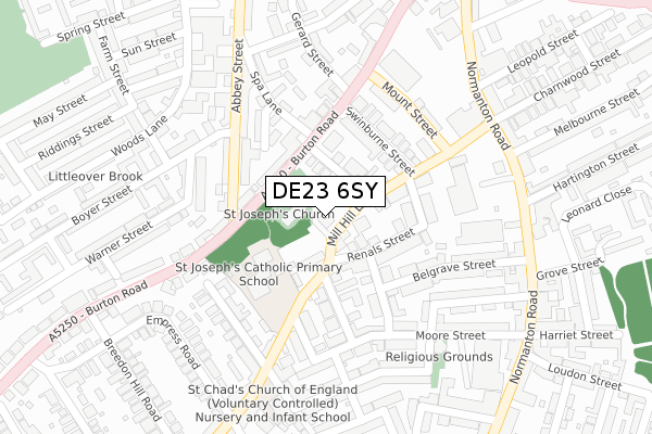
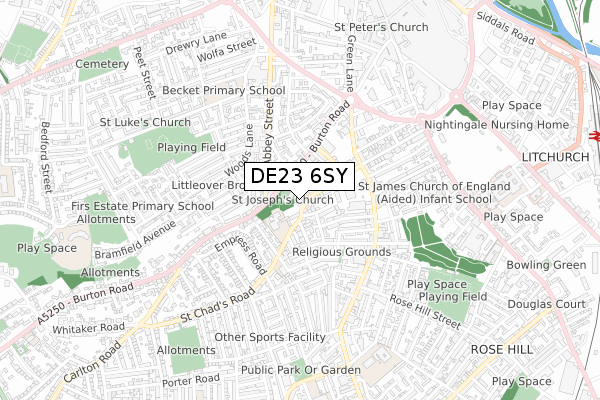
DE23 6SY is located in the Arboretum electoral ward, within the unitary authority of Derby and the English Parliamentary constituency of Derby South. The Sub Integrated Care Board (ICB) Location is NHS Derby and Derbyshire ICB - 15M and the police force is Derbyshire. This postcode has been in use since August 2018.


GetTheData
Source: OS Open Zoomstack (Ordnance Survey)
Licence: Open Government Licence (requires attribution)
Attribution: Contains OS data © Crown copyright and database right 2024
Source: Open Postcode Geo
Licence: Open Government Licence (requires attribution)
Attribution: Contains OS data © Crown copyright and database right 2024; Contains Royal Mail data © Royal Mail copyright and database right 2024; Source: Office for National Statistics licensed under the Open Government Licence v.3.0
| Easting | 434971 |
| Northing | 335283 |
| Latitude | 52.913858 |
| Longitude | -1.481393 |
GetTheData
Source: Open Postcode Geo
Licence: Open Government Licence
| Country | England |
| Postcode District | DE23 |
| ➜ DE23 open data dashboard ➜ See where DE23 is on a map ➜ Where is Derby? | |
GetTheData
Source: Land Registry Price Paid Data
Licence: Open Government Licence
| Ward | Arboretum |
| Constituency | Derby South |
GetTheData
Source: ONS Postcode Database
Licence: Open Government Licence
| January 2024 | Anti-social behaviour | On or near Normanton Road | 321m |
| January 2024 | Burglary | On or near Normanton Road | 321m |
| January 2024 | Burglary | On or near Normanton Road | 321m |
| ➜ Get more crime data in our Crime section | |||
GetTheData
Source: data.police.uk
Licence: Open Government Licence
| Mill Hill Lane | Rose Hill | 104m |
| Mill Hill Lane | Rose Hill | 153m |
| Swinburne Street (Mill Hill Lane) | Rose Hill | 156m |
| Swinburne Street (Mill Hill Lane) | Rose Hill | 163m |
| Abbey Street (Burton Road) | Derby | 170m |
| Derby Station | 1.3km |
| Peartree Station | 2km |
| Spondon Station | 4.7km |
GetTheData
Source: NaPTAN
Licence: Open Government Licence
| Percentage of properties with Next Generation Access | 100.0% |
| Percentage of properties with Superfast Broadband | 100.0% |
| Percentage of properties with Ultrafast Broadband | 100.0% |
| Percentage of properties with Full Fibre Broadband | 0.0% |
Superfast Broadband is between 30Mbps and 300Mbps
Ultrafast Broadband is > 300Mbps
| Percentage of properties unable to receive 2Mbps | 0.0% |
| Percentage of properties unable to receive 5Mbps | 0.0% |
| Percentage of properties unable to receive 10Mbps | 0.0% |
| Percentage of properties unable to receive 30Mbps | 0.0% |
GetTheData
Source: Ofcom
Licence: Ofcom Terms of Use (requires attribution)
GetTheData
Source: ONS Postcode Database
Licence: Open Government Licence


➜ Get more ratings from the Food Standards Agency
GetTheData
Source: Food Standards Agency
Licence: FSA terms & conditions
| Last Collection | |||
|---|---|---|---|
| Location | Mon-Fri | Sat | Distance |
| Mill Hill Lane, Derby | 17:30 | 10:30 | 78m |
| Burton Road Post Office | 17:30 | 11:30 | 171m |
| Grey Street | 18:30 | 11:30 | 267m |
GetTheData
Source: Dracos
Licence: Creative Commons Attribution-ShareAlike
| Facility | Distance |
|---|---|
| St Joseph's Catholic Primary School Mill Hill Lane, Derby Grass Pitches | 122m |
| The Gym Group (Derby) Normanton Road, Derby Health and Fitness Gym | 216m |
| Becket Primary School Monk Street, Derby Grass Pitches | 542m |
GetTheData
Source: Active Places
Licence: Open Government Licence
| School | Phase of Education | Distance |
|---|---|---|
| St Joseph's Catholic Voluntary Academy St Joseph's , Mill Hill Lane, Derby, DE23 6SB | Primary | 14m |
| Derby St Chad's CofE Nursery and Infant School Gordon Road, Gordon Road Normanton, Derby, DE23 6WR | Primary | 301m |
| Stonehill Nursery School Stonehill Road, Derby, DE23 6TJ | Nursery | 487m |
GetTheData
Source: Edubase
Licence: Open Government Licence
The below table lists the International Territorial Level (ITL) codes (formerly Nomenclature of Territorial Units for Statistics (NUTS) codes) and Local Administrative Units (LAU) codes for DE23 6SY:
| ITL 1 Code | Name |
|---|---|
| TLF | East Midlands (England) |
| ITL 2 Code | Name |
| TLF1 | Derbyshire and Nottinghamshire |
| ITL 3 Code | Name |
| TLF11 | Derby |
| LAU 1 Code | Name |
| E06000015 | Derby |
GetTheData
Source: ONS Postcode Directory
Licence: Open Government Licence
The below table lists the Census Output Area (OA), Lower Layer Super Output Area (LSOA), and Middle Layer Super Output Area (MSOA) for DE23 6SY:
| Code | Name | |
|---|---|---|
| OA | E00068076 | |
| LSOA | E01013480 | Derby 016A |
| MSOA | E02002811 | Derby 016 |
GetTheData
Source: ONS Postcode Directory
Licence: Open Government Licence
| DE1 1TU | Lime Avenue | 80m |
| DE23 6SB | Mill Hill Lane | 80m |
| DE23 6SH | Renals Street | 82m |
| DE1 1TQ | Burton Road | 113m |
| DE1 1TJ | Burton Road | 114m |
| DE23 6SJ | Renals Street | 115m |
| DE1 2HJ | Swinburne Street | 129m |
| DE1 1QB | Spa Lane | 142m |
| DE23 6SF | Mill Hill Road | 144m |
| DE23 6SG | Avondale Road | 155m |
GetTheData
Source: Open Postcode Geo; Land Registry Price Paid Data
Licence: Open Government Licence