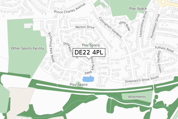
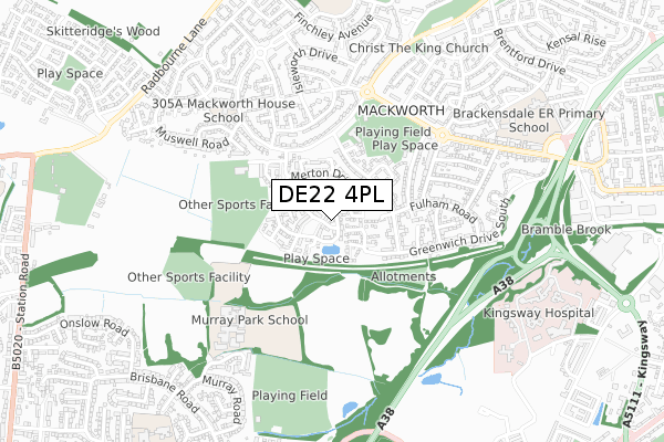
DE22 4PL is located in the Mackworth & New Zealand electoral ward, within the unitary authority of Derby and the English Parliamentary constituency of Derby North. The Sub Integrated Care Board (ICB) Location is NHS Derby and Derbyshire ICB - 15M and the police force is Derbyshire. This postcode has been in use since October 2017.


GetTheData
Source: OS Open Zoomstack (Ordnance Survey)
Licence: Open Government Licence (requires attribution)
Attribution: Contains OS data © Crown copyright and database right 2024
Source: Open Postcode Geo
Licence: Open Government Licence (requires attribution)
Attribution: Contains OS data © Crown copyright and database right 2024; Contains Royal Mail data © Royal Mail copyright and database right 2024; Source: Office for National Statistics licensed under the Open Government Licence v.3.0
| Easting | 432036 |
| Northing | 336158 |
| Latitude | 52.921905 |
| Longitude | -1.524951 |
GetTheData
Source: Open Postcode Geo
Licence: Open Government Licence
| Country | England |
| Postcode District | DE22 |
| ➜ DE22 open data dashboard ➜ See where DE22 is on a map ➜ Where is Derby? | |
GetTheData
Source: Land Registry Price Paid Data
Licence: Open Government Licence
| Ward | Mackworth & New Zealand |
| Constituency | Derby North |
GetTheData
Source: ONS Postcode Database
Licence: Open Government Licence
2022 14 SEP £295,000 |
97, RICHMOND PARK ROAD, DERBY, DE22 4PL 2022 30 MAR £330,000 |
2021 24 FEB £309,500 |
143, RICHMOND PARK ROAD, DERBY, DE22 4PL 2019 1 MAR £250,000 |
125, RICHMOND PARK ROAD, DERBY, DE22 4PL 2019 1 MAR £250,000 |
133, RICHMOND PARK ROAD, DERBY, DE22 4PL 2018 21 DEC £285,000 |
135, RICHMOND PARK ROAD, DERBY, DE22 4PL 2018 21 DEC £315,000 |
139, RICHMOND PARK ROAD, DERBY, DE22 4PL 2018 14 DEC £315,000 |
141, RICHMOND PARK ROAD, DERBY, DE22 4PL 2018 14 DEC £315,000 |
137, RICHMOND PARK ROAD, DERBY, DE22 4PL 2018 14 DEC £315,000 |
GetTheData
Source: HM Land Registry Price Paid Data
Licence: Contains HM Land Registry data © Crown copyright and database right 2024. This data is licensed under the Open Government Licence v3.0.
| August 2023 | Vehicle crime | On or near Norwood Close | 427m |
| July 2023 | Other theft | On or near Norwood Close | 427m |
| March 2023 | Violence and sexual offences | On or near Norwood Close | 427m |
| ➜ Get more crime data in our Crime section | |||
GetTheData
Source: data.police.uk
Licence: Open Government Licence
| Harlow Fields (Prince Charles Avenue) | Mackworth Estate | 300m |
| Harlow Fields (Prince Charles Avenue) | Mackworth Estate | 323m |
| Osterley Green (Fulham Road) | Mackworth Estate | 373m |
| Osterley Green (Fulham Road) | Mackworth Estate | 375m |
| Knightsbridge (Prince Charles Avenue) | Mackworth Estate | 439m |
| Derby Station | 4.2km |
| Peartree Station | 4.4km |
GetTheData
Source: NaPTAN
Licence: Open Government Licence
➜ Broadband speed and availability dashboard for DE22 4PL
| Percentage of properties with Next Generation Access | 100.0% |
| Percentage of properties with Superfast Broadband | 100.0% |
| Percentage of properties with Ultrafast Broadband | 0.0% |
| Percentage of properties with Full Fibre Broadband | 0.0% |
Superfast Broadband is between 30Mbps and 300Mbps
Ultrafast Broadband is > 300Mbps
| Median download speed | 37.0Mbps |
| Average download speed | 31.5Mbps |
| Maximum download speed | 55.00Mbps |
| Median upload speed | 6.0Mbps |
| Average upload speed | 5.9Mbps |
| Maximum upload speed | 10.00Mbps |
| Percentage of properties unable to receive 2Mbps | 0.0% |
| Percentage of properties unable to receive 5Mbps | 0.0% |
| Percentage of properties unable to receive 10Mbps | 0.0% |
| Percentage of properties unable to receive 30Mbps | 0.0% |
➜ Broadband speed and availability dashboard for DE22 4PL
GetTheData
Source: Ofcom
Licence: Ofcom Terms of Use (requires attribution)
GetTheData
Source: ONS Postcode Database
Licence: Open Government Licence


➜ Get more ratings from the Food Standards Agency
GetTheData
Source: Food Standards Agency
Licence: FSA terms & conditions
| Last Collection | |||
|---|---|---|---|
| Location | Mon-Fri | Sat | Distance |
| Fulham Road | 17:30 | 11:00 | 324m |
| Brackensdale Avenue | 17:30 | 11:00 | 691m |
| Henley Green | 17:30 | 11:00 | 729m |
GetTheData
Source: Dracos
Licence: Creative Commons Attribution-ShareAlike
| Facility | Distance |
|---|---|
| Derby Grammar School (Rykneld Sports Centre) Richmond Park Road, Derby Sports Hall, Health and Fitness Gym, Artificial Grass Pitch, Grass Pitches | 394m |
| Knightsbridge Recreation Ground Prince Charles Avenue, Derby Grass Pitches | 397m |
| Murray Park (Closed) Derby Grass Pitches | 524m |
GetTheData
Source: Active Places
Licence: Open Government Licence
| School | Phase of Education | Distance |
|---|---|---|
| Maple View School 305a Prince Charles Avenue, Mackworth, Derby, DE22 4LL | Not applicable | 578m |
| Murray Park Community School Murray Road, Mickleover, Derby, DE3 9LL | Secondary | 578m |
| Brackensdale Spencer Academy Walthamstow Drive, Mackworth Estate, Derby, DE22 4BS | Primary | 776m |
GetTheData
Source: Edubase
Licence: Open Government Licence
The below table lists the International Territorial Level (ITL) codes (formerly Nomenclature of Territorial Units for Statistics (NUTS) codes) and Local Administrative Units (LAU) codes for DE22 4PL:
| ITL 1 Code | Name |
|---|---|
| TLF | East Midlands (England) |
| ITL 2 Code | Name |
| TLF1 | Derbyshire and Nottinghamshire |
| ITL 3 Code | Name |
| TLF11 | Derby |
| LAU 1 Code | Name |
| E06000015 | Derby |
GetTheData
Source: ONS Postcode Directory
Licence: Open Government Licence
The below table lists the Census Output Area (OA), Lower Layer Super Output Area (LSOA), and Middle Layer Super Output Area (MSOA) for DE22 4PL:
| Code | Name | |
|---|---|---|
| OA | E00068410 | |
| LSOA | E01013555 | Derby 009E |
| MSOA | E02002804 | Derby 009 |
GetTheData
Source: ONS Postcode Directory
Licence: Open Government Licence
| DE22 4JH | Redbridge Close | 91m |
| DE22 4LT | Battersea Park Way | 101m |
| DE22 4NJ | Battersea Park Way | 107m |
| DE22 4NL | Hillingdon Avenue | 107m |
| DE22 4JJ | Merton Drive | 174m |
| DE22 4JL | Merton Drive | 174m |
| DE22 4FR | Collingham Gardens | 202m |
| DE22 4FS | Collingham Gardens | 219m |
| DE22 4FB | Richmond Park Road | 220m |
| DE22 4NP | Havering Close | 220m |
GetTheData
Source: Open Postcode Geo; Land Registry Price Paid Data
Licence: Open Government Licence