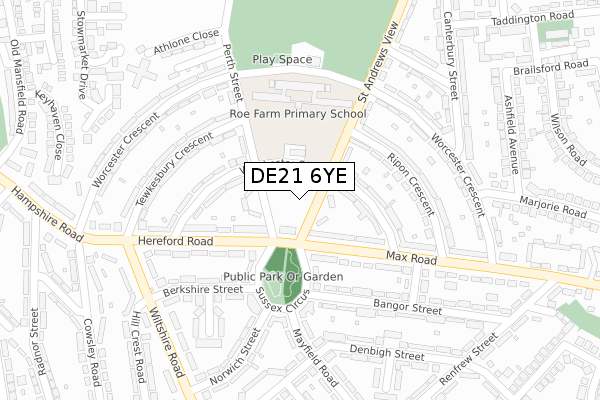
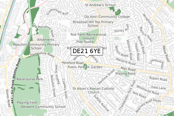
DE21 6YE is located in the Chaddesden North electoral ward, within the unitary authority of Derby and the English Parliamentary constituency of Derby North. The Sub Integrated Care Board (ICB) Location is NHS Derby and Derbyshire ICB - 15M and the police force is Derbyshire. This postcode has been in use since June 2019.


GetTheData
Source: OS Open Zoomstack (Ordnance Survey)
Licence: Open Government Licence (requires attribution)
Attribution: Contains OS data © Crown copyright and database right 2024
Source: Open Postcode Geo
Licence: Open Government Licence (requires attribution)
Attribution: Contains OS data © Crown copyright and database right 2024; Contains Royal Mail data © Royal Mail copyright and database right 2024; Source: Office for National Statistics licensed under the Open Government Licence v.3.0
| Easting | 437092 |
| Northing | 337712 |
| Latitude | 52.935550 |
| Longitude | -1.449577 |
GetTheData
Source: Open Postcode Geo
Licence: Open Government Licence
| Country | England |
| Postcode District | DE21 |
| ➜ DE21 open data dashboard ➜ See where DE21 is on a map ➜ Where is Derby? | |
GetTheData
Source: Land Registry Price Paid Data
Licence: Open Government Licence
| Ward | Chaddesden North |
| Constituency | Derby North |
GetTheData
Source: ONS Postcode Database
Licence: Open Government Licence
| December 2023 | Anti-social behaviour | On or near Liverpool Street | 440m |
| October 2023 | Anti-social behaviour | On or near Liverpool Street | 440m |
| October 2023 | Violence and sexual offences | On or near Liverpool Street | 440m |
| ➜ Get more crime data in our Crime section | |||
GetTheData
Source: data.police.uk
Licence: Open Government Licence
| Sussex Circus Top (Perth Street) | Chaddesden | 67m |
| Sussex Circus Top (Max Road) | Chaddesden | 86m |
| Sussex Circus Top (Hereford Road) | Chaddesden | 109m |
| Berkshire Street (Sussex Circus) | Chaddesden | 129m |
| Tewkesbury Crescent (Perth Street) | Chaddesden | 131m |
| Derby Station | 2.3km |
| Spondon Station | 3.7km |
| Peartree Station | 4.6km |
GetTheData
Source: NaPTAN
Licence: Open Government Licence
| Percentage of properties with Next Generation Access | 100.0% |
| Percentage of properties with Superfast Broadband | 100.0% |
| Percentage of properties with Ultrafast Broadband | 100.0% |
| Percentage of properties with Full Fibre Broadband | 0.0% |
Superfast Broadband is between 30Mbps and 300Mbps
Ultrafast Broadband is > 300Mbps
| Percentage of properties unable to receive 2Mbps | 0.0% |
| Percentage of properties unable to receive 5Mbps | 0.0% |
| Percentage of properties unable to receive 10Mbps | 0.0% |
| Percentage of properties unable to receive 30Mbps | 0.0% |
GetTheData
Source: Ofcom
Licence: Ofcom Terms of Use (requires attribution)
GetTheData
Source: ONS Postcode Database
Licence: Open Government Licence


➜ Get more ratings from the Food Standards Agency
GetTheData
Source: Food Standards Agency
Licence: FSA terms & conditions
| Last Collection | |||
|---|---|---|---|
| Location | Mon-Fri | Sat | Distance |
| Sussex Circus Post Office | 17:30 | 12:00 | 173m |
| Perth Street | 17:30 | 11:00 | 445m |
| Derwent Heights | 17:30 | 11:00 | 530m |
GetTheData
Source: Dracos
Licence: Creative Commons Attribution-ShareAlike
| Facility | Distance |
|---|---|
| Roe Farm Recreation Ground Worcester Crescent, Derby Grass Pitches | 305m |
| Da Vinci Academy St. Andrews View, Derby Sports Hall, Grass Pitches | 655m |
| Rainbow Park Fieldsway Drive, Breadsall Hilltop, Derby Grass Pitches | 874m |
GetTheData
Source: Active Places
Licence: Open Government Licence
| School | Phase of Education | Distance |
|---|---|---|
| Roe Farm Primary School Worcester Crescent, Chaddesden, Derby, DE21 4HG | Primary | 194m |
| Da Vinci Academy St Andrew's View, Breadsall, Derby, DE21 4ET | Secondary | 672m |
| Beaufort Community Primary School Hampshire Road, Beaufort Community Primary School, Derby, DE21 6BT | Primary | 728m |
GetTheData
Source: Edubase
Licence: Open Government Licence
The below table lists the International Territorial Level (ITL) codes (formerly Nomenclature of Territorial Units for Statistics (NUTS) codes) and Local Administrative Units (LAU) codes for DE21 6YE:
| ITL 1 Code | Name |
|---|---|
| TLF | East Midlands (England) |
| ITL 2 Code | Name |
| TLF1 | Derbyshire and Nottinghamshire |
| ITL 3 Code | Name |
| TLF11 | Derby |
| LAU 1 Code | Name |
| E06000015 | Derby |
GetTheData
Source: ONS Postcode Directory
Licence: Open Government Licence
The below table lists the Census Output Area (OA), Lower Layer Super Output Area (LSOA), and Middle Layer Super Output Area (MSOA) for DE21 6YE:
| Code | Name | |
|---|---|---|
| OA | E00068315 | |
| LSOA | E01013532 | Derby 004C |
| MSOA | E02002799 | Derby 004 |
GetTheData
Source: ONS Postcode Directory
Licence: Open Government Licence
| DE21 4LJ | St Andrews View | 104m |
| DE21 4LQ | Winchester Crescent | 105m |
| DE21 4EN | Winchester Crescent | 122m |
| DE21 4EL | Perth Street | 123m |
| DE21 4EJ | Hereford Road | 140m |
| DE21 4HF | Max Road | 145m |
| DE21 4HE | Max Road | 153m |
| DE21 4LN | Ripon Crescent | 175m |
| DE21 6GR | Sussex Circus | 184m |
| DE21 6GS | Bangor Street | 191m |
GetTheData
Source: Open Postcode Geo; Land Registry Price Paid Data
Licence: Open Government Licence