DE21 4TT maps, stats, and open data
DE21 4TT is located in the Oakwood electoral ward, within the unitary authority of Derby and the English Parliamentary constituency of Mid Derbyshire. The Sub Integrated Care Board (ICB) Location is NHS Derby and Derbyshire ICB - 15M and the police force is Derbyshire. This postcode has been in use since November 2017.
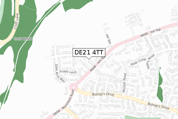
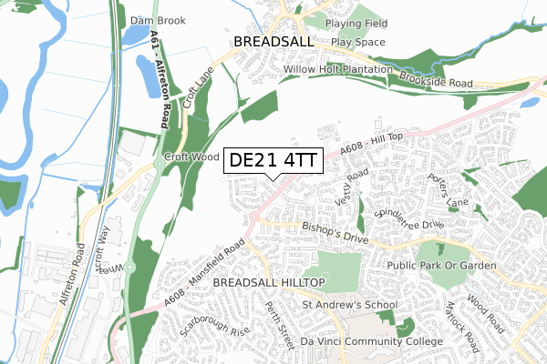
DE21 4TT maps


Licence: Open Government Licence (requires attribution)
Attribution: Contains OS data © Crown copyright and database right 2025
Source: Open Postcode Geo
Licence: Open Government Licence (requires attribution)
Attribution: Contains OS data © Crown copyright and database right 2025; Contains Royal Mail data © Royal Mail copyright and database right 2025; Source: Office for National Statistics licensed under the Open Government Licence v.3.0
DE21 4TT geodata
| Easting | 436933 |
| Northing | 339037 |
| Latitude | 52.947471 |
| Longitude | -1.451792 |
Where is DE21 4TT?
| Country | England |
| Postcode District | DE21 |
Politics
| Ward | Oakwood |
|---|---|
| Constituency | Mid Derbyshire |
House Prices
Sales of detached houses in DE21 4TT
2023 10 MAR £367,500 |
2021 27 AUG £330,000 |
2021 29 JUN £305,000 |
2020 19 JUN £284,000 |
6, WINDMILL PLACE, DERBY, DE21 4TT 2018 13 JUL £275,000 |
8, WINDMILL PLACE, DERBY, DE21 4TT 2018 16 APR £270,000 |
4, WINDMILL PLACE, DERBY, DE21 4TT 2018 13 APR £270,000 |
2018 20 MAR £280,000 |
2018 2 MAR £280,000 |
2, WINDMILL PLACE, DERBY, DE21 4TT 2018 16 FEB £265,000 |
Licence: Contains HM Land Registry data © Crown copyright and database right 2025. This data is licensed under the Open Government Licence v3.0.
Transport
Nearest bus stops to DE21 4TT
| Windmill Garage (Hill Top) | Oakwood | 57m |
| Windmill Garage (Hill Top) | Oakwood | 74m |
| Lychgate Close (Bishops Drive) | Oakwood | 188m |
| Lychgate Close (Bishops Drive) | Oakwood | 196m |
| Stratford Road (Mansfield Road) | Breadsall Hilltop | 280m |
Nearest railway stations to DE21 4TT
| Derby Station | 3.5km |
| Spondon Station | 4.8km |
| Duffield Station | 5.1km |
Broadband
Broadband access in DE21 4TT (2020 data)
| Percentage of properties with Next Generation Access | 100.0% |
| Percentage of properties with Superfast Broadband | 100.0% |
| Percentage of properties with Ultrafast Broadband | 0.0% |
| Percentage of properties with Full Fibre Broadband | 0.0% |
Superfast Broadband is between 30Mbps and 300Mbps
Ultrafast Broadband is > 300Mbps
Broadband speed in DE21 4TT (2019 data)
Download
| Median download speed | 40.0Mbps |
| Average download speed | 45.0Mbps |
| Maximum download speed | 60.94Mbps |
Upload
| Median upload speed | 9.9Mbps |
| Average upload speed | 10.0Mbps |
| Maximum upload speed | 12.76Mbps |
Broadband limitations in DE21 4TT (2020 data)
| Percentage of properties unable to receive 2Mbps | 0.0% |
| Percentage of properties unable to receive 5Mbps | 0.0% |
| Percentage of properties unable to receive 10Mbps | 0.0% |
| Percentage of properties unable to receive 30Mbps | 0.0% |
Deprivation
20.5% of English postcodes are less deprived than DE21 4TT:Food Standards Agency
Three nearest food hygiene ratings to DE21 4TT (metres)


➜ Get more ratings from the Food Standards Agency
Nearest post box to DE21 4TT
| Last Collection | |||
|---|---|---|---|
| Location | Mon-Fri | Sat | Distance |
| Spindletree Drive | 17:30 | 11:30 | 475m |
| Scarborough Rise Post Office | 17:30 | 11:30 | 487m |
| Elmwood Drive | 17:30 | 11:00 | 560m |
DE21 4TT ITL and DE21 4TT LAU
The below table lists the International Territorial Level (ITL) codes (formerly Nomenclature of Territorial Units for Statistics (NUTS) codes) and Local Administrative Units (LAU) codes for DE21 4TT:
| ITL 1 Code | Name |
|---|---|
| TLF | East Midlands (England) |
| ITL 2 Code | Name |
| TLF1 | Derbyshire and Nottinghamshire |
| ITL 3 Code | Name |
| TLF11 | Derby |
| LAU 1 Code | Name |
| E06000015 | Derby |
DE21 4TT census areas
The below table lists the Census Output Area (OA), Lower Layer Super Output Area (LSOA), and Middle Layer Super Output Area (MSOA) for DE21 4TT:
| Code | Name | |
|---|---|---|
| OA | E00068552 | |
| LSOA | E01013575 | Derby 003B |
| MSOA | E02002798 | Derby 003 |
Nearest postcodes to DE21 4TT
| DE21 4FW | Hilltop | 116m |
| DE21 2BG | Chapter Close | 140m |
| DE21 4FX | Hilltop | 181m |
| DE21 2BQ | Abbot Close | 182m |
| DE21 2BH | Minster Road | 220m |
| DE21 2DA | Lychgate Close | 239m |
| DE21 2BS | Alder Close | 259m |
| DE21 2DB | Corbel Close | 286m |
| DE21 2BL | Vestry Road | 294m |
| DE21 2BJ | Deacon Close | 297m |