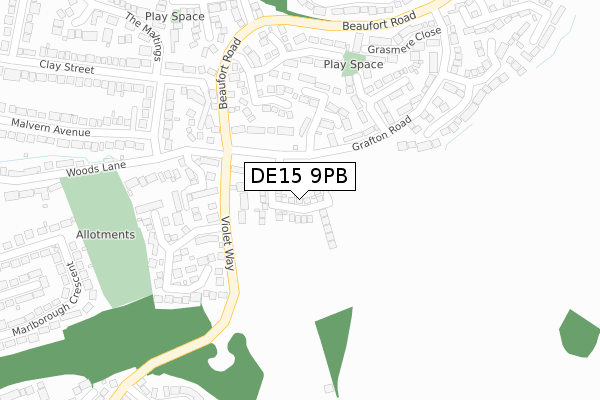
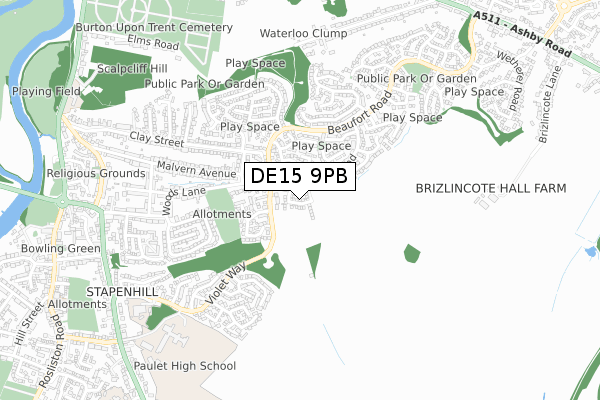
DE15 9PB is located in the Brizlincote electoral ward, within the local authority district of East Staffordshire and the English Parliamentary constituency of Burton. The Sub Integrated Care Board (ICB) Location is NHS Staffordshire and Stoke-on-Trent ICB - 05D and the police force is Staffordshire. This postcode has been in use since September 2019.


GetTheData
Source: OS Open Zoomstack (Ordnance Survey)
Licence: Open Government Licence (requires attribution)
Attribution: Contains OS data © Crown copyright and database right 2024
Source: Open Postcode Geo
Licence: Open Government Licence (requires attribution)
Attribution: Contains OS data © Crown copyright and database right 2024; Contains Royal Mail data © Royal Mail copyright and database right 2024; Source: Office for National Statistics licensed under the Open Government Licence v.3.0
| Easting | 426536 |
| Northing | 322028 |
| Latitude | 52.795187 |
| Longitude | -1.607898 |
GetTheData
Source: Open Postcode Geo
Licence: Open Government Licence
| Country | England |
| Postcode District | DE15 |
| ➜ DE15 open data dashboard ➜ See where DE15 is on a map ➜ Where is Burton upon Trent? | |
GetTheData
Source: Land Registry Price Paid Data
Licence: Open Government Licence
| Ward | Brizlincote |
| Constituency | Burton |
GetTheData
Source: ONS Postcode Database
Licence: Open Government Licence
2, CLAYMILLS CLOSE, BURTON-ON-TRENT, DE15 9PB 2020 9 OCT £285,000 |
7, CLAYMILLS CLOSE, BURTON-ON-TRENT, DE15 9PB 2020 20 AUG £310,000 |
6, CLAYMILLS CLOSE, BURTON-ON-TRENT, DE15 9PB 2020 7 AUG £370,000 |
11, CLAYMILLS CLOSE, BURTON-ON-TRENT, DE15 9PB 2020 19 JUN £285,000 |
17, CLAYMILLS CLOSE, BURTON-ON-TRENT, DE15 9PB 2020 22 MAY £285,000 |
14, CLAYMILLS CLOSE, BURTON-ON-TRENT, DE15 9PB 2020 27 MAR £420,000 |
12, CLAYMILLS CLOSE, BURTON-ON-TRENT, DE15 9PB 2020 20 MAR £420,000 |
8, CLAYMILLS CLOSE, BURTON-ON-TRENT, DE15 9PB 2020 28 FEB £370,000 |
15, CLAYMILLS CLOSE, BURTON-ON-TRENT, DE15 9PB 2020 27 FEB £285,000 |
10, CLAYMILLS CLOSE, BURTON-ON-TRENT, DE15 9PB 2019 20 DEC £370,000 |
➜ Burton upon Trent house prices
GetTheData
Source: HM Land Registry Price Paid Data
Licence: Contains HM Land Registry data © Crown copyright and database right 2024. This data is licensed under the Open Government Licence v3.0.
| March 2023 | Violence and sexual offences | On or near Redwood Drive | 217m |
| March 2023 | Violence and sexual offences | On or near Redwood Drive | 217m |
| January 2023 | Violence and sexual offences | On or near Violet Way | 451m |
| ➜ Get more crime data in our Crime section | |||
GetTheData
Source: data.police.uk
Licence: Open Government Licence
| 14 Springfield Villas (Grafton Rd) | Brizlincote | 102m |
| 14 Springfield Villas (Grafton Rd) | Brizlincote | 103m |
| Sefton Close (Grafton Rd) | Brizlincote | 103m |
| Sefton Close (Grafton Rd) | Brizlincote | 104m |
| Winchcombe Drive (Grafton Rd) | Brizlincote | 279m |
| Burton-on-Trent Station | 2.6km |
GetTheData
Source: NaPTAN
Licence: Open Government Licence
GetTheData
Source: ONS Postcode Database
Licence: Open Government Licence


➜ Get more ratings from the Food Standards Agency
GetTheData
Source: Food Standards Agency
Licence: FSA terms & conditions
| Last Collection | |||
|---|---|---|---|
| Location | Mon-Fri | Sat | Distance |
| Grafton Road | 16:00 | 12:30 | 220m |
| Merridale Road | 16:00 | 10:45 | 429m |
| Violet Way | 16:00 | 12:30 | 527m |
GetTheData
Source: Dracos
Licence: Creative Commons Attribution-ShareAlike
| Facility | Distance |
|---|---|
| Paulet High School Violet Way, Burton-on-trent Sports Hall, Grass Pitches | 804m |
| Burton Tennis & Squash Club Ashby Road, Burton-on-trent Indoor Tennis Centre, Squash Courts, Outdoor Tennis Courts | 913m |
| Blessed Robert Sutton Catholic Voluntary Academy Blue Stone Lane, Burton-on-trent Artificial Grass Pitch, Sports Hall, Grass Pitches | 1.1km |
GetTheData
Source: Active Places
Licence: Open Government Licence
| School | Phase of Education | Distance |
|---|---|---|
| Paulet High School Violet Way, Stapenhill, Burton-on-Trent, DE15 9RT | Secondary | 771m |
| The Violet Way Academy Violet Way, Stapenhill, Burton-on-Trent, DE15 9ES | Primary | 822m |
| Blessed Robert Sutton Catholic Voluntary Academy Bluestone Lane, Stapenhill, Burton-on-Trent, DE15 9SD | Secondary | 1.1km |
GetTheData
Source: Edubase
Licence: Open Government Licence
The below table lists the International Territorial Level (ITL) codes (formerly Nomenclature of Territorial Units for Statistics (NUTS) codes) and Local Administrative Units (LAU) codes for DE15 9PB:
| ITL 1 Code | Name |
|---|---|
| TLG | West Midlands (England) |
| ITL 2 Code | Name |
| TLG2 | Shropshire and Staffordshire |
| ITL 3 Code | Name |
| TLG24 | Staffordshire CC |
| LAU 1 Code | Name |
| E07000193 | East Staffordshire |
GetTheData
Source: ONS Postcode Directory
Licence: Open Government Licence
The below table lists the Census Output Area (OA), Lower Layer Super Output Area (LSOA), and Middle Layer Super Output Area (MSOA) for DE15 9PB:
| Code | Name | |
|---|---|---|
| OA | E00149885 | |
| LSOA | E01029419 | East Staffordshire 012B |
| MSOA | E02006142 | East Staffordshire 012 |
GetTheData
Source: ONS Postcode Directory
Licence: Open Government Licence
| DE15 9BZ | Woods Lane | 75m |
| DE15 9JZ | Buttercup Close | 106m |
| DE15 9BX | Springfield Villas | 112m |
| DE15 9DN | Grafton Road | 121m |
| DE15 9BU | Sefton Close | 162m |
| DE15 9BT | Quorn Close | 196m |
| DE15 9DP | Meynell Close | 206m |
| DE15 9BY | Woods Close | 217m |
| DE15 9HL | Redwood Drive | 223m |
| DE15 9BS | Cottesmore Close | 231m |
GetTheData
Source: Open Postcode Geo; Land Registry Price Paid Data
Licence: Open Government Licence