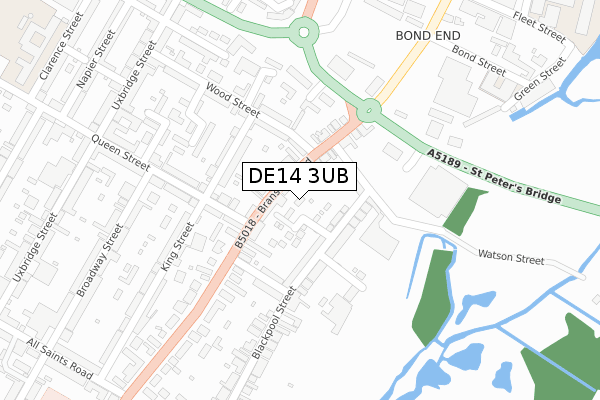
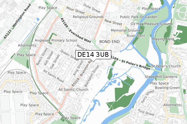
DE14 3UB is located in the Anglesey electoral ward, within the local authority district of East Staffordshire and the English Parliamentary constituency of Burton. The Sub Integrated Care Board (ICB) Location is NHS Staffordshire and Stoke-on-Trent ICB - 05D and the police force is Staffordshire. This postcode has been in use since July 2018.


GetTheData
Source: OS Open Zoomstack (Ordnance Survey)
Licence: Open Government Licence (requires attribution)
Attribution: Contains OS data © Crown copyright and database right 2025
Source: Open Postcode Geo
Licence: Open Government Licence (requires attribution)
Attribution: Contains OS data © Crown copyright and database right 2025; Contains Royal Mail data © Royal Mail copyright and database right 2025; Source: Office for National Statistics licensed under the Open Government Licence v.3.0
| Easting | 424537 |
| Northing | 322172 |
| Latitude | 52.796575 |
| Longitude | -1.637532 |
GetTheData
Source: Open Postcode Geo
Licence: Open Government Licence
| Country | England |
| Postcode District | DE14 |
➜ See where DE14 is on a map ➜ Where is Burton upon Trent? | |
GetTheData
Source: Land Registry Price Paid Data
Licence: Open Government Licence
| Ward | Anglesey |
| Constituency | Burton |
GetTheData
Source: ONS Postcode Database
Licence: Open Government Licence
2, JERRISONS PLACE, BURTON-ON-TRENT, DE14 3UB 2016 31 AUG £250,000 |
➜ Burton upon Trent house prices
GetTheData
Source: HM Land Registry Price Paid Data
Licence: Contains HM Land Registry data © Crown copyright and database right 2025. This data is licensed under the Open Government Licence v3.0.
| Watson Street (Branston Rd) | Burton Upon Trent | 95m |
| Watson Street (Branston Rd) | Burton Upon Trent | 121m |
| Trent Street (Branston Rd) | Burton Upon Trent | 173m |
| Trent Street (Branston Rd) | Burton Upon Trent | 208m |
| Bond Street (Lichfield Street) | Burton Upon Trent | 277m |
| Burton-on-Trent Station | 1.1km |
GetTheData
Source: NaPTAN
Licence: Open Government Licence
| Percentage of properties with Next Generation Access | 100.0% |
| Percentage of properties with Superfast Broadband | 100.0% |
| Percentage of properties with Ultrafast Broadband | 0.0% |
| Percentage of properties with Full Fibre Broadband | 0.0% |
Superfast Broadband is between 30Mbps and 300Mbps
Ultrafast Broadband is > 300Mbps
| Percentage of properties unable to receive 2Mbps | 0.0% |
| Percentage of properties unable to receive 5Mbps | 0.0% |
| Percentage of properties unable to receive 10Mbps | 0.0% |
| Percentage of properties unable to receive 30Mbps | 0.0% |
GetTheData
Source: Ofcom
Licence: Ofcom Terms of Use (requires attribution)
GetTheData
Source: ONS Postcode Database
Licence: Open Government Licence


➜ Get more ratings from the Food Standards Agency
GetTheData
Source: Food Standards Agency
Licence: FSA terms & conditions
| Last Collection | |||
|---|---|---|---|
| Location | Mon-Fri | Sat | Distance |
| Queen Street | 17:30 | 11:00 | 92m |
| Tesco Bot | 17:30 | 11:45 | 299m |
| Sheffield Strret | 17:30 | 11:00 | 373m |
GetTheData
Source: Dracos
Licence: Creative Commons Attribution-ShareAlike
| Risk of DE14 3UB flooding from rivers and sea | Low |
| ➜ DE14 3UB flood map | |
GetTheData
Source: Open Flood Risk by Postcode
Licence: Open Government Licence
The below table lists the International Territorial Level (ITL) codes (formerly Nomenclature of Territorial Units for Statistics (NUTS) codes) and Local Administrative Units (LAU) codes for DE14 3UB:
| ITL 1 Code | Name |
|---|---|
| TLG | West Midlands (England) |
| ITL 2 Code | Name |
| TLG2 | Shropshire and Staffordshire |
| ITL 3 Code | Name |
| TLG24 | Staffordshire CC |
| LAU 1 Code | Name |
| E07000193 | East Staffordshire |
GetTheData
Source: ONS Postcode Directory
Licence: Open Government Licence
The below table lists the Census Output Area (OA), Lower Layer Super Output Area (LSOA), and Middle Layer Super Output Area (MSOA) for DE14 3UB:
| Code | Name | |
|---|---|---|
| OA | E00149841 | |
| LSOA | E01029409 | East Staffordshire 011C |
| MSOA | E02006141 | East Staffordshire 011 |
GetTheData
Source: ONS Postcode Directory
Licence: Open Government Licence
| DE14 3BS | Branston Road | 29m |
| DE14 3AQ | Rose Cottage Gardens | 46m |
| DE14 3AS | Rose Cottage Close | 56m |
| DE14 3AL | Blackpool Street | 95m |
| DE14 3AH | Watson Street | 99m |
| DE14 3AW | Blackpool Street | 113m |
| DE14 3BP | Branston Road | 141m |
| DE14 3AA | Wood Street | 147m |
| DE14 3AE | King Street | 150m |
| DE14 3AP | Trent Street | 158m |
GetTheData
Source: Open Postcode Geo; Land Registry Price Paid Data
Licence: Open Government Licence