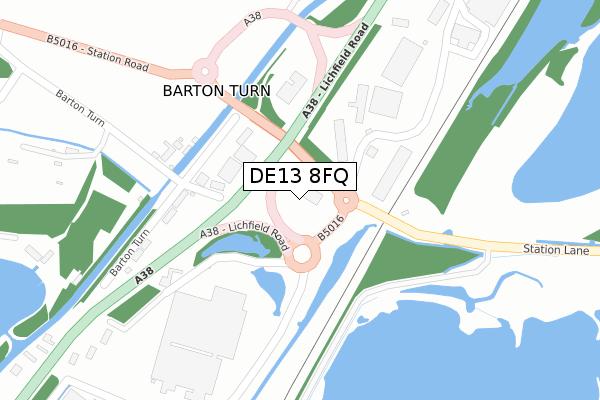
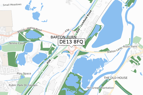
DE13 8FQ is located in the Bagots & Needwood electoral ward, within the local authority district of East Staffordshire and the English Parliamentary constituency of Lichfield. The Sub Integrated Care Board (ICB) Location is NHS Staffordshire and Stoke-on-Trent ICB - 05D and the police force is Staffordshire. This postcode has been in use since April 2019.


GetTheData
Source: OS Open Zoomstack (Ordnance Survey)
Licence: Open Government Licence (requires attribution)
Attribution: Contains OS data © Crown copyright and database right 2024
Source: Open Postcode Geo
Licence: Open Government Licence (requires attribution)
Attribution: Contains OS data © Crown copyright and database right 2024; Contains Royal Mail data © Royal Mail copyright and database right 2024; Source: Office for National Statistics licensed under the Open Government Licence v.3.0
| Easting | 420377 |
| Northing | 318222 |
| Latitude | 52.761239 |
| Longitude | -1.699471 |
GetTheData
Source: Open Postcode Geo
Licence: Open Government Licence
| Country | England |
| Postcode District | DE13 |
| ➜ DE13 open data dashboard ➜ See where DE13 is on a map ➜ Where is Barton Turn? | |
GetTheData
Source: Land Registry Price Paid Data
Licence: Open Government Licence
| Ward | Bagots & Needwood |
| Constituency | Lichfield |
GetTheData
Source: ONS Postcode Database
Licence: Open Government Licence
| June 2022 | Anti-social behaviour | On or near Lichfield Road | 205m |
| May 2022 | Violence and sexual offences | On or near Barton Turn | 307m |
| April 2022 | Violence and sexual offences | On or near Lichfield Road | 205m |
| ➜ Get more crime data in our Crime section | |||
GetTheData
Source: data.police.uk
Licence: Open Government Licence
| Greycar Business Park (Station Road) | Barton Under Needwood | 74m |
| Lichfield Road (Station Road) | Barton Under Needwood | 340m |
| Barton Turn (Station Road) | Barton Under Needwood | 672m |
| Barton Turn (Station Road) | Barton Under Needwood | 676m |
| Bartonfields Garden Centre (Lichfield Road) | Barton Under Needwood | 936m |
| Burton-on-Trent Station | 6.3km |
GetTheData
Source: NaPTAN
Licence: Open Government Licence
GetTheData
Source: ONS Postcode Database
Licence: Open Government Licence


➜ Get more ratings from the Food Standards Agency
GetTheData
Source: Food Standards Agency
Licence: FSA terms & conditions
| Last Collection | |||
|---|---|---|---|
| Location | Mon-Fri | Sat | Distance |
| Barton Turn | 16:00 | 07:30 | 202m |
| Riverside | 16:00 | 12:15 | 1,118m |
| Station Road (Barton) | 16:00 | 09:45 | 1,274m |
GetTheData
Source: Dracos
Licence: Creative Commons Attribution-ShareAlike
| Facility | Distance |
|---|---|
| Holland Sports Club Potters Way, Barton Under Needwood, Burton-on-trent Grass Pitches, Outdoor Tennis Courts | 1km |
| Walton Cricket Club Station Lane, Walton On Trent, Swadlincote Grass Pitches | 1.1km |
| Barton Aquadome (Thomas Russell Junior School) Gilmour Lane, Barton Under Needwood, Burton-on-trent Swimming Pool | 1.1km |
GetTheData
Source: Active Places
Licence: Open Government Licence
| School | Phase of Education | Distance |
|---|---|---|
| Thomas Russell Infants School Station Road, Barton-Under-Needwood, Burton-on-Trent, DE13 8DS | Primary | 1.1km |
| Thomas Russell Junior School Gilmour Lane, Barton-Under-Needwood, Burton-on-Trent, DE13 8EU | Primary | 1.2km |
| Walton On Trent CofE Primary and Nursery School Coton Road, Walton-on-Trent, Swadlincote, DE12 8NL | Primary | 1.4km |
GetTheData
Source: Edubase
Licence: Open Government Licence
The below table lists the International Territorial Level (ITL) codes (formerly Nomenclature of Territorial Units for Statistics (NUTS) codes) and Local Administrative Units (LAU) codes for DE13 8FQ:
| ITL 1 Code | Name |
|---|---|
| TLG | West Midlands (England) |
| ITL 2 Code | Name |
| TLG2 | Shropshire and Staffordshire |
| ITL 3 Code | Name |
| TLG24 | Staffordshire CC |
| LAU 1 Code | Name |
| E07000193 | East Staffordshire |
GetTheData
Source: ONS Postcode Directory
Licence: Open Government Licence
The below table lists the Census Output Area (OA), Lower Layer Super Output Area (LSOA), and Middle Layer Super Output Area (MSOA) for DE13 8FQ:
| Code | Name | |
|---|---|---|
| OA | E00149993 | |
| LSOA | E01029441 | East Staffordshire 015C |
| MSOA | E02006145 | East Staffordshire 015 |
GetTheData
Source: ONS Postcode Directory
Licence: Open Government Licence
| DE13 8EA | Barton Turn | 223m |
| DE13 8DZ | Wharf Houses | 239m |
| DE13 8EH | Lichfield Road | 479m |
| DE13 8AS | Barton Turn | 655m |
| DE13 8DS | Station Road | 1043m |
| DE12 8NP | Riverside | 1114m |
| DE13 8FD | Causer Road | 1135m |
| DE13 8FB | Causer Road | 1146m |
| DE12 8NA | Station Lane | 1146m |
| DE13 8FE | Sutton Crescent | 1154m |
GetTheData
Source: Open Postcode Geo; Land Registry Price Paid Data
Licence: Open Government Licence