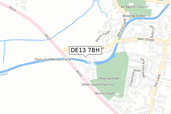
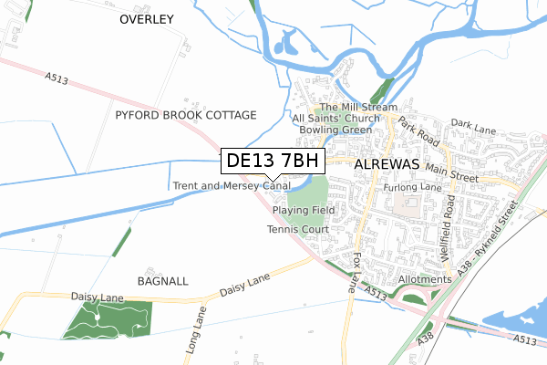
DE13 7BH is located in the Alrewas & Fradley electoral ward, within the local authority district of Lichfield and the English Parliamentary constituency of Lichfield. The Sub Integrated Care Board (ICB) Location is NHS Staffordshire and Stoke-on-Trent ICB - 05D and the police force is Staffordshire. This postcode has been in use since November 2018.


GetTheData
Source: OS Open Zoomstack (Ordnance Survey)
Licence: Open Government Licence (requires attribution)
Attribution: Contains OS data © Crown copyright and database right 2024
Source: Open Postcode Geo
Licence: Open Government Licence (requires attribution)
Attribution: Contains OS data © Crown copyright and database right 2024; Contains Royal Mail data © Royal Mail copyright and database right 2024; Source: Office for National Statistics licensed under the Open Government Licence v.3.0
| Easting | 416502 |
| Northing | 314957 |
| Latitude | 52.732020 |
| Longitude | -1.757056 |
GetTheData
Source: Open Postcode Geo
Licence: Open Government Licence
| Country | England |
| Postcode District | DE13 |
| ➜ DE13 open data dashboard ➜ See where DE13 is on a map ➜ Where is Alrewas? | |
GetTheData
Source: Land Registry Price Paid Data
Licence: Open Government Licence
| Ward | Alrewas & Fradley |
| Constituency | Lichfield |
GetTheData
Source: ONS Postcode Database
Licence: Open Government Licence
| June 2023 | Public order | On or near Mill End Lane | 350m |
| June 2023 | Violence and sexual offences | On or near Mill End Lane | 350m |
| June 2023 | Possession of weapons | On or near Mill End Lane | 350m |
| ➜ Get more crime data in our Crime section | |||
GetTheData
Source: data.police.uk
Licence: Open Government Licence
| Churchill Crescent (Fox Lane) | Alrewas | 448m |
| George & Dragon Ph (Main St) | Alrewas | 515m |
| George & Dragon Ph (Main St) | Alrewas | 554m |
| Exchange Road (Main St) | Alrewas | 834m |
| Exchange Road (Main St) | Alrewas | 877m |
GetTheData
Source: NaPTAN
Licence: Open Government Licence
| Percentage of properties with Next Generation Access | 100.0% |
| Percentage of properties with Superfast Broadband | 100.0% |
| Percentage of properties with Ultrafast Broadband | 0.0% |
| Percentage of properties with Full Fibre Broadband | 0.0% |
Superfast Broadband is between 30Mbps and 300Mbps
Ultrafast Broadband is > 300Mbps
| Percentage of properties unable to receive 2Mbps | 0.0% |
| Percentage of properties unable to receive 5Mbps | 0.0% |
| Percentage of properties unable to receive 10Mbps | 0.0% |
| Percentage of properties unable to receive 30Mbps | 0.0% |
GetTheData
Source: Ofcom
Licence: Ofcom Terms of Use (requires attribution)
GetTheData
Source: ONS Postcode Database
Licence: Open Government Licence


➜ Get more ratings from the Food Standards Agency
GetTheData
Source: Food Standards Agency
Licence: FSA terms & conditions
| Last Collection | |||
|---|---|---|---|
| Location | Mon-Fri | Sat | Distance |
| Alrewas So | 16:00 | 10:30 | 520m |
| Alrewas | 16:00 | 08:00 | 557m |
| Park Road | 16:00 | 09:00 | 808m |
GetTheData
Source: Dracos
Licence: Creative Commons Attribution-ShareAlike
| Facility | Distance |
|---|---|
| Walk Field Daisy Lane, Alrewas, Burton Upon Trent Grass Pitches, Outdoor Tennis Courts | 286m |
| All Saints C Of E (C) Primary School Furlong Close, Alrewas, Burton-on-trent Grass Pitches | 643m |
| Long Lane (Closed) Long Lane, Fradley, Lichfield Grass Pitches | 1.3km |
GetTheData
Source: Active Places
Licence: Open Government Licence
| School | Phase of Education | Distance |
|---|---|---|
| All Saints Church of England Primary and Nursery School Furlong Close, Alrewas, Burton-on-Trent, DE13 7EF | Primary | 652m |
| St Stephen's Primary School Church Lane, Fradley, Lichfield, WS13 8NL | Primary | 1.7km |
| Fradley Park Primary and Nursery School Murphy Street, Fradley, Lichfield, WS13 8TW | Primary | 2.6km |
GetTheData
Source: Edubase
Licence: Open Government Licence
The below table lists the International Territorial Level (ITL) codes (formerly Nomenclature of Territorial Units for Statistics (NUTS) codes) and Local Administrative Units (LAU) codes for DE13 7BH:
| ITL 1 Code | Name |
|---|---|
| TLG | West Midlands (England) |
| ITL 2 Code | Name |
| TLG2 | Shropshire and Staffordshire |
| ITL 3 Code | Name |
| TLG24 | Staffordshire CC |
| LAU 1 Code | Name |
| E07000194 | Lichfield |
GetTheData
Source: ONS Postcode Directory
Licence: Open Government Licence
The below table lists the Census Output Area (OA), Lower Layer Super Output Area (LSOA), and Middle Layer Super Output Area (MSOA) for DE13 7BH:
| Code | Name | |
|---|---|---|
| OA | E00150187 | |
| LSOA | E01029477 | Lichfield 002A |
| MSOA | E02006147 | Lichfield 002 |
GetTheData
Source: ONS Postcode Directory
Licence: Open Government Licence
| DE13 7DB | Kings Bromley Road | 101m |
| DE13 7DA | Manor Fields | 192m |
| DE13 7EL | Chaseview Road | 281m |
| DE13 7BX | Mill End Lane | 311m |
| DE13 7DJ | The Cricketers | 322m |
| DE13 7EN | Walkfield Road | 329m |
| DE13 7EH | Churchill Crescent | 345m |
| DE13 7ED | Main Street | 355m |
| DE13 7DT | Mays Walk | 359m |
| DE13 7FG | Broomhalls Croft | 394m |
GetTheData
Source: Open Postcode Geo; Land Registry Price Paid Data
Licence: Open Government Licence