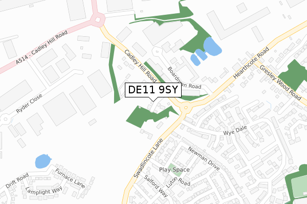
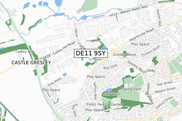
DE11 9SY is located in the Church Gresley electoral ward, within the local authority district of South Derbyshire and the English Parliamentary constituency of South Derbyshire. The Sub Integrated Care Board (ICB) Location is NHS Derby and Derbyshire ICB - 15M and the police force is Derbyshire. This postcode has been in use since December 2019.


GetTheData
Source: OS Open Zoomstack (Ordnance Survey)
Licence: Open Government Licence (requires attribution)
Attribution: Contains OS data © Crown copyright and database right 2024
Source: Open Postcode Geo
Licence: Open Government Licence (requires attribution)
Attribution: Contains OS data © Crown copyright and database right 2024; Contains Royal Mail data © Royal Mail copyright and database right 2024; Source: Office for National Statistics licensed under the Open Government Licence v.3.0
| Easting | 428381 |
| Northing | 318920 |
| Latitude | 52.767154 |
| Longitude | -1.580804 |
GetTheData
Source: Open Postcode Geo
Licence: Open Government Licence
| Country | England |
| Postcode District | DE11 |
| ➜ DE11 open data dashboard ➜ See where DE11 is on a map ➜ Where is Swadlincote? | |
GetTheData
Source: Land Registry Price Paid Data
Licence: Open Government Licence
| Ward | Church Gresley |
| Constituency | South Derbyshire |
GetTheData
Source: ONS Postcode Database
Licence: Open Government Licence
3, WOODLANDS CLOSE, SWADLINCOTE, DE11 9SY 2020 30 JUN £290,000 |
1, WOODLANDS CLOSE, SWADLINCOTE, DE11 9SY 2020 18 FEB £360,000 |
2, WOODLANDS CLOSE, SWADLINCOTE, DE11 9SY 2020 13 JAN £330,000 |
4, WOODLANDS CLOSE, SWADLINCOTE, DE11 9SY 2019 25 NOV £310,000 |
8, WOODLANDS CLOSE, SWADLINCOTE, DE11 9SY 2018 17 JUL £355,000 |
GetTheData
Source: HM Land Registry Price Paid Data
Licence: Contains HM Land Registry data © Crown copyright and database right 2024. This data is licensed under the Open Government Licence v3.0.
| November 2023 | Anti-social behaviour | On or near Salford Way | 441m |
| August 2023 | Criminal damage and arson | On or near Salford Way | 441m |
| July 2023 | Anti-social behaviour | On or near Salford Way | 441m |
| ➜ Get more crime data in our Crime section | |||
GetTheData
Source: data.police.uk
Licence: Open Government Licence
| Newman Drive (Swadlincote Lane) | Church Gresley | 112m |
| Newman Drive (Swadlincote Lane) | Church Gresley | 115m |
| Boardman Industrial Estate (Cadley Hill Road) | Swadlincote | 143m |
| Boardman Industrial Estate (Cadley Hill Road) | Swadlincote | 214m |
| Salford Way (Swadlincote Lane) | Church Gresley | 249m |
| Burton-on-Trent Station | 6km |
GetTheData
Source: NaPTAN
Licence: Open Government Licence
GetTheData
Source: ONS Postcode Database
Licence: Open Government Licence

➜ Get more ratings from the Food Standards Agency
GetTheData
Source: Food Standards Agency
Licence: FSA terms & conditions
| Last Collection | |||
|---|---|---|---|
| Location | Mon-Fri | Sat | Distance |
| Wye Dale | 16:00 | 11:00 | 114m |
| Chiltern Road | 16:00 | 11:00 | 603m |
| Appleby Glade | 16:00 | 10:45 | 689m |
GetTheData
Source: Dracos
Licence: Creative Commons Attribution-ShareAlike
| Facility | Distance |
|---|---|
| Gresley Old Hall Gresley Wood Road, Church Gresley, Swadlincote Indoor Bowls, Grass Pitches | 643m |
| Evisa Fitness Astron Business Park, Hearthcote Road, Swadlincote Health and Fitness Gym, Studio | 837m |
| Pennine Way Junior Academy Pennine Way, Swadlincote Grass Pitches | 1km |
GetTheData
Source: Active Places
Licence: Open Government Licence
| School | Phase of Education | Distance |
|---|---|---|
| Pennine Way Junior Academy Pennine Way, Swadlincote, DE11 9EY | Primary | 1km |
| Church Gresley Infant and Nursery School Pennine Way, Church Gresley, Swadlincote, DE11 9EY | Primary | 1km |
| Fairmeadows Foundation Primary School Fairfield Crescent, Newhall, Swadlincote, DE11 0SW | Primary | 1.3km |
GetTheData
Source: Edubase
Licence: Open Government Licence
The below table lists the International Territorial Level (ITL) codes (formerly Nomenclature of Territorial Units for Statistics (NUTS) codes) and Local Administrative Units (LAU) codes for DE11 9SY:
| ITL 1 Code | Name |
|---|---|
| TLF | East Midlands (England) |
| ITL 2 Code | Name |
| TLF1 | Derbyshire and Nottinghamshire |
| ITL 3 Code | Name |
| TLF13 | South and West Derbyshire |
| LAU 1 Code | Name |
| E07000039 | South Derbyshire |
GetTheData
Source: ONS Postcode Directory
Licence: Open Government Licence
The below table lists the Census Output Area (OA), Lower Layer Super Output Area (LSOA), and Middle Layer Super Output Area (MSOA) for DE11 9SY:
| Code | Name | |
|---|---|---|
| OA | E00174587 | |
| LSOA | E01033531 | South Derbyshire 012C |
| MSOA | E02006919 | South Derbyshire 012 |
GetTheData
Source: ONS Postcode Directory
Licence: Open Government Licence
| DE11 9DL | Boardman Road | 130m |
| DE11 9EQ | Cadley Hill Road | 174m |
| DE11 9RY | Napier Close | 191m |
| DE11 9RW | Westacre Drive | 205m |
| DE11 9SS | Kent Way | 229m |
| DE11 9RR | Beresford Dale | 232m |
| DE11 9RZ | Newman Drive | 237m |
| DE11 9RJ | Salford Way | 278m |
| DE11 9TF | Luton Road | 281m |
| DE11 9TH | Portsmouth Close | 305m |
GetTheData
Source: Open Postcode Geo; Land Registry Price Paid Data
Licence: Open Government Licence