Property/Postcode Data Search:
DA18 4AX maps, stats, and open data
DA18 4AX is located in the Thamesmead East electoral ward, within the London borough of Bexley and the English Parliamentary constituency of Erith and Thamesmead. The Sub Integrated Care Board (ICB) Location is NHS South East London ICB - 72Q and the police force is Metropolitan Police. This postcode has been in use since August 2017.
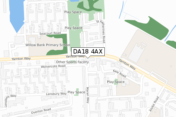
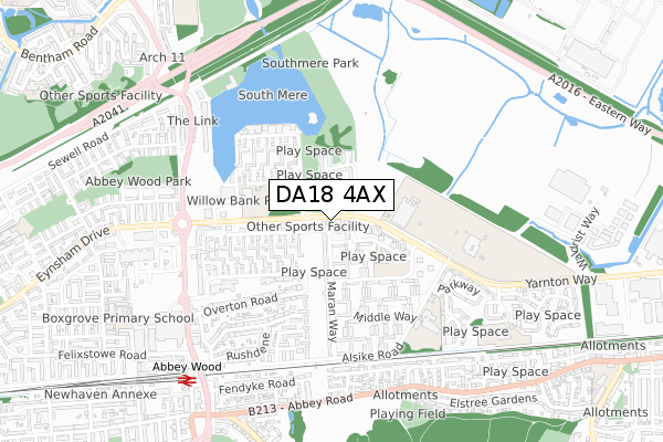
DA18 4AX maps


Source: OS Open Zoomstack (Ordnance Survey)
Licence: Open Government Licence (requires attribution)
Attribution: Contains OS data © Crown copyright and database right 2025
Source: Open Postcode Geo
Licence: Open Government Licence (requires attribution)
Attribution: Contains OS data © Crown copyright and database right 2025; Contains Royal Mail data © Royal Mail copyright and database right 2025; Source: Office for National Statistics licensed under the Open Government Licence v.3.0
Licence: Open Government Licence (requires attribution)
Attribution: Contains OS data © Crown copyright and database right 2025
Source: Open Postcode Geo
Licence: Open Government Licence (requires attribution)
Attribution: Contains OS data © Crown copyright and database right 2025; Contains Royal Mail data © Royal Mail copyright and database right 2025; Source: Office for National Statistics licensed under the Open Government Licence v.3.0
DA18 4AX geodata
| Easting | 547898 |
| Northing | 179625 |
| Latitude | 51.496226 |
| Longitude | 0.129211 |
Where is DA18 4AX?
| Country | England |
| Postcode District | DA18 |
Politics
| Ward | Thamesmead East |
|---|---|
| Constituency | Erith And Thamesmead |
Transport
Nearest bus stops to DA18 4AX
| Limestone Walk (Yarnton Way) | Thamesmead South | 30m |
| Limestone Walk (Yarnton Way) | Thamesmead South | 42m |
| Hartslock Drive (Yarnton Way) | Thamesmead South | 101m |
| The Business Academy | Thamesmead South | 288m |
| The Business Academy | Thamesmead South | 333m |
Nearest railway stations to DA18 4AX
| Abbey Wood (London) Station | 0.8km |
| Belvedere Station | 1.7km |
| Plumstead Station | 3.2km |
Deprivation
64.7% of English postcodes are less deprived than DA18 4AX:Food Standards Agency
Three nearest food hygiene ratings to DA18 4AX (metres)
Yarnton Way Stores

202 - 206 Yarnton Way
7m
Omo's Market

210 Yarnton Way
11m
Young Foundations Pre-School At Emmanuel Baptist Church

Yarnton Way
87m
➜ Get more ratings from the Food Standards Agency
Nearest post box to DA18 4AX
| Last Collection | |||
|---|---|---|---|
| Location | Mon-Fri | Sat | Distance |
| Wolvercote Road | 17:30 | 12:00 | 111m |
| Alsike Road | 18:00 | 12:15 | 434m |
| Yarnton Way | 17:30 | 12:00 | 458m |
Environment
| Risk of DA18 4AX flooding from rivers and sea | Very Low |
DA18 4AX ITL and DA18 4AX LAU
The below table lists the International Territorial Level (ITL) codes (formerly Nomenclature of Territorial Units for Statistics (NUTS) codes) and Local Administrative Units (LAU) codes for DA18 4AX:
| ITL 1 Code | Name |
|---|---|
| TLI | London |
| ITL 2 Code | Name |
| TLI5 | Outer London - East and North East |
| ITL 3 Code | Name |
| TLI51 | Bexley and Greenwich |
| LAU 1 Code | Name |
| E09000004 | Bexley |
DA18 4AX census areas
The below table lists the Census Output Area (OA), Lower Layer Super Output Area (LSOA), and Middle Layer Super Output Area (MSOA) for DA18 4AX:
| Code | Name | |
|---|---|---|
| OA | E00002296 | |
| LSOA | E01000466 | Bexley 001A |
| MSOA | E02000065 | Bexley 001 |
Nearest postcodes to DA18 4AX
| DA18 4BL | Kale Road | 92m |
| DA18 4DX | St Helens Road | 95m |
| DA18 4DZ | St Martins Close | 96m |
| DA18 4BU | Redpoll Way | 121m |
| DA18 4BP | Maran Way | 132m |
| DA18 4BT | Maran Way | 132m |
| SE2 9TW | Wolvercote Road | 138m |
| DA18 4DY | St Michaels Close | 149m |
| DA18 4BX | Redpoll Way | 160m |
| DA18 4DS | St Katherines Road | 194m |