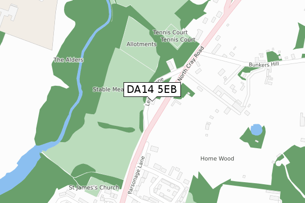
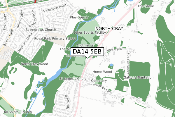
DA14 5EB is located in the St Mary's & St James electoral ward, within the London borough of Bexley and the English Parliamentary constituency of Old Bexley and Sidcup. The Sub Integrated Care Board (ICB) Location is NHS South East London ICB - 72Q and the police force is Metropolitan Police. This postcode has been in use since September 2018.


GetTheData
Source: OS Open Zoomstack (Ordnance Survey)
Licence: Open Government Licence (requires attribution)
Attribution: Contains OS data © Crown copyright and database right 2024
Source: Open Postcode Geo
Licence: Open Government Licence (requires attribution)
Attribution: Contains OS data © Crown copyright and database right 2024; Contains Royal Mail data © Royal Mail copyright and database right 2024; Source: Office for National Statistics licensed under the Open Government Licence v.3.0
| Easting | 548602 |
| Northing | 172037 |
| Latitude | 51.427861 |
| Longitude | 0.136157 |
GetTheData
Source: Open Postcode Geo
Licence: Open Government Licence
| Country | England |
| Postcode District | DA14 |
| ➜ DA14 open data dashboard ➜ See where DA14 is on a map ➜ Where is North Cray? | |
GetTheData
Source: Land Registry Price Paid Data
Licence: Open Government Licence
| Ward | St Mary's & St James |
| Constituency | Old Bexley And Sidcup |
GetTheData
Source: ONS Postcode Database
Licence: Open Government Licence
| June 2022 | Public order | On or near Gattons Way | 265m |
| June 2022 | Public order | On or near Gattons Way | 265m |
| June 2022 | Vehicle crime | On or near Gattons Way | 265m |
| ➜ Get more crime data in our Crime section | |||
GetTheData
Source: data.police.uk
Licence: Open Government Licence
| Parsonage Lane North Cray Church | North Cray | 165m |
| Parsonage Lane North Cray Church (North Cray Road) | North Cray | 268m |
| Bunkers Hill The White Cross | North Cray | 334m |
| Bunkers Hill The White Cross | North Cray | 427m |
| Ellenborough Road | Ruxley | 906m |
| Albany Park Station | 1.1km |
| Bexley Station | 1.6km |
| Sidcup Station | 2.3km |
GetTheData
Source: NaPTAN
Licence: Open Government Licence
GetTheData
Source: ONS Postcode Database
Licence: Open Government Licence


➜ Get more ratings from the Food Standards Agency
GetTheData
Source: Food Standards Agency
Licence: FSA terms & conditions
| Last Collection | |||
|---|---|---|---|
| Location | Mon-Fri | Sat | Distance |
| The Grove | 17:30 | 11:30 | 757m |
| Betterton Drive | 17:30 | 11:30 | 818m |
| Bedensfield Post Office | 17:30 | 11:30 | 909m |
GetTheData
Source: Dracos
Licence: Creative Commons Attribution-ShareAlike
| Facility | Distance |
|---|---|
| Loring Hall Sports Ground Water Lane, Sidcup Grass Pitches | 408m |
| Royal Park Primary Academy Riverside Road, Riverside Road, Sidcup Grass Pitches, Swimming Pool | 565m |
| Cleeve Park School Bexley Lane, Sidcup Grass Pitches, Sports Hall, Studio, Outdoor Tennis Courts, Artificial Grass Pitch | 1.2km |
GetTheData
Source: Active Places
Licence: Open Government Licence
| School | Phase of Education | Distance |
|---|---|---|
| Royal Park Primary Academy Riverside Road, Sidcup, DA14 4PX | Primary | 565m |
| Cleeve Meadow School Bexley Lane, Sidcup, DA14 4JN | Not applicable | 1.2km |
| Cleeve Park School Bexley Lane, Sidcup, DA14 4JN | Secondary | 1.2km |
GetTheData
Source: Edubase
Licence: Open Government Licence
The below table lists the International Territorial Level (ITL) codes (formerly Nomenclature of Territorial Units for Statistics (NUTS) codes) and Local Administrative Units (LAU) codes for DA14 5EB:
| ITL 1 Code | Name |
|---|---|
| TLI | London |
| ITL 2 Code | Name |
| TLI5 | Outer London - East and North East |
| ITL 3 Code | Name |
| TLI51 | Bexley and Greenwich |
| LAU 1 Code | Name |
| E09000004 | Bexley |
GetTheData
Source: ONS Postcode Directory
Licence: Open Government Licence
The below table lists the Census Output Area (OA), Lower Layer Super Output Area (LSOA), and Middle Layer Super Output Area (MSOA) for DA14 5EB:
| Code | Name | |
|---|---|---|
| OA | E00001877 | |
| LSOA | E01000381 | Bexley 028A |
| MSOA | E02000092 | Bexley 028 |
GetTheData
Source: ONS Postcode Directory
Licence: Open Government Licence
| DA14 5EP | North Cray Road | 162m |
| DA14 5HD | Parsonage Lane | 264m |
| DA14 5EL | North Cray Road | 278m |
| DA14 5EW | Gattons Way | 282m |
| DA14 5EX | Bunkers Hill | 312m |
| DA14 5EQ | Holt Close | 335m |
| DA14 5EJ | Water Lane | 454m |
| DA14 5EY | Cocksure Lane | 514m |
| DA14 5NG | The Grove | 534m |
| DA14 5NQ | The Grove | 553m |
GetTheData
Source: Open Postcode Geo; Land Registry Price Paid Data
Licence: Open Government Licence