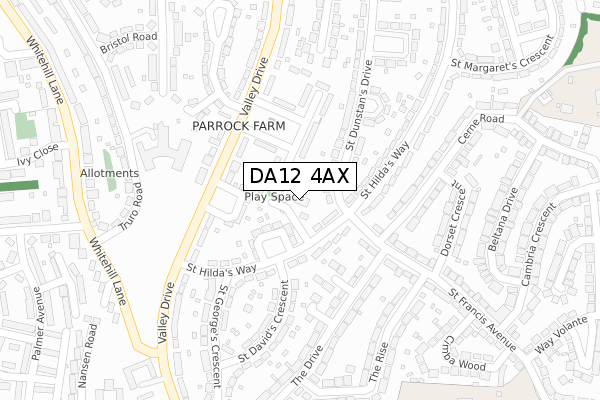
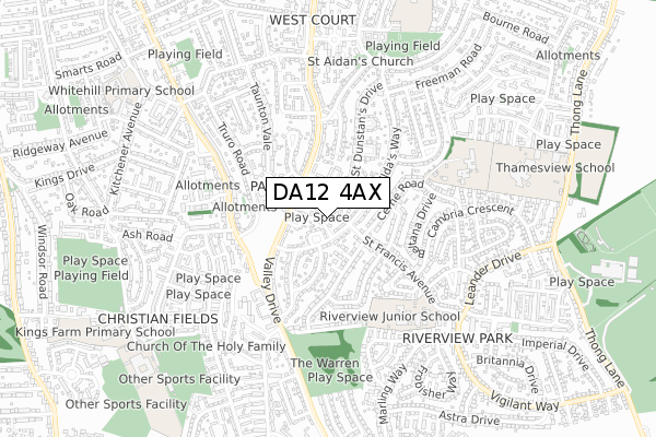
DA12 4AX is located in the Westcourt electoral ward, within the local authority district of Gravesham and the English Parliamentary constituency of Gravesham. The Sub Integrated Care Board (ICB) Location is NHS Kent and Medway ICB - 91Q and the police force is Kent. This postcode has been in use since February 2020.


GetTheData
Source: OS Open Zoomstack (Ordnance Survey)
Licence: Open Government Licence (requires attribution)
Attribution: Contains OS data © Crown copyright and database right 2024
Source: Open Postcode Geo
Licence: Open Government Licence (requires attribution)
Attribution: Contains OS data © Crown copyright and database right 2024; Contains Royal Mail data © Royal Mail copyright and database right 2024; Source: Office for National Statistics licensed under the Open Government Licence v.3.0
| Easting | 566000 |
| Northing | 171945 |
| Latitude | 51.422210 |
| Longitude | 0.386152 |
GetTheData
Source: Open Postcode Geo
Licence: Open Government Licence
| Country | England |
| Postcode District | DA12 |
| ➜ DA12 open data dashboard ➜ See where DA12 is on a map ➜ Where is Gravesend? | |
GetTheData
Source: Land Registry Price Paid Data
Licence: Open Government Licence
| Ward | Westcourt |
| Constituency | Gravesham |
GetTheData
Source: ONS Postcode Database
Licence: Open Government Licence
| January 2024 | Vehicle crime | On or near Winchester Crescent | 452m |
| November 2023 | Violence and sexual offences | On or near Winchester Crescent | 452m |
| November 2023 | Violence and sexual offences | On or near Winchester Crescent | 452m |
| ➜ Get more crime data in our Crime section | |||
GetTheData
Source: data.police.uk
Licence: Open Government Licence
| St David's Crescent (St Hilda's Way) | Gravesend | 101m |
| St Francis Avenue (St Hilda's Way) | Gravesend | 118m |
| St David's Crescent (St Hilda's Way) | Gravesend | 119m |
| St Francis Avenue (St Hilda's Way) | Gravesend | 151m |
| St Patricks Gardens (Valley Drive) | Kings Farm | 160m |
| Gravesend Station | 2.5km |
| Sole Street Station | 4.4km |
| Meopham Station | 4.5km |
GetTheData
Source: NaPTAN
Licence: Open Government Licence
GetTheData
Source: ONS Postcode Database
Licence: Open Government Licence


➜ Get more ratings from the Food Standards Agency
GetTheData
Source: Food Standards Agency
Licence: FSA terms & conditions
| Last Collection | |||
|---|---|---|---|
| Location | Mon-Fri | Sat | Distance |
| St Hildas Way | 17:30 | 11:30 | 109m |
| Cambria Crescent | 17:30 | 11:30 | 402m |
| Livingstone Road Post Office | 17:45 | 12:00 | 474m |
GetTheData
Source: Dracos
Licence: Creative Commons Attribution-ShareAlike
| Facility | Distance |
|---|---|
| Riverview Junior School Cimba Wood, Gravesend Grass Pitches | 479m |
| Thamesview School Thong Lane, Gravesend Sports Hall, Health and Fitness Gym, Studio, Grass Pitches | 744m |
| Thamesview School (Closed) Thong Lane, Gravesend Grass Pitches, Sports Hall | 815m |
GetTheData
Source: Active Places
Licence: Open Government Licence
| School | Phase of Education | Distance |
|---|---|---|
| Tymberwood Academy Cerne Road, Gravesend, DA12 4BN | Primary | 449m |
| Riverview Junior School Cimba Wood, Gravesend, DA12 4SD | Primary | 479m |
| Riverview Infant School Cimba Wood, Gravesend, DA12 4SD | Primary | 511m |
GetTheData
Source: Edubase
Licence: Open Government Licence
The below table lists the International Territorial Level (ITL) codes (formerly Nomenclature of Territorial Units for Statistics (NUTS) codes) and Local Administrative Units (LAU) codes for DA12 4AX:
| ITL 1 Code | Name |
|---|---|
| TLJ | South East (England) |
| ITL 2 Code | Name |
| TLJ4 | Kent |
| ITL 3 Code | Name |
| TLJ43 | Kent Thames Gateway |
| LAU 1 Code | Name |
| E07000109 | Gravesham |
GetTheData
Source: ONS Postcode Directory
Licence: Open Government Licence
The below table lists the Census Output Area (OA), Lower Layer Super Output Area (LSOA), and Middle Layer Super Output Area (MSOA) for DA12 4AX:
| Code | Name | |
|---|---|---|
| OA | E00123415 | |
| LSOA | E01024308 | Gravesham 007A |
| MSOA | E02005061 | Gravesham 007 |
GetTheData
Source: ONS Postcode Directory
Licence: Open Government Licence
| DA12 4AW | St Patricks Gardens | 70m |
| DA12 4AL | St Hildas Way | 79m |
| DA12 4AN | St Patricks Gardens | 95m |
| DA12 4AP | St Hildas Way | 110m |
| DA12 5SG | Valley Drive | 131m |
| DA12 4BJ | St Dunstans Drive | 143m |
| DA12 4BQ | St Dunstans Drive | 157m |
| DA12 4AJ | St Patricks Gardens | 166m |
| DA12 5SH | Valley Drive | 170m |
| DA12 4SH | St Francis Avenue | 187m |
GetTheData
Source: Open Postcode Geo; Land Registry Price Paid Data
Licence: Open Government Licence