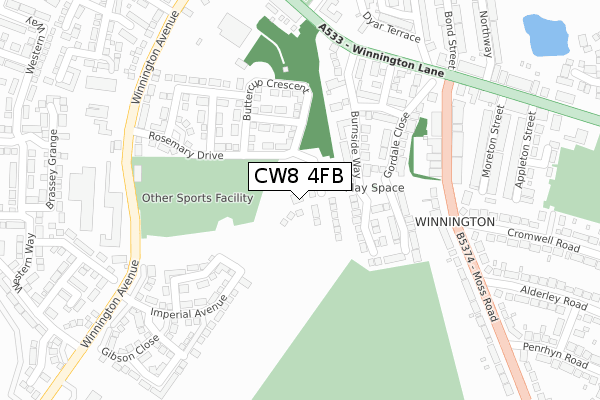
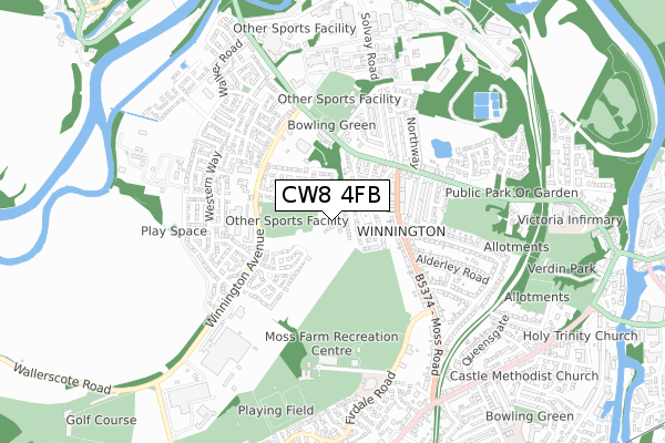
CW8 4FB is located in the Northwich Winnington & Castle electoral ward, within the unitary authority of Cheshire West and Chester and the English Parliamentary constituency of Weaver Vale. The Sub Integrated Care Board (ICB) Location is NHS Cheshire and Merseyside ICB - 27D and the police force is Cheshire. This postcode has been in use since January 2020.


GetTheData
Source: OS Open Zoomstack (Ordnance Survey)
Licence: Open Government Licence (requires attribution)
Attribution: Contains OS data © Crown copyright and database right 2024
Source: Open Postcode Geo
Licence: Open Government Licence (requires attribution)
Attribution: Contains OS data © Crown copyright and database right 2024; Contains Royal Mail data © Royal Mail copyright and database right 2024; Source: Office for National Statistics licensed under the Open Government Licence v.3.0
| Easting | 364520 |
| Northing | 373902 |
| Latitude | 53.260939 |
| Longitude | -2.533338 |
GetTheData
Source: Open Postcode Geo
Licence: Open Government Licence
| Country | England |
| Postcode District | CW8 |
| ➜ CW8 open data dashboard ➜ See where CW8 is on a map ➜ Where is Northwich? | |
GetTheData
Source: Land Registry Price Paid Data
Licence: Open Government Licence
| Ward | Northwich Winnington & Castle |
| Constituency | Weaver Vale |
GetTheData
Source: ONS Postcode Database
Licence: Open Government Licence
35, DAHLIA CRESCENT, NORTHWICH, CW8 4FB 2022 18 MAR £321,995 |
31, DAHLIA CRESCENT, NORTHWICH, CW8 4FB 2022 25 FEB £293,995 |
33, DAHLIA CRESCENT, NORTHWICH, CW8 4FB 2022 25 FEB £293,495 |
21, DAHLIA CRESCENT, NORTHWICH, CW8 4FB 2021 24 SEP £280,995 |
23, DAHLIA CRESCENT, NORTHWICH, CW8 4FB 2021 24 SEP £280,995 |
25, DAHLIA CRESCENT, NORTHWICH, CW8 4FB 2021 24 SEP £283,995 |
9, DAHLIA CRESCENT, NORTHWICH, CW8 4FB 2020 27 MAR £297,995 |
7, DAHLIA CRESCENT, NORTHWICH, CW8 4FB 2020 26 MAR £247,995 |
4, DAHLIA CRESCENT, NORTHWICH, CW8 4FB 2019 20 DEC £244,995 |
6, DAHLIA CRESCENT, NORTHWICH, CW8 4FB 2019 18 DEC £231,995 |
GetTheData
Source: HM Land Registry Price Paid Data
Licence: Contains HM Land Registry data © Crown copyright and database right 2024. This data is licensed under the Open Government Licence v3.0.
| November 2023 | Other theft | On or near Gordale Close | 230m |
| August 2023 | Violence and sexual offences | On or near Gordale Close | 230m |
| November 2022 | Public order | On or near Gordale Close | 230m |
| ➜ Get more crime data in our Crime section | |||
GetTheData
Source: data.police.uk
Licence: Open Government Licence
| Cromwell Road (Moss Road) | Winnington | 322m |
| Winnington Lane (Moss Road) | Winnington | 361m |
| Garden Centre (Winnington Lane) | Winnington | 406m |
| Garden Centre (Winnington Lane) | Winnington | 433m |
| Penrhyn Road (Moss Road) | Northwich | 438m |
| Greenbank Station | 1.1km |
| Northwich Station | 2.4km |
| Hartford Station | 2.5km |
GetTheData
Source: NaPTAN
Licence: Open Government Licence
GetTheData
Source: ONS Postcode Database
Licence: Open Government Licence


➜ Get more ratings from the Food Standards Agency
GetTheData
Source: Food Standards Agency
Licence: FSA terms & conditions
| Last Collection | |||
|---|---|---|---|
| Location | Mon-Fri | Sat | Distance |
| Winnington Hill | 17:45 | 11:00 | 1,250m |
| Barnton So | 17:30 | 11:30 | 1,484m |
| Hartford Road | 17:30 | 08:00 | 1,680m |
GetTheData
Source: Dracos
Licence: Creative Commons Attribution-ShareAlike
| Facility | Distance |
|---|---|
| Winnington Jubilee Fields Winnington Avenue, Northwich Grass Pitches | 254m |
| Northwich Cricket Club Moss Lane, Northwich Grass Pitches | 445m |
| Moss Farm Leisure Complex Moss Lane, Northwich Swimming Pool, Health and Fitness Gym, Grass Pitches, Artificial Grass Pitch, Squash Courts | 525m |
GetTheData
Source: Active Places
Licence: Open Government Licence
| School | Phase of Education | Distance |
|---|---|---|
| Winnington Park Community Primary and Nursery School Firdale Road, Firdale Park, Winnington, Northwich, CW8 4AZ | Primary | 584m |
| Charles Darwin Community Primary School Darwin Street, Castle, Northwich, CW8 1BN | Primary | 964m |
| OneSchool Global Northwich Hartford Manor, Greenbank Lane, Hartford, Northwich, CW8 1HW | Not applicable | 1.4km |
GetTheData
Source: Edubase
Licence: Open Government Licence
The below table lists the International Territorial Level (ITL) codes (formerly Nomenclature of Territorial Units for Statistics (NUTS) codes) and Local Administrative Units (LAU) codes for CW8 4FB:
| ITL 1 Code | Name |
|---|---|
| TLD | North West (England) |
| ITL 2 Code | Name |
| TLD6 | Cheshire |
| ITL 3 Code | Name |
| TLD63 | Cheshire West and Chester |
| LAU 1 Code | Name |
| E06000050 | Cheshire West and Chester |
GetTheData
Source: ONS Postcode Directory
Licence: Open Government Licence
The below table lists the Census Output Area (OA), Lower Layer Super Output Area (LSOA), and Middle Layer Super Output Area (MSOA) for CW8 4FB:
| Code | Name | |
|---|---|---|
| OA | E00094459 | |
| LSOA | E01018713 | Cheshire West and Chester 018A |
| MSOA | E02003879 | Cheshire West and Chester 018 |
GetTheData
Source: ONS Postcode Directory
Licence: Open Government Licence
| CW8 4XS | Burnside Way | 175m |
| CW8 4DW | Rosemary Drive | 179m |
| CW8 4XR | Burnside Way | 189m |
| CW8 4RQ | Fuchsia Road | 216m |
| CW8 4EG | Buttercup Crescent | 217m |
| CW8 4XU | Gordale Close | 225m |
| CW8 4BF | Orchid Green | 241m |
| CW8 4XT | Gordale Close | 242m |
| CW8 4RS | Sunflower Way | 284m |
| CW8 4BJ | Moss Road | 291m |
GetTheData
Source: Open Postcode Geo; Land Registry Price Paid Data
Licence: Open Government Licence