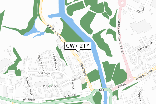
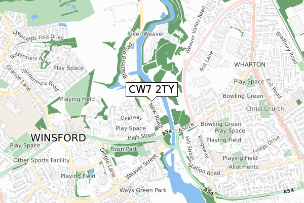
CW7 2TY is located in the Winsford Over & Verdin electoral ward, within the unitary authority of Cheshire West and Chester and the English Parliamentary constituency of Eddisbury. The Sub Integrated Care Board (ICB) Location is NHS Cheshire and Merseyside ICB - 27D and the police force is Cheshire. This postcode has been in use since November 2017.


GetTheData
Source: OS Open Zoomstack (Ordnance Survey)
Licence: Open Government Licence (requires attribution)
Attribution: Contains OS data © Crown copyright and database right 2024
Source: Open Postcode Geo
Licence: Open Government Licence (requires attribution)
Attribution: Contains OS data © Crown copyright and database right 2024; Contains Royal Mail data © Royal Mail copyright and database right 2024; Source: Office for National Statistics licensed under the Open Government Licence v.3.0
| Easting | 365370 |
| Northing | 366588 |
| Latitude | 53.195254 |
| Longitude | -2.519799 |
GetTheData
Source: Open Postcode Geo
Licence: Open Government Licence
| Country | England |
| Postcode District | CW7 |
| ➜ CW7 open data dashboard ➜ See where CW7 is on a map ➜ Where is Winsford? | |
GetTheData
Source: Land Registry Price Paid Data
Licence: Open Government Licence
| Ward | Winsford Over & Verdin |
| Constituency | Eddisbury |
GetTheData
Source: ONS Postcode Database
Licence: Open Government Licence
| January 2024 | Criminal damage and arson | On or near Leven Avenue | 379m |
| January 2024 | Violence and sexual offences | On or near Leven Avenue | 379m |
| January 2024 | Public order | On or near Parking Area | 440m |
| ➜ Get more crime data in our Crime section | |||
GetTheData
Source: data.police.uk
Licence: Open Government Licence
| Town Bridge (High Street) | Winsford | 282m |
| Morrisons (Wharton Park Road) | Wharton | 313m |
| Town Bridge (High Street) | Winsford | 316m |
| Siddon Street (High Street) | Winsford | 448m |
| Siddon Street (High Street) | Winsford | 465m |
| Winsford Station | 1.8km |
GetTheData
Source: NaPTAN
Licence: Open Government Licence
➜ Broadband speed and availability dashboard for CW7 2TY
| Percentage of properties with Next Generation Access | 100.0% |
| Percentage of properties with Superfast Broadband | 100.0% |
| Percentage of properties with Ultrafast Broadband | 0.0% |
| Percentage of properties with Full Fibre Broadband | 0.0% |
Superfast Broadband is between 30Mbps and 300Mbps
Ultrafast Broadband is > 300Mbps
| Median download speed | 40.0Mbps |
| Average download speed | 43.9Mbps |
| Maximum download speed | 79.97Mbps |
| Median upload speed | 10.0Mbps |
| Average upload speed | 9.5Mbps |
| Maximum upload speed | 20.00Mbps |
| Percentage of properties unable to receive 2Mbps | 0.0% |
| Percentage of properties unable to receive 5Mbps | 0.0% |
| Percentage of properties unable to receive 10Mbps | 0.0% |
| Percentage of properties unable to receive 30Mbps | 0.0% |
➜ Broadband speed and availability dashboard for CW7 2TY
GetTheData
Source: Ofcom
Licence: Ofcom Terms of Use (requires attribution)
GetTheData
Source: ONS Postcode Database
Licence: Open Government Licence


➜ Get more ratings from the Food Standards Agency
GetTheData
Source: Food Standards Agency
Licence: FSA terms & conditions
| Last Collection | |||
|---|---|---|---|
| Location | Mon-Fri | Sat | Distance |
| Queens Hotel | 17:30 | 11:30 | 777m |
| Over So | 17:00 | 11:30 | 1,490m |
| St Georges Road | 17:30 | 11:30 | 1,496m |
GetTheData
Source: Dracos
Licence: Creative Commons Attribution-ShareAlike
| Facility | Distance |
|---|---|
| The Gym (Closed) Chapel Road, Winsford Studio, Health and Fitness Gym | 445m |
| Wharton Recreation Ground East Dudley Street, Winsford Grass Pitches, Outdoor Tennis Courts | 592m |
| Barton Stadium (Winsford United Fc) Wharton Road, Winsford Grass Pitches | 610m |
GetTheData
Source: Active Places
Licence: Open Government Licence
| School | Phase of Education | Distance |
|---|---|---|
| Winsford High Street Community Primary School High Street, Winsford, CW7 2AU | Primary | 671m |
| Wharton CofE Primary School Greville Drive, Winsford, CW7 3EP | Primary | 745m |
| Willow Wood Community Nursery & Primary School Bradbury Road, Wharton, Winsford, CW7 3HN | Primary | 1.1km |
GetTheData
Source: Edubase
Licence: Open Government Licence
The below table lists the International Territorial Level (ITL) codes (formerly Nomenclature of Territorial Units for Statistics (NUTS) codes) and Local Administrative Units (LAU) codes for CW7 2TY:
| ITL 1 Code | Name |
|---|---|
| TLD | North West (England) |
| ITL 2 Code | Name |
| TLD6 | Cheshire |
| ITL 3 Code | Name |
| TLD63 | Cheshire West and Chester |
| LAU 1 Code | Name |
| E06000050 | Cheshire West and Chester |
GetTheData
Source: ONS Postcode Directory
Licence: Open Government Licence
The below table lists the Census Output Area (OA), Lower Layer Super Output Area (LSOA), and Middle Layer Super Output Area (MSOA) for CW7 2TY:
| Code | Name | |
|---|---|---|
| OA | E00094610 | |
| LSOA | E01018746 | Cheshire West and Chester 038C |
| MSOA | E02003888 | Cheshire West and Chester 038 |
GetTheData
Source: ONS Postcode Directory
Licence: Open Government Licence
| CW7 2BJ | Lagos Grove | 168m |
| CW7 2BG | Bakers Lane | 220m |
| CW7 2DZ | Saville Rise | 224m |
| CW7 2AD | High Street | 280m |
| CW7 2BE | Overway | 304m |
| CW7 3AA | Wharton Road | 311m |
| CW7 2GQ | Saville Court | 325m |
| CW7 2GP | Pimlott Drive | 349m |
| CW7 2BB | Coronation Avenue | 352m |
| CW7 2AP | High Street | 358m |
GetTheData
Source: Open Postcode Geo; Land Registry Price Paid Data
Licence: Open Government Licence