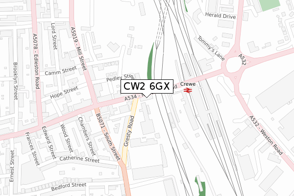
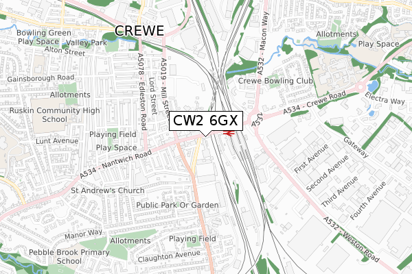
CW2 6GX is located in the Crewe South electoral ward, within the unitary authority of Cheshire East and the English Parliamentary constituency of Crewe and Nantwich. The Sub Integrated Care Board (ICB) Location is NHS Cheshire and Merseyside ICB - 27D and the police force is Cheshire. This postcode has been in use since April 2020.


GetTheData
Source: OS Open Zoomstack (Ordnance Survey)
Licence: Open Government Licence (requires attribution)
Attribution: Contains OS data © Crown copyright and database right 2024
Source: Open Postcode Geo
Licence: Open Government Licence (requires attribution)
Attribution: Contains OS data © Crown copyright and database right 2024; Contains Royal Mail data © Royal Mail copyright and database right 2024; Source: Office for National Statistics licensed under the Open Government Licence v.3.0
| Easting | 370919 |
| Northing | 354756 |
| Latitude | 53.089234 |
| Longitude | -2.435668 |
GetTheData
Source: Open Postcode Geo
Licence: Open Government Licence
| Country | England |
| Postcode District | CW2 |
| ➜ CW2 open data dashboard ➜ See where CW2 is on a map ➜ Where is Crewe? | |
GetTheData
Source: Land Registry Price Paid Data
Licence: Open Government Licence
| Ward | Crewe South |
| Constituency | Crewe And Nantwich |
GetTheData
Source: ONS Postcode Database
Licence: Open Government Licence
| January 2024 | Bicycle theft | On or near Hewitt Street | 104m |
| January 2024 | Violence and sexual offences | On or near Hewitt Street | 104m |
| January 2024 | Vehicle crime | On or near Parking Area | 136m |
| ➜ Get more crime data in our Crime section | |||
GetTheData
Source: data.police.uk
Licence: Open Government Licence
| Rail House (Gresty Road) | Crewe | 94m |
| Rail House (Gresty Road) | Crewe | 100m |
| Mill Street Alighting Only (Nantwich Road) | Crewe | 123m |
| Railway Station (Access Road) | Crewe | 148m |
| Railway Station (Nantwich Road) | Crewe | 148m |
| Crewe Station | 0.2km |
GetTheData
Source: NaPTAN
Licence: Open Government Licence
GetTheData
Source: ONS Postcode Database
Licence: Open Government Licence


➜ Get more ratings from the Food Standards Agency
GetTheData
Source: Food Standards Agency
Licence: FSA terms & conditions
| Last Collection | |||
|---|---|---|---|
| Location | Mon-Fri | Sat | Distance |
| The Brunswick | 17:30 | 12:30 | 254m |
| Gresty Road | 17:00 | 13:00 | 304m |
| Delivery Office | 18:30 | 419m | |
GetTheData
Source: Dracos
Licence: Creative Commons Attribution-ShareAlike
| Facility | Distance |
|---|---|
| Crewe Alexandra (Alexandra Stadium) Gresty Road, Crewe Grass Pitches | 146m |
| Camm Street Centre Camm Street, Crewe Health and Fitness Gym, Studio | 294m |
| Total Fitness (Crewe) (Closed) Macon Way, Crewe Swimming Pool, Health and Fitness Gym, Studio, Squash Courts | 565m |
GetTheData
Source: Active Places
Licence: Open Government Licence
| School | Phase of Education | Distance |
|---|---|---|
| Westminster Nursery School Nelson Street, Crewe, CW2 7LJ | Nursery | 510m |
| Safe Opportunities Unit G4, Scope House, Weston Road, Crewe, CW1 6DD | Not applicable | 635m |
| Ruskin Community High School Ruskin Road, Crewe, CW2 7JT | Secondary | 781m |
GetTheData
Source: Edubase
Licence: Open Government Licence
The below table lists the International Territorial Level (ITL) codes (formerly Nomenclature of Territorial Units for Statistics (NUTS) codes) and Local Administrative Units (LAU) codes for CW2 6GX:
| ITL 1 Code | Name |
|---|---|
| TLD | North West (England) |
| ITL 2 Code | Name |
| TLD6 | Cheshire |
| ITL 3 Code | Name |
| TLD62 | Cheshire East |
| LAU 1 Code | Name |
| E06000049 | Cheshire East |
GetTheData
Source: ONS Postcode Directory
Licence: Open Government Licence
The below table lists the Census Output Area (OA), Lower Layer Super Output Area (LSOA), and Middle Layer Super Output Area (MSOA) for CW2 6GX:
| Code | Name | |
|---|---|---|
| OA | E00174391 | |
| LSOA | E01018445 | Cheshire East 045A |
| MSOA | E02003834 | Cheshire East 045 |
GetTheData
Source: ONS Postcode Directory
Licence: Open Government Licence
| CW2 6AD | Nantwich Road | 114m |
| CW2 6AF | Nantwich Road | 124m |
| CW2 6DZ | Hewitt Street | 131m |
| CW2 7AA | Pedley Street | 149m |
| CW2 6DY | Gresty Road | 159m |
| CW2 6HN | South Street | 168m |
| CW2 7AP | Herdman Street | 181m |
| CW2 7AJ | Mill Street | 206m |
| CW2 7BE | Waverley Court | 213m |
| CW2 7BH | Waverley Court | 213m |
GetTheData
Source: Open Postcode Geo; Land Registry Price Paid Data
Licence: Open Government Licence