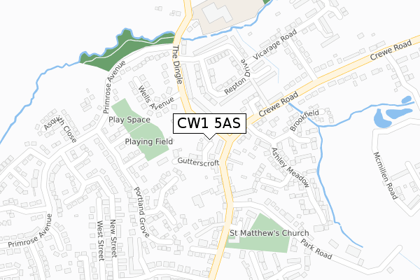
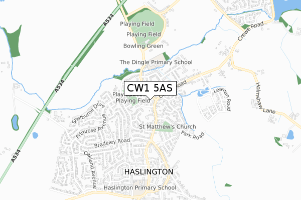
CW1 5AS is located in the Haslington electoral ward, within the unitary authority of Cheshire East and the English Parliamentary constituency of Crewe and Nantwich. The Sub Integrated Care Board (ICB) Location is NHS Cheshire and Merseyside ICB - 27D and the police force is Cheshire. This postcode has been in use since May 2018.


GetTheData
Source: OS Open Zoomstack (Ordnance Survey)
Licence: Open Government Licence (requires attribution)
Attribution: Contains OS data © Crown copyright and database right 2024
Source: Open Postcode Geo
Licence: Open Government Licence (requires attribution)
Attribution: Contains OS data © Crown copyright and database right 2024; Contains Royal Mail data © Royal Mail copyright and database right 2024; Source: Office for National Statistics licensed under the Open Government Licence v.3.0
| Easting | 373707 |
| Northing | 356300 |
| Latitude | 53.103258 |
| Longitude | -2.394167 |
GetTheData
Source: Open Postcode Geo
Licence: Open Government Licence
| Country | England |
| Postcode District | CW1 |
| ➜ CW1 open data dashboard ➜ See where CW1 is on a map ➜ Where is Haslington? | |
GetTheData
Source: Land Registry Price Paid Data
Licence: Open Government Licence
| Ward | Haslington |
| Constituency | Crewe And Nantwich |
GetTheData
Source: ONS Postcode Database
Licence: Open Government Licence
5, WILLIAM DYKES CLOSE, HASLINGTON, CREWE, CW1 5AS 2019 22 FEB £380,000 |
4, WILLIAM DYKES CLOSE, HASLINGTON, CREWE, CW1 5AS 2018 17 DEC £299,950 |
2, WILLIAM DYKES CLOSE, HASLINGTON, CREWE, CW1 5AS 2018 7 DEC £299,950 |
6, WILLIAM DYKES CLOSE, HASLINGTON, CREWE, CW1 5AS 2018 11 OCT £305,000 |
3, WILLIAM DYKES CLOSE, HASLINGTON, CREWE, CW1 5AS 2018 7 AUG £309,950 |
7, WILLIAM DYKES CLOSE, HASLINGTON, CREWE, CW1 5AS 2018 15 JUN £309,950 |
1, WILLIAM DYKES CLOSE, HASLINGTON, CREWE, CW1 5AS 2018 10 MAY £299,950 |
GetTheData
Source: HM Land Registry Price Paid Data
Licence: Contains HM Land Registry data © Crown copyright and database right 2024. This data is licensed under the Open Government Licence v3.0.
| December 2023 | Anti-social behaviour | On or near The Dingle | 217m |
| December 2023 | Violence and sexual offences | On or near Parking Area | 385m |
| November 2023 | Shoplifting | On or near Supermarket | 150m |
| ➜ Get more crime data in our Crime section | |||
GetTheData
Source: data.police.uk
Licence: Open Government Licence
| The Dingle (Primrose Avenue) | Haslington | 258m |
| Cartwright Road (Crewe Road) | Haslington | 271m |
| Cartwright Road (Crewe Road) | Haslington | 272m |
| The Dingle (Primrose Avenue) | Haslington | 273m |
| Broughton Arms Ph (Crewe Road) | Haslington | 315m |
| Crewe Station | 3km |
GetTheData
Source: NaPTAN
Licence: Open Government Licence
➜ Broadband speed and availability dashboard for CW1 5AS
| Percentage of properties with Next Generation Access | 100.0% |
| Percentage of properties with Superfast Broadband | 100.0% |
| Percentage of properties with Ultrafast Broadband | 0.0% |
| Percentage of properties with Full Fibre Broadband | 0.0% |
Superfast Broadband is between 30Mbps and 300Mbps
Ultrafast Broadband is > 300Mbps
| Median download speed | 60.7Mbps |
| Average download speed | 59.8Mbps |
| Maximum download speed | 80.00Mbps |
| Median upload speed | 17.6Mbps |
| Average upload speed | 15.0Mbps |
| Maximum upload speed | 20.00Mbps |
| Percentage of properties unable to receive 2Mbps | 0.0% |
| Percentage of properties unable to receive 5Mbps | 0.0% |
| Percentage of properties unable to receive 10Mbps | 0.0% |
| Percentage of properties unable to receive 30Mbps | 0.0% |
➜ Broadband speed and availability dashboard for CW1 5AS
GetTheData
Source: Ofcom
Licence: Ofcom Terms of Use (requires attribution)
GetTheData
Source: ONS Postcode Database
Licence: Open Government Licence


➜ Get more ratings from the Food Standards Agency
GetTheData
Source: Food Standards Agency
Licence: FSA terms & conditions
| Last Collection | |||
|---|---|---|---|
| Location | Mon-Fri | Sat | Distance |
| Primrose Avenue | 17:30 | 11:15 | 424m |
| Laureston Avenue | 17:30 | 13:00 | 1,899m |
| The College | 17:30 | 12:30 | 2,231m |
GetTheData
Source: Dracos
Licence: Creative Commons Attribution-ShareAlike
| Facility | Distance |
|---|---|
| The Dingle Primary School The Dingle, Haslington, Crewe Grass Pitches | 309m |
| Haslington Cricket Club Ltd Clay Lane, Haslington, Crewe Grass Pitches | 493m |
| Haslington Playing Fields Clay Lane, Haslington, Crewe Grass Pitches | 610m |
GetTheData
Source: Active Places
Licence: Open Government Licence
| School | Phase of Education | Distance |
|---|---|---|
| The Dingle Primary School The Dingle, Haslington, Crewe, CW1 5SD | Primary | 309m |
| Haslington Primary Academy Crewe Road, Haslington, Crewe, CW1 5SL | Primary | 687m |
| Springfield School Crewe Green Road, Cheshire East, Crewe, CW1 5HS | Not applicable | 1.9km |
GetTheData
Source: Edubase
Licence: Open Government Licence
The below table lists the International Territorial Level (ITL) codes (formerly Nomenclature of Territorial Units for Statistics (NUTS) codes) and Local Administrative Units (LAU) codes for CW1 5AS:
| ITL 1 Code | Name |
|---|---|
| TLD | North West (England) |
| ITL 2 Code | Name |
| TLD6 | Cheshire |
| ITL 3 Code | Name |
| TLD62 | Cheshire East |
| LAU 1 Code | Name |
| E06000049 | Cheshire East |
GetTheData
Source: ONS Postcode Directory
Licence: Open Government Licence
The below table lists the Census Output Area (OA), Lower Layer Super Output Area (LSOA), and Middle Layer Super Output Area (MSOA) for CW1 5AS:
| Code | Name | |
|---|---|---|
| OA | E00093216 | |
| LSOA | E01018469 | Cheshire East 041C |
| MSOA | E02003831 | Cheshire East 041 |
GetTheData
Source: ONS Postcode Directory
Licence: Open Government Licence
| CW1 5RJ | Gutterscroft | 58m |
| CW1 5RY | The Dingle | 91m |
| CW1 5RG | Crewe Road | 98m |
| CW1 5RQ | Crewe Road | 110m |
| CW1 5UA | Delves Broughton Court | 143m |
| CW1 5RZ | Wells Avenue | 162m |
| CW1 5WF | Mulcaster Court | 163m |
| CW1 5SA | Repton Drive | 164m |
| CW1 5RN | Crewe Road | 168m |
| CW1 5NN | Batterbee Court | 178m |
GetTheData
Source: Open Postcode Geo; Land Registry Price Paid Data
Licence: Open Government Licence