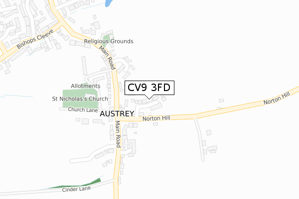
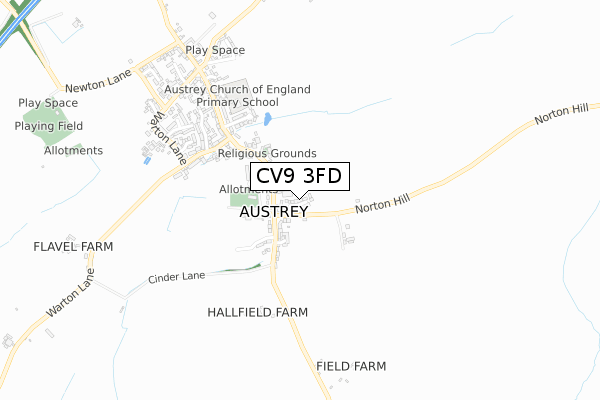
CV9 3FD is located in the Newton Regis and Warton electoral ward, within the local authority district of North Warwickshire and the English Parliamentary constituency of North Warwickshire. The Sub Integrated Care Board (ICB) Location is NHS Coventry and Warwickshire ICB - B2M3M and the police force is Warwickshire. This postcode has been in use since May 2019.


GetTheData
Source: OS Open Zoomstack (Ordnance Survey)
Licence: Open Government Licence (requires attribution)
Attribution: Contains OS data © Crown copyright and database right 2024
Source: Open Postcode Geo
Licence: Open Government Licence (requires attribution)
Attribution: Contains OS data © Crown copyright and database right 2024; Contains Royal Mail data © Royal Mail copyright and database right 2024; Source: Office for National Statistics licensed under the Open Government Licence v.3.0
| Easting | 429787 |
| Northing | 306270 |
| Latitude | 52.653364 |
| Longitude | -1.561108 |
GetTheData
Source: Open Postcode Geo
Licence: Open Government Licence
| Country | England |
| Postcode District | CV9 |
| ➜ CV9 open data dashboard ➜ See where CV9 is on a map ➜ Where is Austrey? | |
GetTheData
Source: Land Registry Price Paid Data
Licence: Open Government Licence
| Ward | Newton Regis And Warton |
| Constituency | North Warwickshire |
GetTheData
Source: ONS Postcode Database
Licence: Open Government Licence
5, MILL VIEW GARDENS, AUSTREY, ATHERSTONE, CV9 3FD 2020 7 DEC £529,995 |
2020 31 JUL £324,950 |
12, MILL VIEW GARDENS, AUSTREY, ATHERSTONE, CV9 3FD 2020 3 JUL £400,000 |
11, MILL VIEW GARDENS, AUSTREY, ATHERSTONE, CV9 3FD 2020 3 JUL £399,950 |
8, MILL VIEW GARDENS, AUSTREY, ATHERSTONE, CV9 3FD 2020 24 JUN £409,950 |
10, MILL VIEW GARDENS, AUSTREY, ATHERSTONE, CV9 3FD 2020 19 JUN £415,000 |
6, MILL VIEW GARDENS, AUSTREY, ATHERSTONE, CV9 3FD 2020 1 MAY £514,950 |
7, MILL VIEW GARDENS, AUSTREY, ATHERSTONE, CV9 3FD 2020 31 JAN £399,950 |
9, MILL VIEW GARDENS, AUSTREY, ATHERSTONE, CV9 3FD 2020 24 JAN £390,000 |
14, MILL VIEW GARDENS, AUSTREY, ATHERSTONE, CV9 3FD 2020 10 JAN £329,950 |
GetTheData
Source: HM Land Registry Price Paid Data
Licence: Contains HM Land Registry data © Crown copyright and database right 2024. This data is licensed under the Open Government Licence v3.0.
| June 2022 | Anti-social behaviour | On or near The Green | 180m |
| May 2022 | Burglary | On or near Glebe Rise | 201m |
| April 2022 | Violence and sexual offences | On or near St Nicholas Close | 419m |
| ➜ Get more crime data in our Crime section | |||
GetTheData
Source: data.police.uk
Licence: Open Government Licence
| Bird In Hand (Main Road) | Austrey | 109m |
| Bird In Hand (Main Road) | Austrey | 124m |
| Bishops Cleeve (Main Road) | Austrey | 375m |
| Main Road (Bishops Cleeve) | Austrey | 397m |
| Main Road (Bishops Cleeve) | Austrey | 412m |
| Polesworth Station | 4.5km |
GetTheData
Source: NaPTAN
Licence: Open Government Licence
GetTheData
Source: ONS Postcode Database
Licence: Open Government Licence


➜ Get more ratings from the Food Standards Agency
GetTheData
Source: Food Standards Agency
Licence: FSA terms & conditions
| Last Collection | |||
|---|---|---|---|
| Location | Mon-Fri | Sat | Distance |
| Warton Post Office | 16:45 | 07:30 | 2,946m |
| Opp 1 Little Warton Road | 16:45 | 07:00 | 2,958m |
| Appleby Magna P.o. | 16:00 | 12:15 | 4,030m |
GetTheData
Source: Dracos
Licence: Creative Commons Attribution-ShareAlike
| Facility | Distance |
|---|---|
| Austrey Ce Primary School St. Nicholas Close, Austrey, Atherstone Grass Pitches | 479m |
| Austrey Playing Fields Newton Lane, Austrey, Atherstone Grass Pitches | 1.1km |
| Newton Recreation Ground Austrey Lane, Newton Regis, Tamworth Grass Pitches, Outdoor Tennis Courts | 2.1km |
GetTheData
Source: Active Places
Licence: Open Government Licence
| School | Phase of Education | Distance |
|---|---|---|
| Austrey CofE Primary School St Nicholas Close, Austrey, Atherstone, CV9 3EQ | Primary | 479m |
| Newton Regis CofE Primary School Austrey Lane, Newton Regis, Tamworth, B79 0NL | Primary | 2.2km |
| Warton Nethersole's CofE Primary School Maypole Road, Warton, Tamworth, B79 0HP | Primary | 2.9km |
GetTheData
Source: Edubase
Licence: Open Government Licence
The below table lists the International Territorial Level (ITL) codes (formerly Nomenclature of Territorial Units for Statistics (NUTS) codes) and Local Administrative Units (LAU) codes for CV9 3FD:
| ITL 1 Code | Name |
|---|---|
| TLG | West Midlands (England) |
| ITL 2 Code | Name |
| TLG1 | Herefordshire, Worcestershire and Warwickshire |
| ITL 3 Code | Name |
| TLG13 | Warwickshire CC |
| LAU 1 Code | Name |
| E07000218 | North Warwickshire |
GetTheData
Source: ONS Postcode Directory
Licence: Open Government Licence
The below table lists the Census Output Area (OA), Lower Layer Super Output Area (LSOA), and Middle Layer Super Output Area (MSOA) for CV9 3FD:
| Code | Name | |
|---|---|---|
| OA | E00158217 | |
| LSOA | E01031036 | North Warwickshire 001B |
| MSOA | E02006468 | North Warwickshire 001 |
GetTheData
Source: ONS Postcode Directory
Licence: Open Government Licence
| CV9 3ED | Norton Hill | 84m |
| CV9 3EZ | Kirtland Close | 148m |
| CV9 3EB | Main Road | 157m |
| CV9 3EE | Church Lane | 174m |
| CV9 3HF | Glebe Rise | 187m |
| CV9 3EF | The Green | 190m |
| CV9 3EG | Main Road | 263m |
| CV9 3EU | Bishops Cleeve | 410m |
| CV9 3EQ | St Nicholas Close | 429m |
| CV9 3EX | Newborough Close | 498m |
GetTheData
Source: Open Postcode Geo; Land Registry Price Paid Data
Licence: Open Government Licence