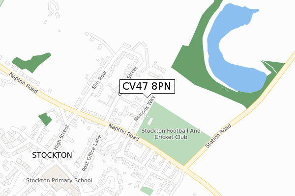
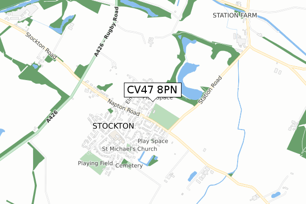
CV47 8PN is located in the Bishop's Itchington, Fenny Compton & Napton electoral ward, within the local authority district of Stratford-on-Avon and the English Parliamentary constituency of Kenilworth and Southam. The Sub Integrated Care Board (ICB) Location is NHS Coventry and Warwickshire ICB - B2M3M and the police force is Warwickshire. This postcode has been in use since June 2019.


GetTheData
Source: OS Open Zoomstack (Ordnance Survey)
Licence: Open Government Licence (requires attribution)
Attribution: Contains OS data © Crown copyright and database right 2024
Source: Open Postcode Geo
Licence: Open Government Licence (requires attribution)
Attribution: Contains OS data © Crown copyright and database right 2024; Contains Royal Mail data © Royal Mail copyright and database right 2024; Source: Office for National Statistics licensed under the Open Government Licence v.3.0
| Easting | 446069 |
| Northing | 261775 |
| Latitude | 52.252245 |
| Longitude | -1.326558 |
GetTheData
Source: Open Postcode Geo
Licence: Open Government Licence
| Country | England |
| Postcode District | CV47 |
| ➜ CV47 open data dashboard ➜ See where CV47 is on a map ➜ Where is Napton on the Hill? | |
GetTheData
Source: Land Registry Price Paid Data
Licence: Open Government Licence
| Ward | Bishop's Itchington, Fenny Compton & Napton |
| Constituency | Kenilworth And Southam |
GetTheData
Source: ONS Postcode Database
Licence: Open Government Licence
| June 2022 | Violence and sexual offences | On or near Petrol Station | 485m |
| April 2022 | Violence and sexual offences | On or near Petrol Station | 485m |
| February 2022 | Criminal damage and arson | On or near Hillside | 426m |
| ➜ Get more crime data in our Crime section | |||
GetTheData
Source: data.police.uk
Licence: Open Government Licence
| Kings Head (Butt Hill) | Napton On The Hill | 417m |
| Kings Head (Butt Hill) | Napton On The Hill | 469m |
| Crown (High Street) | Napton On The Hill | 817m |
| Crown (High Street) | Napton On The Hill | 821m |
GetTheData
Source: NaPTAN
Licence: Open Government Licence
| Percentage of properties with Next Generation Access | 100.0% |
| Percentage of properties with Superfast Broadband | 100.0% |
| Percentage of properties with Ultrafast Broadband | 0.0% |
| Percentage of properties with Full Fibre Broadband | 0.0% |
Superfast Broadband is between 30Mbps and 300Mbps
Ultrafast Broadband is > 300Mbps
| Percentage of properties unable to receive 2Mbps | 0.0% |
| Percentage of properties unable to receive 5Mbps | 0.0% |
| Percentage of properties unable to receive 10Mbps | 0.0% |
| Percentage of properties unable to receive 30Mbps | 0.0% |
GetTheData
Source: Ofcom
Licence: Ofcom Terms of Use (requires attribution)
GetTheData
Source: ONS Postcode Database
Licence: Open Government Licence


➜ Get more ratings from the Food Standards Agency
GetTheData
Source: Food Standards Agency
Licence: FSA terms & conditions
| Last Collection | |||
|---|---|---|---|
| Location | Mon-Fri | Sat | Distance |
| Butt Hill | 16:00 | 10:45 | 722m |
| Tollgate Road | 16:00 | 09:00 | 4,152m |
| Coventry Street Post Office | 18:00 | 11:30 | 4,184m |
GetTheData
Source: Dracos
Licence: Creative Commons Attribution-ShareAlike
| Facility | Distance |
|---|---|
| Napton Sports Association Priors Marston Road, Napton, Southam Grass Pitches, Outdoor Tennis Courts, Artificial Grass Pitch | 939m |
| St Lawrence C Of E (Voluntary Aided) Primary School St. Lawrence Close, Napton, Southam Grass Pitches | 953m |
| Stockton Football And Cricket Club Napton Road, Stockton, Southam Grass Pitches | 3km |
GetTheData
Source: Active Places
Licence: Open Government Licence
| School | Phase of Education | Distance |
|---|---|---|
| Arc School Napton Vicarage Road, Napton-On-The-Hill, Nr Southam, Warwickshire, CV47 8NA | Not applicable | 650m |
| St Lawrence CofE (Voluntary Aided) Primary School Dog Lane, Napton-on-the-Hill, Southam, CV47 8LU | Primary | 959m |
| Stockton Primary School School Street, Stockton, Southam, CV47 8JE | Primary | 3.1km |
GetTheData
Source: Edubase
Licence: Open Government Licence
The below table lists the International Territorial Level (ITL) codes (formerly Nomenclature of Territorial Units for Statistics (NUTS) codes) and Local Administrative Units (LAU) codes for CV47 8PN:
| ITL 1 Code | Name |
|---|---|
| TLG | West Midlands (England) |
| ITL 2 Code | Name |
| TLG1 | Herefordshire, Worcestershire and Warwickshire |
| ITL 3 Code | Name |
| TLG13 | Warwickshire CC |
| LAU 1 Code | Name |
| E07000221 | Stratford-on-Avon |
GetTheData
Source: ONS Postcode Directory
Licence: Open Government Licence
The below table lists the Census Output Area (OA), Lower Layer Super Output Area (LSOA), and Middle Layer Super Output Area (MSOA) for CV47 8PN:
| Code | Name | |
|---|---|---|
| OA | E00159186 | |
| LSOA | E01031224 | Stratford-on-Avon 004F |
| MSOA | E02006507 | Stratford-on-Avon 004 |
GetTheData
Source: ONS Postcode Directory
Licence: Open Government Licence
| CV47 8NG | Southam Road | 185m |
| CV47 8NU | Hillside Croft | 402m |
| CV47 8NH | Hillside | 409m |
| CV47 8NE | Butt Hill | 538m |
| CV47 8NR | 584m | |
| CV47 8NP | Howcombe | 667m |
| CV47 8NW | The Butts | 667m |
| CV47 8PD | Howcombe Gardens | 670m |
| CV47 8NN | School Hill | 689m |
| CV47 8FJ | Vicarage Place | 690m |
GetTheData
Source: Open Postcode Geo; Land Registry Price Paid Data
Licence: Open Government Licence