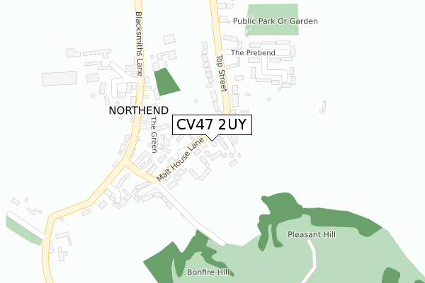
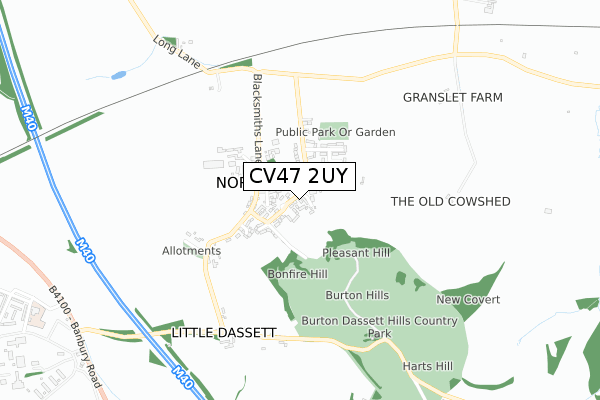
CV47 2UY is located in the Gaydon, Kineton & Upper Lighthorne electoral ward, within the local authority district of Stratford-on-Avon and the English Parliamentary constituency of Kenilworth and Southam. The Sub Integrated Care Board (ICB) Location is NHS Coventry and Warwickshire ICB - B2M3M and the police force is Warwickshire. This postcode has been in use since August 2018.


GetTheData
Source: OS Open Zoomstack (Ordnance Survey)
Licence: Open Government Licence (requires attribution)
Attribution: Contains OS data © Crown copyright and database right 2024
Source: Open Postcode Geo
Licence: Open Government Licence (requires attribution)
Attribution: Contains OS data © Crown copyright and database right 2024; Contains Royal Mail data © Royal Mail copyright and database right 2024; Source: Office for National Statistics licensed under the Open Government Licence v.3.0
| Easting | 439315 |
| Northing | 252533 |
| Latitude | 52.169682 |
| Longitude | -1.426561 |
GetTheData
Source: Open Postcode Geo
Licence: Open Government Licence
| Country | England |
| Postcode District | CV47 |
| ➜ CV47 open data dashboard ➜ See where CV47 is on a map ➜ Where is Northend? | |
GetTheData
Source: Land Registry Price Paid Data
Licence: Open Government Licence
| Ward | Gaydon, Kineton & Upper Lighthorne |
| Constituency | Kenilworth And Southam |
GetTheData
Source: ONS Postcode Database
Licence: Open Government Licence
| February 2022 | Drugs | On or near Leys Close | 257m |
| January 2022 | Burglary | On or near Bottom Street | 185m |
| January 2022 | Violence and sexual offences | On or near The Prebend | 231m |
| ➜ Get more crime data in our Crime section | |||
GetTheData
Source: data.police.uk
Licence: Open Government Licence
| Village Hall (Top Street) | Northend | 12m |
| Village Hall (Top Street) | Northend | 27m |
| Peartrees (Malthouse Lane) | Northend | 96m |
| Peartrees (Malthouse Lane) | Northend | 99m |
| The Prebend (Top Street) | Northend | 189m |
GetTheData
Source: NaPTAN
Licence: Open Government Licence
| Percentage of properties with Next Generation Access | 100.0% |
| Percentage of properties with Superfast Broadband | 100.0% |
| Percentage of properties with Ultrafast Broadband | 100.0% |
| Percentage of properties with Full Fibre Broadband | 0.0% |
Superfast Broadband is between 30Mbps and 300Mbps
Ultrafast Broadband is > 300Mbps
| Percentage of properties unable to receive 2Mbps | 0.0% |
| Percentage of properties unable to receive 5Mbps | 0.0% |
| Percentage of properties unable to receive 10Mbps | 0.0% |
| Percentage of properties unable to receive 30Mbps | 0.0% |
GetTheData
Source: Ofcom
Licence: Ofcom Terms of Use (requires attribution)
GetTheData
Source: ONS Postcode Database
Licence: Open Government Licence


➜ Get more ratings from the Food Standards Agency
GetTheData
Source: Food Standards Agency
Licence: FSA terms & conditions
| Last Collection | |||
|---|---|---|---|
| Location | Mon-Fri | Sat | Distance |
| Bridge Street | 16:00 | 09:15 | 2,299m |
| Fenny Compton Post Office | 16:00 | 09:15 | 2,442m |
| Station Road | 16:00 | 09:15 | 2,633m |
GetTheData
Source: Dracos
Licence: Creative Commons Attribution-ShareAlike
| Facility | Distance |
|---|---|
| Dm Kineton Banbury Road, Burton Dassett Grass Pitches, Artificial Grass Pitch, Outdoor Tennis Courts | 2km |
| The Dassett C Of E Primary School Memorial Road, Fenny Compton Grass Pitches | 2.5km |
| Fenny Compton Playing Field Station Road, Fenny Compton Grass Pitches | 2.9km |
GetTheData
Source: Active Places
Licence: Open Government Licence
| School | Phase of Education | Distance |
|---|---|---|
| Temple Herdewyke Primary School Falkland Place, Temple Herdewyke, Southam, CV47 2UD | Primary | 1.2km |
| The Dassett CofE Primary School Fenny Compton, Southam, CV47 2XU | Primary | 2.5km |
| Lighthorne Heath Primary School Stratford Road, Lighthorne Heath, Leamington Spa, CV33 9TW | Primary | 5.6km |
GetTheData
Source: Edubase
Licence: Open Government Licence
The below table lists the International Territorial Level (ITL) codes (formerly Nomenclature of Territorial Units for Statistics (NUTS) codes) and Local Administrative Units (LAU) codes for CV47 2UY:
| ITL 1 Code | Name |
|---|---|
| TLG | West Midlands (England) |
| ITL 2 Code | Name |
| TLG1 | Herefordshire, Worcestershire and Warwickshire |
| ITL 3 Code | Name |
| TLG13 | Warwickshire CC |
| LAU 1 Code | Name |
| E07000221 | Stratford-on-Avon |
GetTheData
Source: ONS Postcode Directory
Licence: Open Government Licence
The below table lists the Census Output Area (OA), Lower Layer Super Output Area (LSOA), and Middle Layer Super Output Area (MSOA) for CV47 2UY:
| Code | Name | |
|---|---|---|
| OA | E00159017 | |
| LSOA | E01031194 | Stratford-on-Avon 013A |
| MSOA | E02006516 | Stratford-on-Avon 013 |
GetTheData
Source: ONS Postcode Directory
Licence: Open Government Licence
| CV47 2TS | Malthouse Close | 51m |
| CV47 2TW | Top Street | 84m |
| CV47 2TY | 129m | |
| CV47 2TN | Top Street | 132m |
| CV47 2TL | Bottom Street | 160m |
| CV47 2TJ | Bottom Street | 165m |
| CV47 2FJ | The Green | 169m |
| CV47 2TZ | Nortons Close | 193m |
| CV47 2TP | Hill Close | 201m |
| CV47 2TH | Bottom Street | 232m |
GetTheData
Source: Open Postcode Geo; Land Registry Price Paid Data
Licence: Open Government Licence