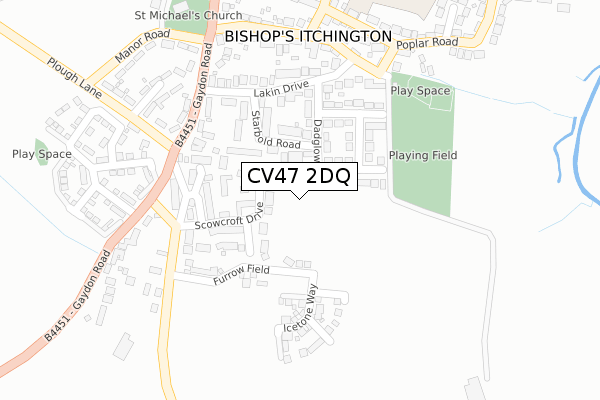
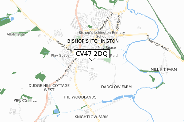
CV47 2DQ is located in the Bishop's Itchington, Fenny Compton & Napton electoral ward, within the local authority district of Stratford-on-Avon and the English Parliamentary constituency of Kenilworth and Southam. The Sub Integrated Care Board (ICB) Location is NHS Coventry and Warwickshire ICB - B2M3M and the police force is Warwickshire. This postcode has been in use since November 2019.


GetTheData
Source: OS Open Zoomstack (Ordnance Survey)
Licence: Open Government Licence (requires attribution)
Attribution: Contains OS data © Crown copyright and database right 2024
Source: Open Postcode Geo
Licence: Open Government Licence (requires attribution)
Attribution: Contains OS data © Crown copyright and database right 2024; Contains Royal Mail data © Royal Mail copyright and database right 2024; Source: Office for National Statistics licensed under the Open Government Licence v.3.0
| Easting | 439013 |
| Northing | 257314 |
| Latitude | 52.212685 |
| Longitude | -1.430428 |
GetTheData
Source: Open Postcode Geo
Licence: Open Government Licence
| Country | England |
| Postcode District | CV47 |
| ➜ CV47 open data dashboard ➜ See where CV47 is on a map ➜ Where is Bishop's Itchington? | |
GetTheData
Source: Land Registry Price Paid Data
Licence: Open Government Licence
| Ward | Bishop's Itchington, Fenny Compton & Napton |
| Constituency | Kenilworth And Southam |
GetTheData
Source: ONS Postcode Database
Licence: Open Government Licence
| September 2022 | Violence and sexual offences | On or near Scowcroft Drive | 149m |
| June 2022 | Public order | On or near Mandale Close | 175m |
| June 2022 | Anti-social behaviour | On or near Supermarket | 335m |
| ➜ Get more crime data in our Crime section | |||
GetTheData
Source: data.police.uk
Licence: Open Government Licence
| Church (Station Road) | Bishop's Itchington | 427m |
| Church (Station Road) | Bishop's Itchington | 433m |
| Greaves Club (Ladbroke Road) | Bishop's Itchington | 528m |
| Ladbroke Road (Old Road) | Bishop's Itchington | 749m |
GetTheData
Source: NaPTAN
Licence: Open Government Licence
GetTheData
Source: ONS Postcode Database
Licence: Open Government Licence


➜ Get more ratings from the Food Standards Agency
GetTheData
Source: Food Standards Agency
Licence: FSA terms & conditions
| Last Collection | |||
|---|---|---|---|
| Location | Mon-Fri | Sat | Distance |
| Bishops Itchington P.o. | 16:45 | 10:00 | 368m |
| The Green | 16:40 | 08:50 | 405m |
| Deppers Bridge | 17:00 | 10:15 | 2,194m |
GetTheData
Source: Dracos
Licence: Creative Commons Attribution-ShareAlike
| Facility | Distance |
|---|---|
| Bishops Itchington Playing Field Chapel Street, Bishops Itchington Grass Pitches, Outdoor Tennis Courts | 268m |
| Harbury Playing Fields Constance Drive, Harbury, Leamington Spa Outdoor Tennis Courts, Grass Pitches | 2.9km |
| Harbury Village Hall South Parade, Harbury Sports Hall | 3km |
GetTheData
Source: Active Places
Licence: Open Government Licence
| School | Phase of Education | Distance |
|---|---|---|
| Bishops Itchington Primary School Ladbroke Road, Bishops Itchington, Southam, CV47 2RN | Primary | 498m |
| Harbury CofE Primary School Mill Street, Harbury, Leamington Spa, CV33 9HR | Primary | 3.2km |
| Lighthorne Heath Primary School Stratford Road, Lighthorne Heath, Leamington Spa, CV33 9TW | Primary | 4.3km |
GetTheData
Source: Edubase
Licence: Open Government Licence
The below table lists the International Territorial Level (ITL) codes (formerly Nomenclature of Territorial Units for Statistics (NUTS) codes) and Local Administrative Units (LAU) codes for CV47 2DQ:
| ITL 1 Code | Name |
|---|---|
| TLG | West Midlands (England) |
| ITL 2 Code | Name |
| TLG1 | Herefordshire, Worcestershire and Warwickshire |
| ITL 3 Code | Name |
| TLG13 | Warwickshire CC |
| LAU 1 Code | Name |
| E07000221 | Stratford-on-Avon |
GetTheData
Source: ONS Postcode Directory
Licence: Open Government Licence
The below table lists the Census Output Area (OA), Lower Layer Super Output Area (LSOA), and Middle Layer Super Output Area (MSOA) for CV47 2DQ:
| Code | Name | |
|---|---|---|
| OA | E00159053 | |
| LSOA | E01031200 | Stratford-on-Avon 005D |
| MSOA | E02006508 | Stratford-on-Avon 005 |
GetTheData
Source: ONS Postcode Directory
Licence: Open Government Licence
| CV47 2YR | Parrish Close | 111m |
| CV47 2YP | Scowcroft Drive | 135m |
| CV47 2TG | Dadglow Road | 153m |
| CV47 2YS | Hill View | 185m |
| CV47 2TQ | Starbold Road | 201m |
| CV47 2TF | Huckson Road | 220m |
| CV47 2YT | Wilcox Close | 231m |
| CV47 2QR | Cross Green Flats | 235m |
| CV47 2TE | Lakin Drive | 284m |
| CV47 2QW | Gaydon Road | 292m |
GetTheData
Source: Open Postcode Geo; Land Registry Price Paid Data
Licence: Open Government Licence