CV47 0NF maps, stats, and open data
CV47 0NF is located in the Southam North & Long Itchington electoral ward, within the local authority district of Stratford-on-Avon and the English Parliamentary constituency of Kenilworth and Southam. The Sub Integrated Care Board (ICB) Location is NHS Coventry and Warwickshire ICB - B2M3M and the police force is Warwickshire. This postcode has been in use since September 2018.
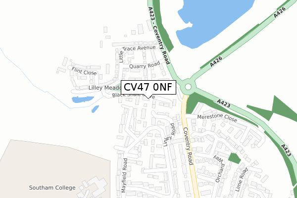
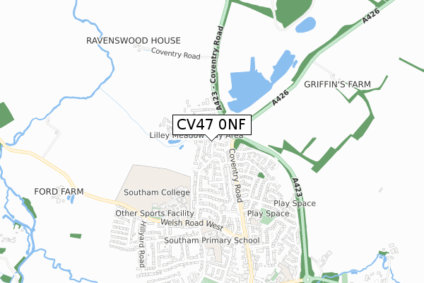
CV47 0NF maps


Licence: Open Government Licence (requires attribution)
Attribution: Contains OS data © Crown copyright and database right 2025
Source: Open Postcode Geo
Licence: Open Government Licence (requires attribution)
Attribution: Contains OS data © Crown copyright and database right 2025; Contains Royal Mail data © Royal Mail copyright and database right 2025; Source: Office for National Statistics licensed under the Open Government Licence v.3.0
CV47 0NF geodata
| Easting | 441662 |
| Northing | 262686 |
| Latitude | 52.260785 |
| Longitude | -1.391000 |
Where is CV47 0NF?
| Country | England |
| Postcode District | CV47 |
Politics
| Ward | Southam North & Long Itchington |
|---|---|
| Constituency | Kenilworth And Southam |
House Prices
Sales of detached houses in CV47 0NF
2025 24 JUL £340,000 |
2021 18 JUN £291,000 |
2018 7 DEC £291,995 |
2018 28 SEP £289,995 |
Licence: Contains HM Land Registry data © Crown copyright and database right 2025. This data is licensed under the Open Government Licence v3.0.
Transport
Nearest bus stops to CV47 0NF
| Merestone Close (Coventry Road) | Southam | 185m |
| Merestone Close (Coventry Road) | Southam | 192m |
| Southam College (Welsh Road West) | Southam | 471m |
| Springs Crescent (Welsh Road West) | Southam | 498m |
| Southam Primary School (St James Road) | Southam | 523m |
Broadband
Broadband access in CV47 0NF (2020 data)
| Percentage of properties with Next Generation Access | 5.6% |
| Percentage of properties with Superfast Broadband | 5.6% |
| Percentage of properties with Ultrafast Broadband | 0.0% |
| Percentage of properties with Full Fibre Broadband | 0.0% |
Superfast Broadband is between 30Mbps and 300Mbps
Ultrafast Broadband is > 300Mbps
Broadband speed in CV47 0NF (2019 data)
Download
| Median download speed | 14.3Mbps |
| Average download speed | 13.8Mbps |
| Maximum download speed | 16.85Mbps |
Upload
| Median upload speed | 1.1Mbps |
| Average upload speed | 1.1Mbps |
| Maximum upload speed | 1.24Mbps |
Broadband limitations in CV47 0NF (2020 data)
| Percentage of properties unable to receive 2Mbps | 0.0% |
| Percentage of properties unable to receive 5Mbps | 0.0% |
| Percentage of properties unable to receive 10Mbps | 0.0% |
| Percentage of properties unable to receive 30Mbps | 94.4% |
Deprivation
42.3% of English postcodes are less deprived than CV47 0NF:Food Standards Agency
Three nearest food hygiene ratings to CV47 0NF (metres)


➜ Get more ratings from the Food Standards Agency
Nearest post box to CV47 0NF
| Last Collection | |||
|---|---|---|---|
| Location | Mon-Fri | Sat | Distance |
| Tollgate Road | 16:00 | 09:00 | 464m |
| Coventry Street Post Office | 18:00 | 11:30 | 813m |
| Warwick Road | 17:00 | 09:00 | 1,122m |
CV47 0NF ITL and CV47 0NF LAU
The below table lists the International Territorial Level (ITL) codes (formerly Nomenclature of Territorial Units for Statistics (NUTS) codes) and Local Administrative Units (LAU) codes for CV47 0NF:
| ITL 1 Code | Name |
|---|---|
| TLG | West Midlands (England) |
| ITL 2 Code | Name |
| TLG1 | Herefordshire, Worcestershire and Warwickshire |
| ITL 3 Code | Name |
| TLG13 | Warwickshire CC |
| LAU 1 Code | Name |
| E07000221 | Stratford-on-Avon |
CV47 0NF census areas
The below table lists the Census Output Area (OA), Lower Layer Super Output Area (LSOA), and Middle Layer Super Output Area (MSOA) for CV47 0NF:
| Code | Name | |
|---|---|---|
| OA | E00159178 | |
| LSOA | E01031221 | Stratford-on-Avon 004C |
| MSOA | E02006507 | Stratford-on-Avon 004 |
Nearest postcodes to CV47 0NF
| CV47 0ET | Mayfield Road | 85m |
| CV47 0EU | Ploughmans Holt | 114m |
| CV47 0JZ | Linley Road | 166m |
| CV47 0ES | Springfield Grove | 213m |
| CV47 0JX | Mayfield Road | 216m |
| CV47 1BG | Coventry Road | 242m |
| CV47 1EY | Sycamore Grove | 256m |
| CV47 1GU | Merestone Close | 299m |
| CV47 0JY | Linley Road | 304m |
| CV47 1EB | Coventry Road | 308m |