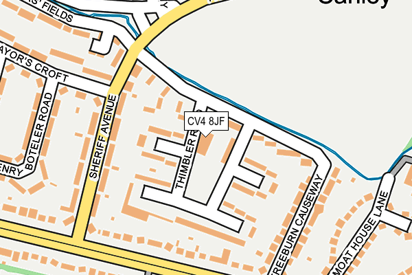
CV4 8JF is located in the Westwood electoral ward, within the metropolitan district of Coventry and the English Parliamentary constituency of Coventry South. The Sub Integrated Care Board (ICB) Location is NHS Coventry and Warwickshire ICB - B2M3M and the police force is West Midlands. This postcode has been in use since April 2017.


GetTheData
Source: OS OpenMap – Local (Ordnance Survey)
Source: OS VectorMap District (Ordnance Survey)
Licence: Open Government Licence (requires attribution)
| Easting | 430088 |
| Northing | 277273 |
| Latitude | 52.392674 |
| Longitude | -1.559271 |
GetTheData
Source: Open Postcode Geo
Licence: Open Government Licence
| Country | England |
| Postcode District | CV4 |
| ➜ CV4 open data dashboard ➜ See where CV4 is on a map ➜ Where is Coventry? | |
GetTheData
Source: Land Registry Price Paid Data
Licence: Open Government Licence
| Ward | Westwood |
| Constituency | Coventry South |
GetTheData
Source: ONS Postcode Database
Licence: Open Government Licence
| June 2022 | Criminal damage and arson | On or near Sheriff Avenue | 148m |
| June 2022 | Other theft | On or near Prior Deram Walk | 197m |
| June 2022 | Other theft | On or near Sports/Recreation Area | 198m |
| ➜ Get more crime data in our Crime section | |||
GetTheData
Source: data.police.uk
Licence: Open Government Licence
| Freeburn Causeway (Sheriff Ave) | Canley | 151m |
| Freeburn Causeway (Sheriff Ave) | Canley | 170m |
| Prior Deram Walk (Sheriff Ave) | Canley | 194m |
| Northfolk Terrace (Charter Ave) | Canley | 201m |
| Northfolk Terrace (Charter Ave) | Canley | 219m |
| Canley Station | 1.1km |
| Tile Hill Station | 2.6km |
| Coventry Station | 3.2km |
GetTheData
Source: NaPTAN
Licence: Open Government Licence
| Percentage of properties with Next Generation Access | 100.0% |
| Percentage of properties with Superfast Broadband | 100.0% |
| Percentage of properties with Ultrafast Broadband | 0.0% |
| Percentage of properties with Full Fibre Broadband | 0.0% |
Superfast Broadband is between 30Mbps and 300Mbps
Ultrafast Broadband is > 300Mbps
| Percentage of properties unable to receive 2Mbps | 0.0% |
| Percentage of properties unable to receive 5Mbps | 0.0% |
| Percentage of properties unable to receive 10Mbps | 0.0% |
| Percentage of properties unable to receive 30Mbps | 0.0% |
GetTheData
Source: Ofcom
Licence: Ofcom Terms of Use (requires attribution)
GetTheData
Source: ONS Postcode Database
Licence: Open Government Licence


➜ Get more ratings from the Food Standards Agency
GetTheData
Source: Food Standards Agency
Licence: FSA terms & conditions
| Last Collection | |||
|---|---|---|---|
| Location | Mon-Fri | Sat | Distance |
| Prior Deram Walk | 17:00 | 10:15 | 202m |
| Kirby Corner | 16:45 | 10:30 | 440m |
| Lynchgate Road Post Office | 17:30 | 10:15 | 575m |
GetTheData
Source: Dracos
Licence: Creative Commons Attribution-ShareAlike
| Facility | Distance |
|---|---|
| Sir Henry Parkes (Closed) Prior Deram Walk, Coventry Grass Pitches | 341m |
| Coventry Technical Sporting Club Mitchell Avenue, Coventry Grass Pitches | 620m |
| Simply Gym Coventry (Closed) Cannon Park Centre, Lynchgate Road, Coventry Health and Fitness Gym, Studio | 658m |
GetTheData
Source: Active Places
Licence: Open Government Licence
| School | Phase of Education | Distance |
|---|---|---|
| University of Warwick University House, Coventry, CV4 8UW | Not applicable | 484m |
| Charter Academy 314 Mitchell Avenue, Coventry, CV4 8DW | Primary | 718m |
| The Westwood Academy Mitchell Avenue, Canley, Coventry, CV4 8DY | Secondary | 793m |
GetTheData
Source: Edubase
Licence: Open Government Licence
The below table lists the International Territorial Level (ITL) codes (formerly Nomenclature of Territorial Units for Statistics (NUTS) codes) and Local Administrative Units (LAU) codes for CV4 8JF:
| ITL 1 Code | Name |
|---|---|
| TLG | West Midlands (England) |
| ITL 2 Code | Name |
| TLG3 | West Midlands |
| ITL 3 Code | Name |
| TLG33 | Coventry |
| LAU 1 Code | Name |
| E08000026 | Coventry |
GetTheData
Source: ONS Postcode Directory
Licence: Open Government Licence
The below table lists the Census Output Area (OA), Lower Layer Super Output Area (LSOA), and Middle Layer Super Output Area (MSOA) for CV4 8JF:
| Code | Name | |
|---|---|---|
| OA | E00048996 | |
| LSOA | E01009679 | Coventry 036C |
| MSOA | E02001993 | Coventry 036 |
GetTheData
Source: ONS Postcode Directory
Licence: Open Government Licence
| CV4 8FJ | Freeburn Causeway | 85m |
| CV4 8FN | Thimbler Road | 90m |
| CV4 8FL | Thimbler Road | 97m |
| CV4 8FD | Sheriff Avenue | 137m |
| CV4 8FP | Freeburn Causeway | 160m |
| CV4 8EB | Charter Avenue | 169m |
| CV4 8FE | Sheriff Avenue | 173m |
| CV4 8GQ | Grafton Court | 178m |
| CV4 8FQ | Freeburn Causeway | 200m |
| CV4 8FT | Prior Deram Walk | 216m |
GetTheData
Source: Open Postcode Geo; Land Registry Price Paid Data
Licence: Open Government Licence