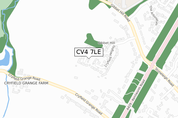
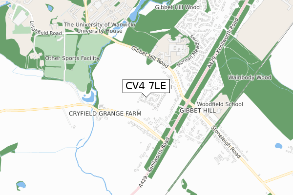
CV4 7LE is located in the Wainbody electoral ward, within the metropolitan district of Coventry and the English Parliamentary constituency of Coventry South. The Sub Integrated Care Board (ICB) Location is NHS Coventry and Warwickshire ICB - B2M3M and the police force is West Midlands. This postcode has been in use since September 2019.


GetTheData
Source: OS Open Zoomstack (Ordnance Survey)
Licence: Open Government Licence (requires attribution)
Attribution: Contains OS data © Crown copyright and database right 2024
Source: Open Postcode Geo
Licence: Open Government Licence (requires attribution)
Attribution: Contains OS data © Crown copyright and database right 2024; Contains Royal Mail data © Royal Mail copyright and database right 2024; Source: Office for National Statistics licensed under the Open Government Licence v.3.0
| Easting | 430414 |
| Northing | 274998 |
| Latitude | 52.372204 |
| Longitude | -1.554685 |
GetTheData
Source: Open Postcode Geo
Licence: Open Government Licence
| Country | England |
| Postcode District | CV4 |
| ➜ CV4 open data dashboard ➜ See where CV4 is on a map ➜ Where is Coventry? | |
GetTheData
Source: Land Registry Price Paid Data
Licence: Open Government Licence
| Ward | Wainbody |
| Constituency | Coventry South |
GetTheData
Source: ONS Postcode Database
Licence: Open Government Licence
5, ETHELRED CLOSE, COVENTRY, CV4 7LE 2022 26 AUG £570,000 |
7, ETHELRED CLOSE, COVENTRY, CV4 7LE 2022 19 AUG £635,000 |
10, ETHELRED CLOSE, COVENTRY, CV4 7LE 2022 12 AUG £565,000 |
3, ETHELRED CLOSE, COVENTRY, CV4 7LE 2022 29 JUL £725,000 |
4, ETHELRED CLOSE, COVENTRY, CV4 7LE 2022 22 JUL £500,000 |
1, ETHELRED CLOSE, COVENTRY, CV4 7LE 2022 8 JUL £730,000 |
2, ETHELRED CLOSE, COVENTRY, CV4 7LE 2022 30 JUN £590,000 |
8, ETHELRED CLOSE, COVENTRY, CV4 7LE 2022 31 MAY £565,000 |
12, ETHELRED CLOSE, COVENTRY, CV4 7LE 2022 31 MAY £625,000 |
6, ETHELRED CLOSE, COVENTRY, CV4 7LE 2022 27 MAY £590,000 |
GetTheData
Source: HM Land Registry Price Paid Data
Licence: Contains HM Land Registry data © Crown copyright and database right 2024. This data is licensed under the Open Government Licence v3.0.
| June 2022 | Vehicle crime | On or near Little Cryfield | 72m |
| June 2022 | Burglary | On or near Cryfield Heights | 116m |
| June 2022 | Violence and sexual offences | On or near Leighton Close | 480m |
| ➜ Get more crime data in our Crime section | |||
GetTheData
Source: data.police.uk
Licence: Open Government Licence
| Gibbet Hill Campus (Gibbet Hill Rd) | Gibbet Hill | 212m |
| Gibbet Hill Campus (Gibbet Hill Rd) | Gibbet Hill | 222m |
| Gibbet Hill Rd (Kenilworth Rd) | Gibbet Hill | 350m |
| Gibbet Hill Rd (Kenilworth Rd) | Gibbet Hill | 363m |
| Cryfield Grange Rd (Kenilworth Rd) | Gibbet Hill | 486m |
| Canley Station | 3km |
| Tile Hill Station | 3.8km |
| Coventry Station | 4.2km |
GetTheData
Source: NaPTAN
Licence: Open Government Licence
GetTheData
Source: ONS Postcode Database
Licence: Open Government Licence


➜ Get more ratings from the Food Standards Agency
GetTheData
Source: Food Standards Agency
Licence: FSA terms & conditions
| Last Collection | |||
|---|---|---|---|
| Location | Mon-Fri | Sat | Distance |
| Gibbet Hill Road | 15:30 | 10:30 | 336m |
| The Galliards | 17:00 | 10:45 | 797m |
| University Of Warwick | 17:00 | 10:30 | 907m |
GetTheData
Source: Dracos
Licence: Creative Commons Attribution-ShareAlike
| Facility | Distance |
|---|---|
| Woodfield School (Stoneleigh Road Site) Stoneleigh Road, Coventry Grass Pitches | 625m |
| University Of Warwick (Cryfield Sports Pavilion) Leighfield Road, Coventry Grass Pitches, Artificial Grass Pitch | 860m |
| University Of Warwick Sports Centre (Closed) Gibbet Hill Road, Coventry Sports Hall, Swimming Pool, Health and Fitness Gym, Studio, Squash Courts | 975m |
GetTheData
Source: Active Places
Licence: Open Government Licence
| School | Phase of Education | Distance |
|---|---|---|
| Woodfield Stoneleigh Road, Coventry, CV4 7AB | Not applicable | 625m |
| Woodfield Stoneleigh Road, Coventry, CV4 7AB | Not applicable | 964m |
| Cannon Park Primary School Bransford Avenue, Coventry, CV4 7PS | Primary | 1.3km |
GetTheData
Source: Edubase
Licence: Open Government Licence
The below table lists the International Territorial Level (ITL) codes (formerly Nomenclature of Territorial Units for Statistics (NUTS) codes) and Local Administrative Units (LAU) codes for CV4 7LE:
| ITL 1 Code | Name |
|---|---|
| TLG | West Midlands (England) |
| ITL 2 Code | Name |
| TLG3 | West Midlands |
| ITL 3 Code | Name |
| TLG33 | Coventry |
| LAU 1 Code | Name |
| E08000026 | Coventry |
GetTheData
Source: ONS Postcode Directory
Licence: Open Government Licence
The below table lists the Census Output Area (OA), Lower Layer Super Output Area (LSOA), and Middle Layer Super Output Area (MSOA) for CV4 7LE:
| Code | Name | |
|---|---|---|
| OA | E00172151 | |
| LSOA | E01009671 | Coventry 042C |
| MSOA | E02001999 | Coventry 042 |
GetTheData
Source: ONS Postcode Directory
Licence: Open Government Licence
| CV4 7LB | Little Cryfield | 115m |
| CV4 7LA | Cryfield Heights | 138m |
| CV4 7AJ | Gibbet Hill Road | 161m |
| CV4 7HH | Russet Grove | 317m |
| CV4 7HX | The Arboretum | 381m |
| CV4 7AQ | Cryfield Grange Road | 408m |
| CV4 7BD | Stoneleigh Road | 444m |
| CV4 7HN | Cassandra Close | 460m |
| CV4 7AE | Leighton Close | 466m |
| CV4 7HL | Moreall Meadows | 523m |
GetTheData
Source: Open Postcode Geo; Land Registry Price Paid Data
Licence: Open Government Licence